Rain Returns to Close Out The Week
TUESDAY NIGHT: Showers will begin to move back into northeast Mississippi and west Alabama overnight Tuesday night, into the early morning hours on Wednesday. Overnight, lows will drop down into the lower 50’s. Rain chances will remain isolated overnight.
WEDNESDAY/THURSDAY/FRIDAY: Two disturbances will move through our area between Wednesday and Friday of this week. The first disturbance moves through on Wednesday, bring the southern portions of our area a decent shot at some rain. This system will push out during the evening hours on Wednesday. Highs on Wednesday will peak in the lower 60’s. On Thursday afternoon, our next disturbance begins to work its way into the area. This system will bring a decent shot at some rain to the entire area Thursday on into Friday. Before all is said and done with, some of us could pick up between 0.50″ and 1.00″ of rain. Highs on Thursday and Friday will tumble from the lower 60’s to the middle 50’s.
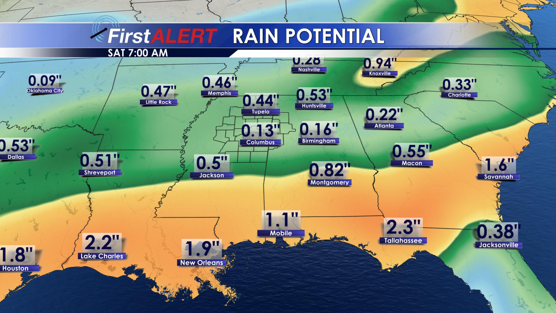
Rainfall Projections
SATURDAY/SUNDAY: The rain will move out this weekend, but it will leave us with some much colder temperatures. Highs will remain in the lower to middle 50’s on both Saturday and Sunday. Much of the area will see their first freeze this weekend! Lows will drop down into the lower 30’s on both Saturday and Sunday mornings. The coldest morning looks to be on Sunday.
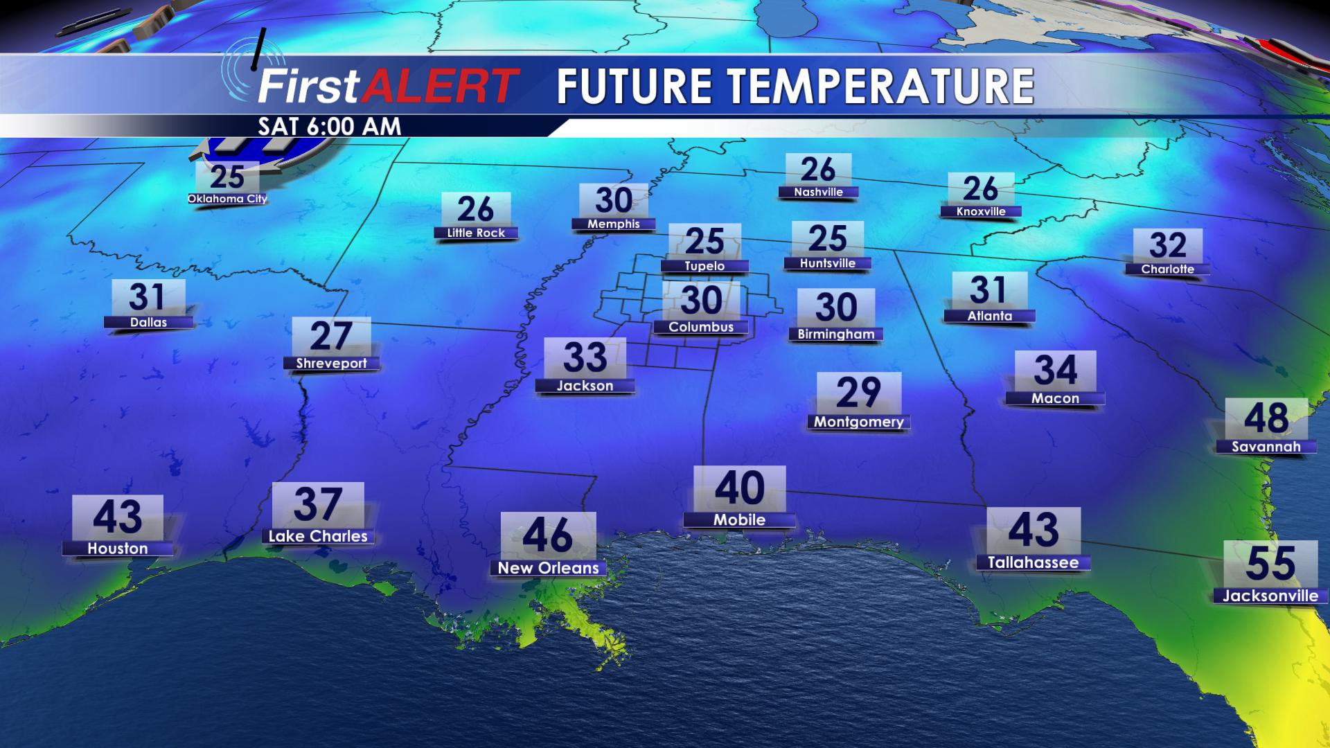
First Significant Frost
FOLLOW US ON SOCIAL MEDIA @WCBIWEATHER


Leave a Reply