Rain Returns This Week
Clouds will build through the day on Sunday as a cold front approaches the area. We’ll enter into an unsettled weather pattern through the week with rain chances increasing.
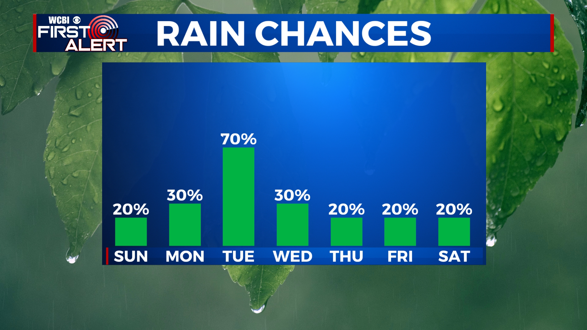
SUNDAY: Clouds will continue to filter into the area through the day. A sprinkle or two can’t be ruled out, but most will remain dry. Highs will be near 60 with winds out of the southeast at 5 to 10 mph.
SUNDAY NIGHT: Mostly cloudy with some isolated showers. Lows in the low to mid 50s.
MONDAY: There is a slight chance for an isolated shower or storm through the day on Monday. Rain chances will increase overnight Monday into Tuesday with a couple of thundershowers possible. Highs will be in the upper 60s in the afternoon, but will drop overnight as a cold front passes the area.
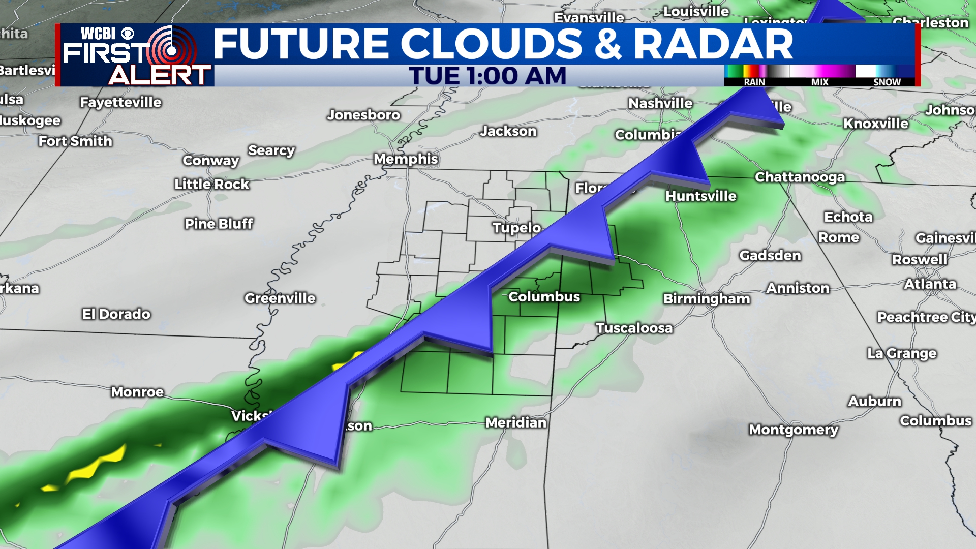
TUESDAY: Light rain will continue off-and-on through the day on Tuesday, even after the cold front passes. We’ll hit our high of 52 before sunrise with temperatures falling into the 30s by the afternoon hours. Rain looks to finally exit the area after sunset on Tuesday.
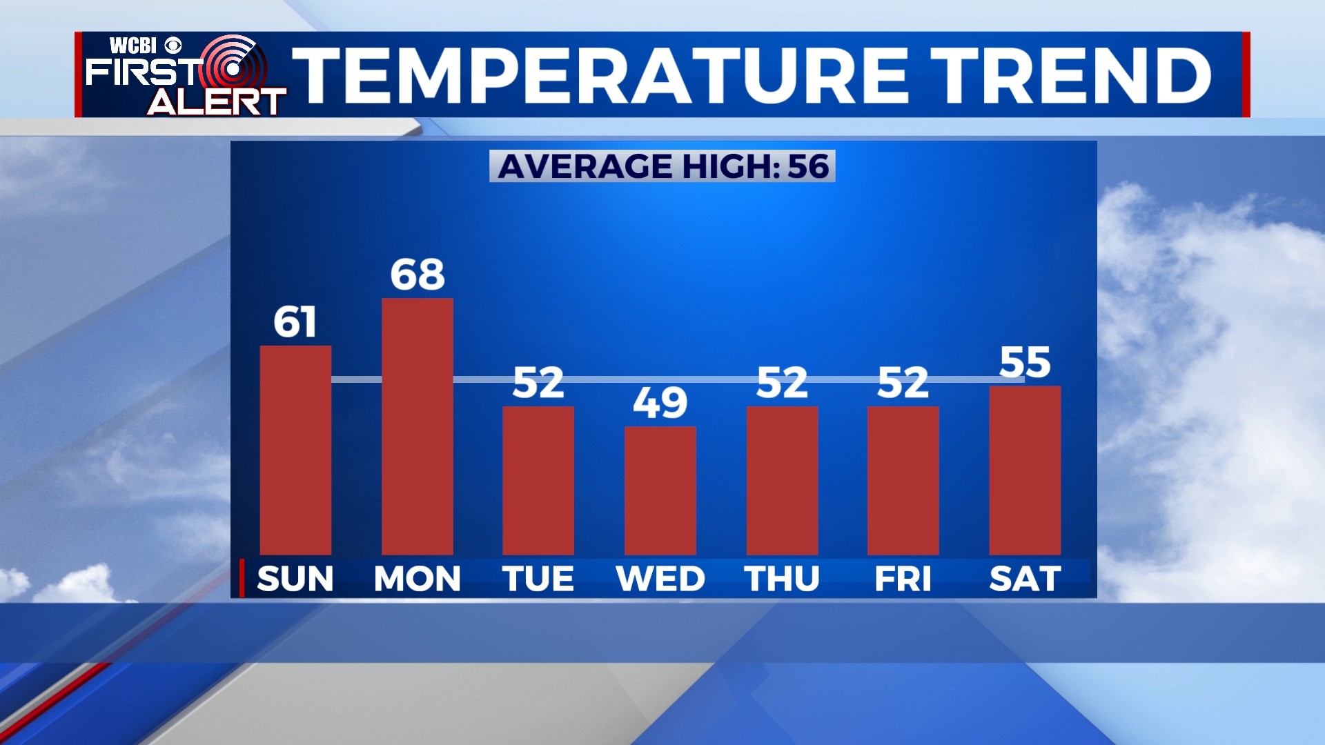
WEDNESDAY: A few showers are possible through the day, otherwise we’ll see a mix of sun and clouds. Temperatures will be near freezing in the morning with an afternoon high in the upper 40s.
THURSDAY-SATURDAY: Temperatures will remain in the low to mid 50s for the end of the week and into the weekend with a mix of sun and clouds. An isolated shower is possible.


Leave a Reply