More rain and storms on the way
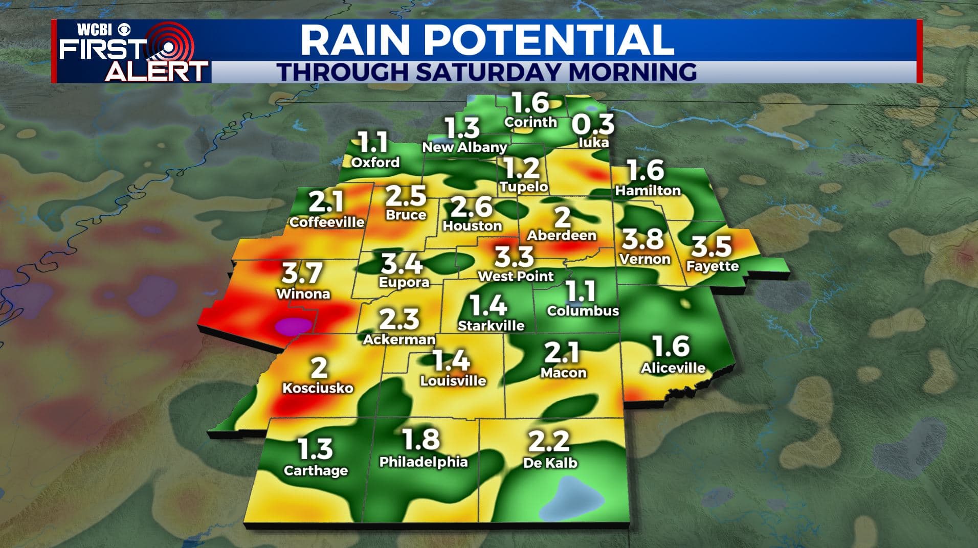
SUMMARY: Our wet and unsettled weather pattern will remain in place a few more days heading into the weekend. It does appear things will dry out and warm up a bit by Sunday and early next week.
WEDNESDAY NIGHT: Areas of rain and storms may redevelop and some could produce more heavy rain and localized flooding. Lows around 70 with southerly winds 4-10 mph.
THURSDAY: Partly to mostly cloudy with a 60-70% chance of showers and storms. Any storm may produce torrential downpours and lightning. More flooding could occur, especially in areas that have had several inches of rain over the last few days. Highs in the mid 80s. Winds SSW 5-15 mph.
THURSDAY NIGHT: A continuing chance of showers and storms. Lows around 70.
FRIDAY & SATURDAY: Partly cloudy with a 50% chance of rain and storms. Not everyone will see one but anything that pops may produce heavy rain, lightning, and gusty breezes. Highs in the upper 80s with lows in the lower 70s.
SUNDAY – WEDNESDAY: Partly cloudy and warm. Highs in the upper 80s to lower 90s. We’re going to keep a daily 20% chance of showers and storms but overall coverage may be spotty at best. It’s something we’ll need to have with all of the recent heavy rain.
Follow @WCBIWEATHER on Facebook, Twitter, Instagram, and the WCBI News App


Leave a Reply