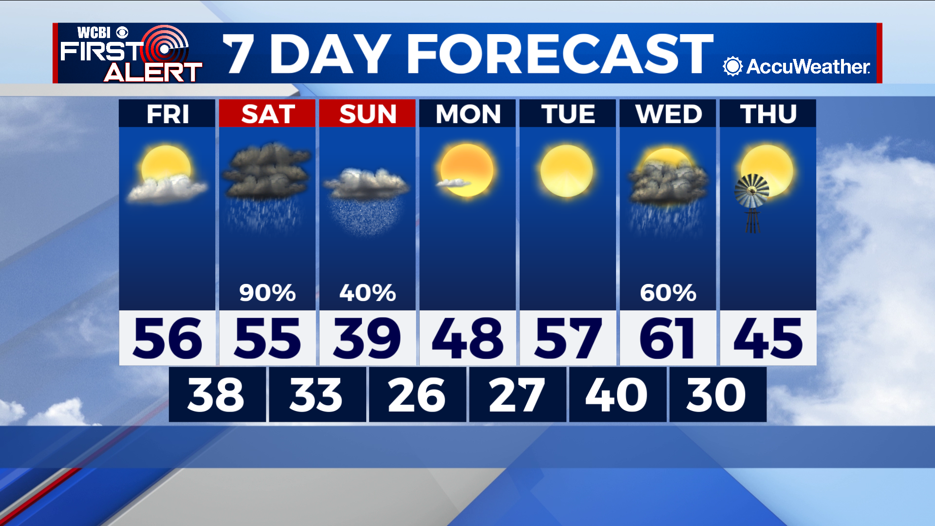
Rainy afternoon Saturday, then snow likely Saturday night and Sunday
COLUMBUS, Mississippi (WCBI) – SUMMARY: Today was another beautiful day with a sunny sky and high temperatures in the 60s.
TONIGHT: Mostly clear with lows in the mid-30s. Calm wind.
FRIDAY: A few afternoon clouds with highs in the mid-50s. Calm wind.
FRIDAY NIGHT: Increasing clouds with lows in the upper-30s. Calm wind.
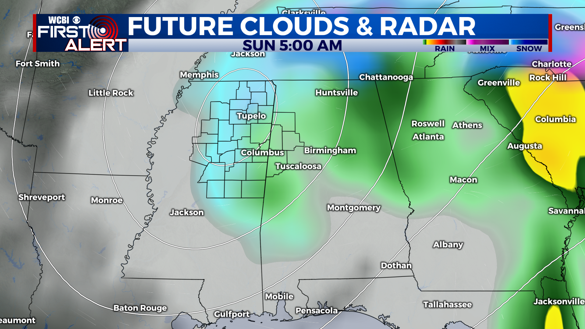
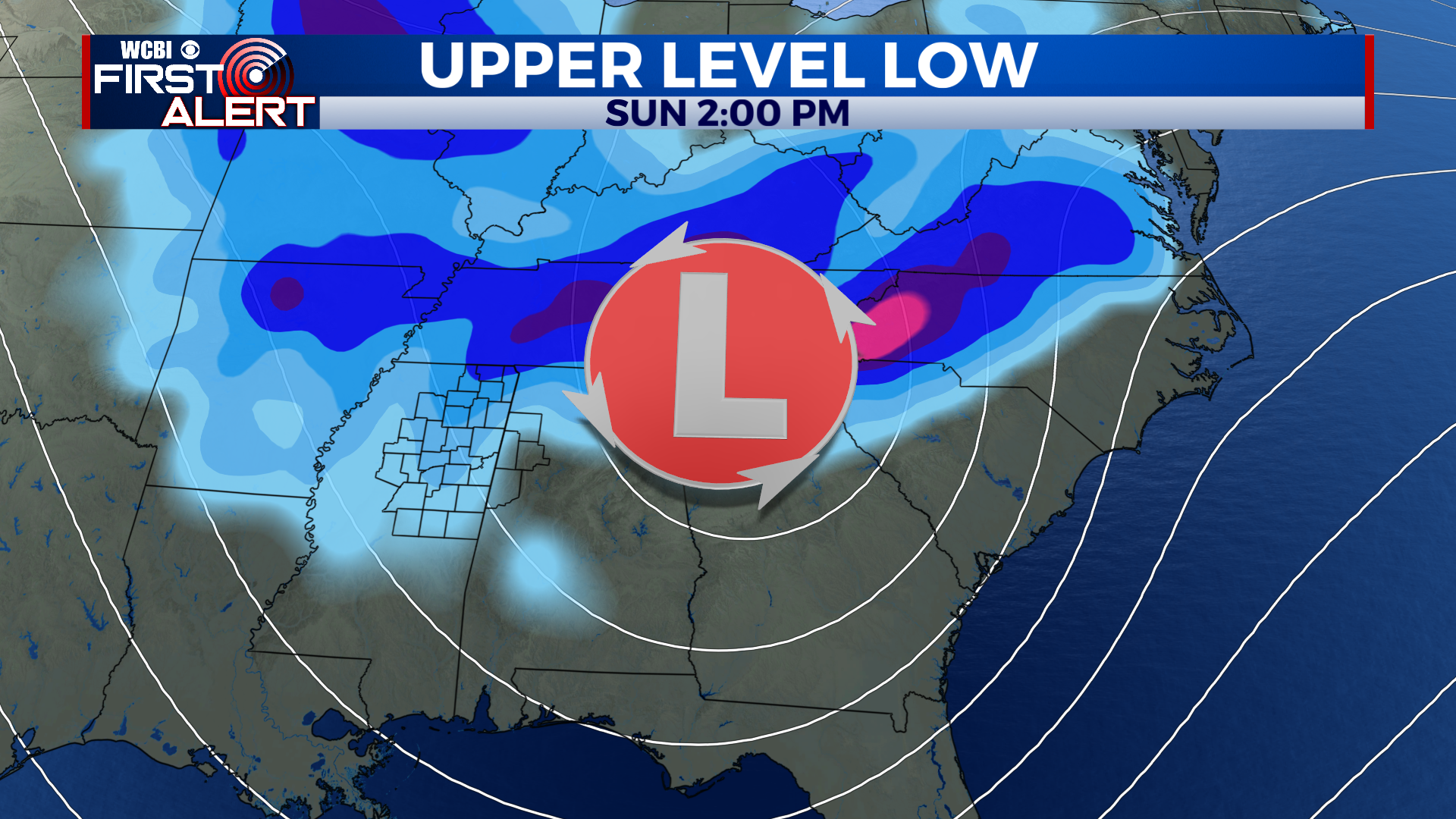
EXTENDED FORECAST: Another weekend of active weather returns to the forecast for our region. A low pressure system will push across Northern Mississippi Saturday, producing occasional showers. An associated cold front will usher in much colder temperatures as well, and may result in a brief period of mixed precipitation Saturday night, then a transition to all snow through Sunday. There is still a lot of uncertainty with the forecast, and changes to the low pressure track and its overall intensity will have impacts on what type of precipitation we see with this system as it moves across our area. Once the system is to our east by Sunday afternoon, wrap around moisture will produce isolated snow showers through the afternoon. In all, we expect mostly minor accumulations across the region, with the highest totals to the north. This will continue to evolve so check in for additional updates. Next week will feature moderating temperatures with highs starting out in the mid-40s Monday then low-60s by Wednesday ahead of our next system.