Rainy Saturday
A partially wet weekend leads the way
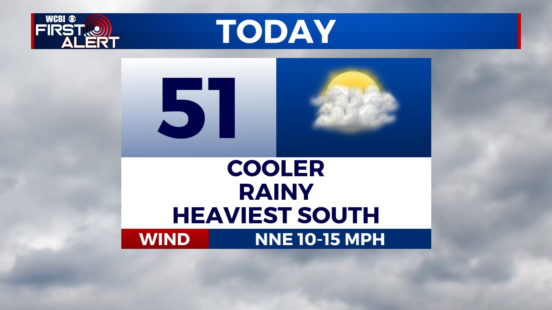
COLUMBUS, Mississippi (WCBI) – Rain showers move in before lunch today and continue overnight. Sunshine awaits us on Sunday before more rain and storm chances arrive next week.
TODAY: Steady cloud cover and rain will occupy the area by early afternoon. Areas east of of I-55 will receive the greatest amount of rainfall. Our southern counties could see up to 2” while most places north of HWY 82 will be left with 0.5″ or less. Temperatures will settle in the low 50s before dropping to the 30s overnight.
SUNDAY: You’ll be waking up to frost with morning lows in the 30s! A cold start to the day but sunshine will warm us into the mid to upper 50s. Staying dry!
NEXT WEEK: Monday will be the nicest day of the new week with mostly sunny skies and spring-like temperatures in the mid 60s. Tuesday introduces more rain. A wet pattern will continue through Thursday as we’re monitoring the potential for severe storms. As of now, this system is projected to bring storms in Thursday afternoon. We are vigilantly tracking this set-up and will continue to keep you informed as changes occur. Temperatures drop from the 60s and 70s to daytime highs in the mid 4os on Friday.


