Rainy start to Tuesday, dry & mild Wednesday
COLUMBUS, Mississippi (WCBI) – Steady showers are expected for the first half of Tuesday. An Arctic blast still awaits Thursday night.
TUESDAY: Clouds and steady showers will start off the day with temperatures in the lower 40s. Once the rain moves out after lunch, highs may rebound into the upper 40s even as clouds linger.
WEDNESDAY: This still looks to be the best weather day of the next seven. Expect a variably cloudy sky with highs into the 50s – normal for late December! If you’ve put off shopping, this is the day to try and find a last-second deal!
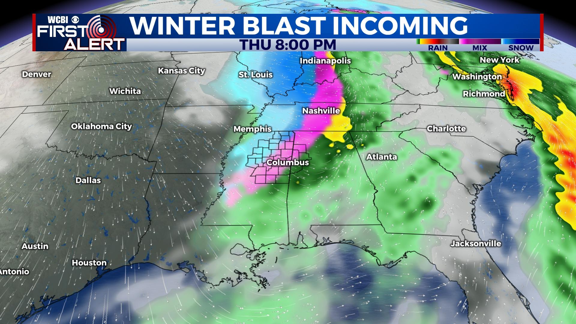
THURSDAY: Cloud coverage will continue for much of the day ahead of an Arctic front. Scattered rain should break out across the region in advance of the front with temperatures in the 50s. As colder air plunges in, a changeover to a wintry mix or brief light snow is expected after sunset. This should only last for an hour or two, resulting in no accumulation. However, as temperatures crash through the 30s and 20s, some flash freezing of the residual moisture is possible. Overnight lows will range from 7 to 12 degrees with dangerous wind chills as low as -15°.
FRIDAY: Little recovery is expected through the day as highs stay in the lower 20s and wind chills only get to the single digits. Scattered flurries are possible.
CHRISTMAS WEEKEND: Occasional flurries will continue Saturday as highs stay in the middle 20s. Christmas morning starts off in the teens and *might* get above freezing for some by afternoon.


