Rainy through Tuesday, Much drier & nicer late week
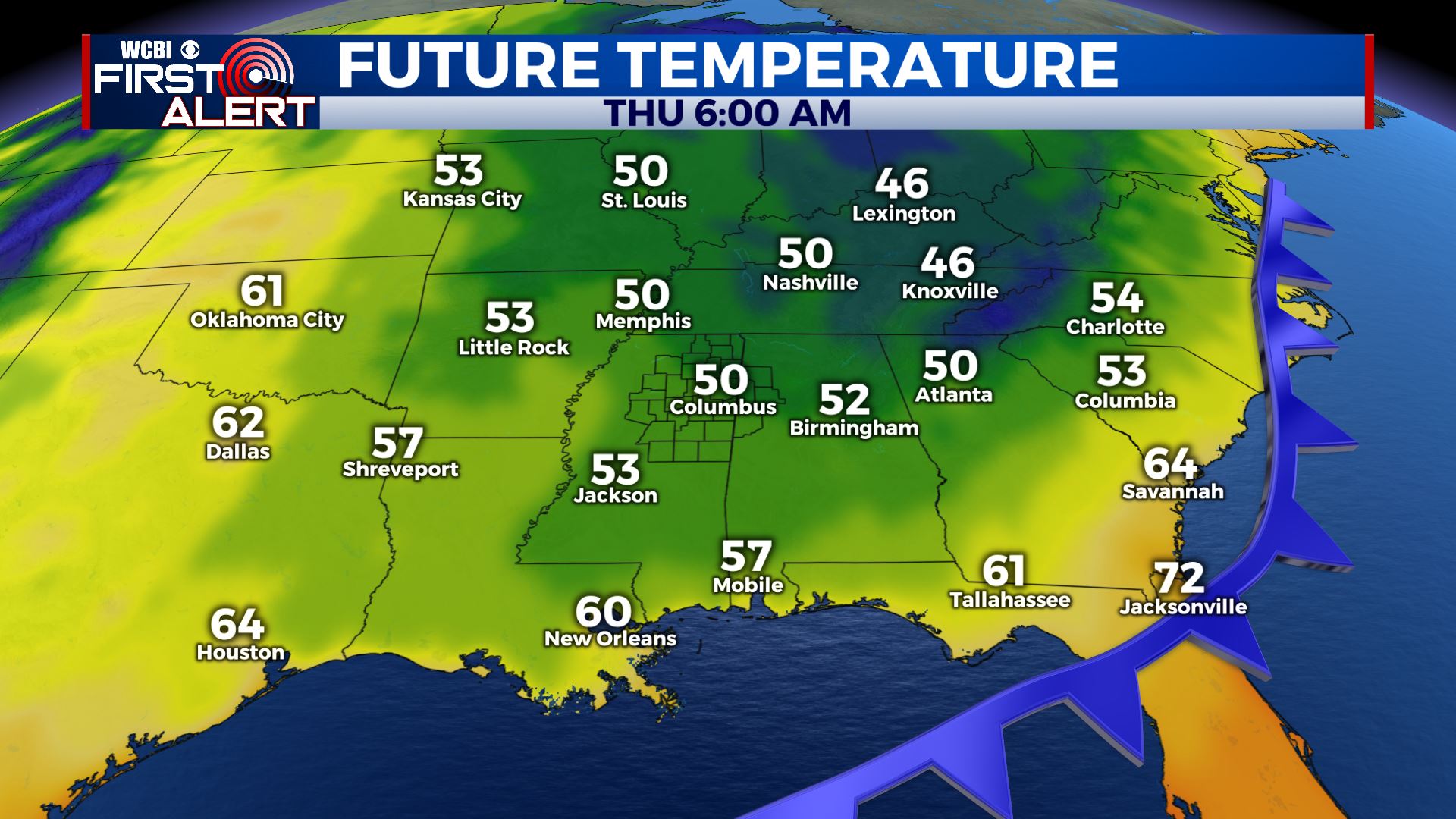
SUMMARY: A pesky area of low pressure continues to linger over the south, keeping rain chances elevated. Things look pretty wet through Tuesday, with highs held down by the rain and cloud cover in the upper 70s to low 80s. Big changes are in store by mid week as a powerful cold front will plunge through the central and eastern United States, bringing with it a big blast of Fall! Highs will tumble into the low to mid 70s, dry air will filter in, and lows will be in the low 50s, with 40s possible in spots! Fall lovers, this is the forecast for you!
SATURDAY NIGHT: Wet weather continues into Saturday night, with cloudy skies and rain continuing for most of us. Lows will be in the low 70s.
SUNDAY: Rinse and repeat for Sunday with more widespread rain throughout the day, highs will be right around 80 degrees.
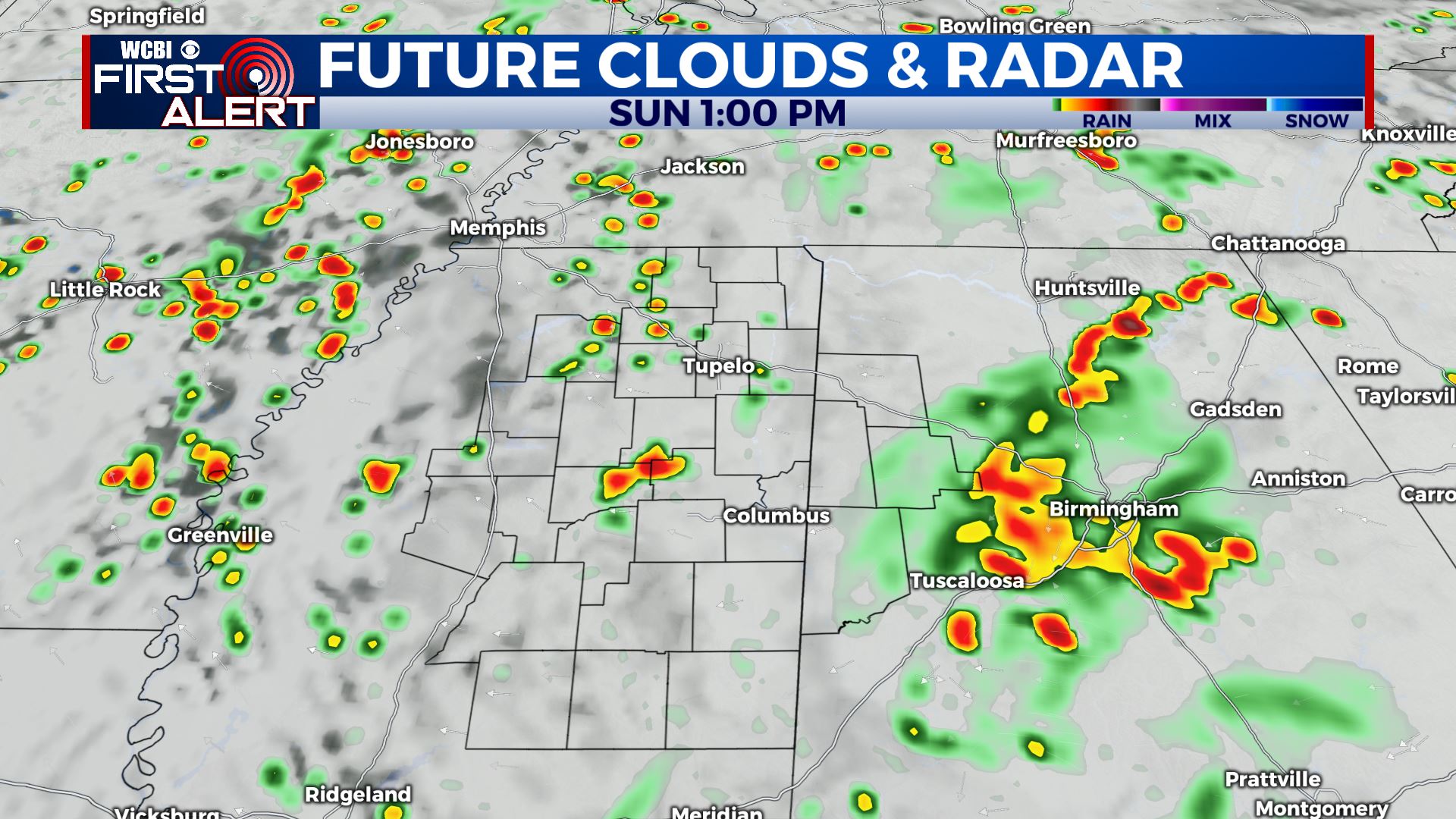
SUNDAY NIGHT: Showers and storms continue into Sunday night with cloudy skies. Lows in the low 70s.
MONDAY: Wet once again for Monday, with showers and storms likely throughout the day. Cloudy with a high in the low to mid 80s.
TUESDAY TO SATURDAY: Monday and Tuesday also look wet, as a powerful cold front approaches the area. Widespread showers and storms likely both days with highs in the low to mid 80s. The cold front blasts through on Tuesday night, leaving Wednesday with clearing skies, much drier air, and temps about 10 degrees cooler in the mid 70s. Dry air and fall like temps stick around through the end of the week, with lows dropping into the 50s Wednesday, Thursday and Friday nights. Some 40s will be possible, especially in rural areas! Next weekend looks great as well, with lows in the 50s and highs right around 80 degrees under sunny skies.
TROPICS: we’re in the peak of the season, so we can’t let our guard down yet, but nothing tropical is on our horizon for now!
CONNECT WITH @WCBIWEATHER ON TWITTER, FACEBOOK, AND INSTAGRAM


