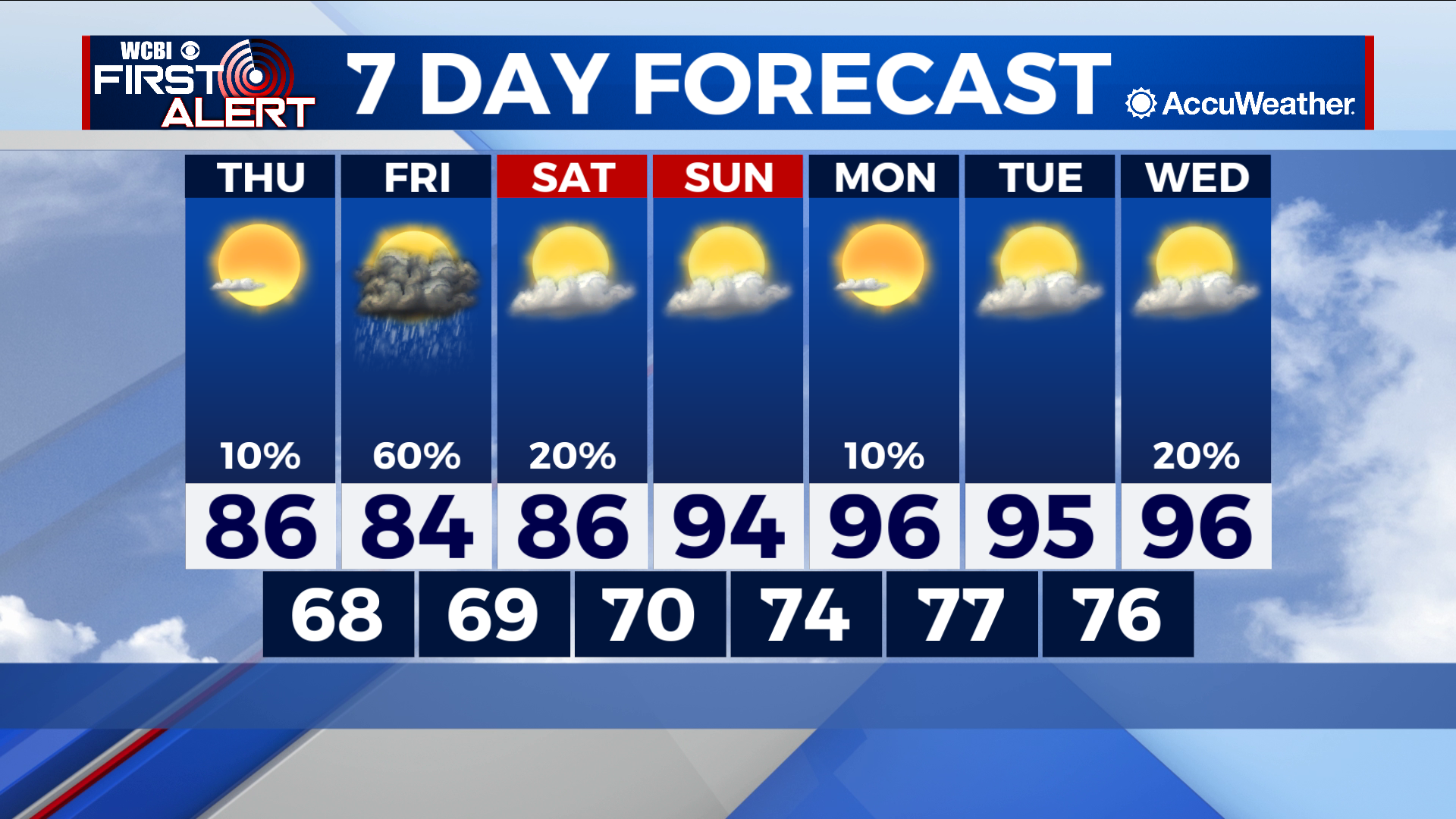
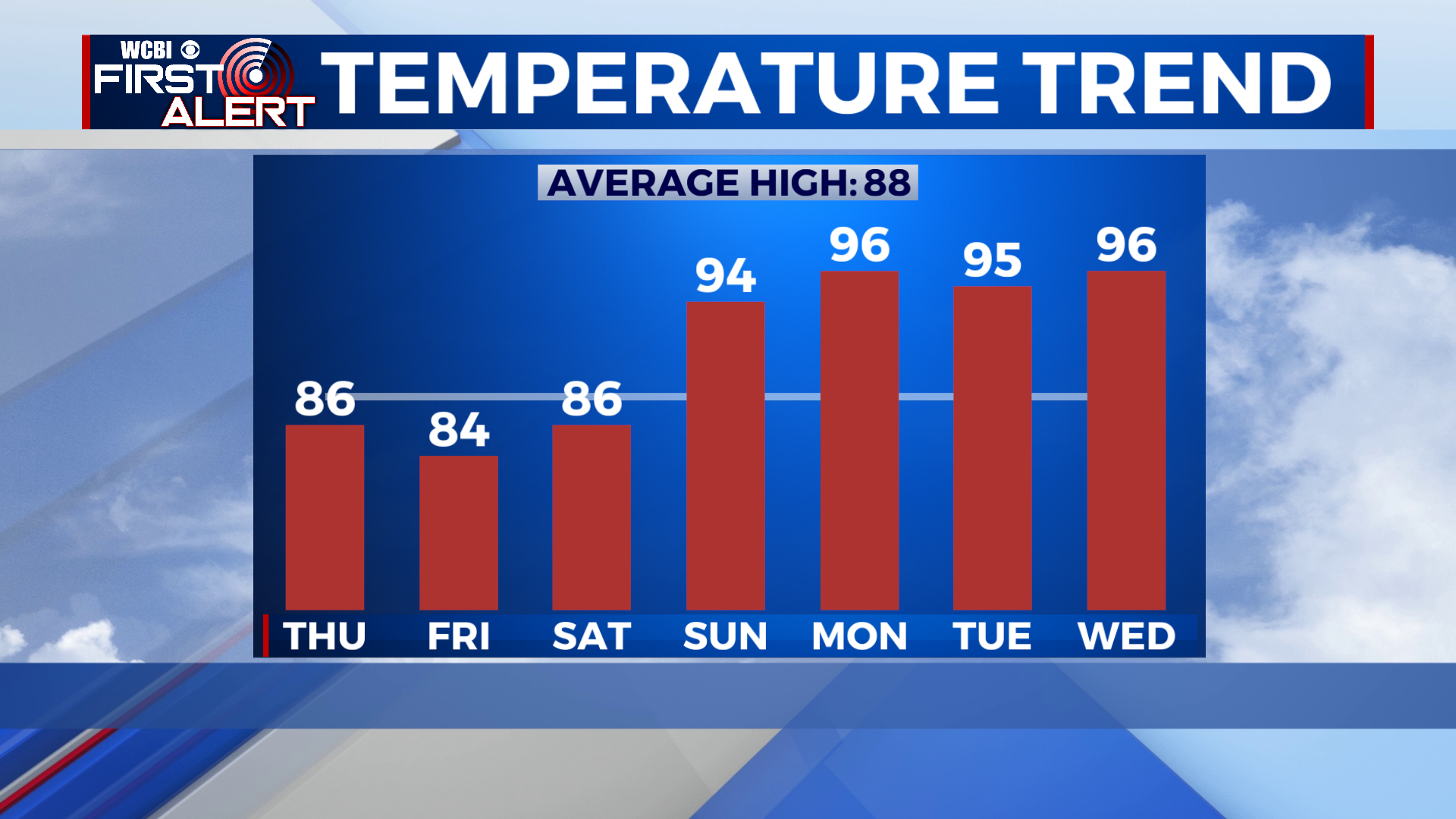
Rapid warmup ahead next week
COLUMBUS – SUMMARY: Storms Saturday mark the last major rain chance for the next few days. Highs in the mid to upper 80s through Saturday will be replaced by much hotter conditions in the mid 90s heading into next week.
THURSDAY: The odd popcorn shower or thunderstorm is possible during the day but conditions remain generally sunny. Highs touch the mid to upper 80s while lows sit in the upper 60s.
THURSDAY: Most rain Thursday should arrive around lunch time and move through during the afternoon hours. The latest models show the brunt of the storms missing us and moving through the delta, although this track can potentially change as we get closer to Friday. Highs reach into the mid 80s, while lows once again bottom out in the upper 90s.
REST OF THE WEEK: Highs Saturday sit in more enjoyable upper 80s temperatures before our rapid warmup begins Monday. Highs hit the mid 90s Monday and generally stay that way throughout the first half of next week. No major rain chances are expected during this stretch, which will contribute to the warmer temperatures. Lows likewise will increase into the upper 70s by overnight Monday.