Record heat possible through Friday, then storms possible this weekend
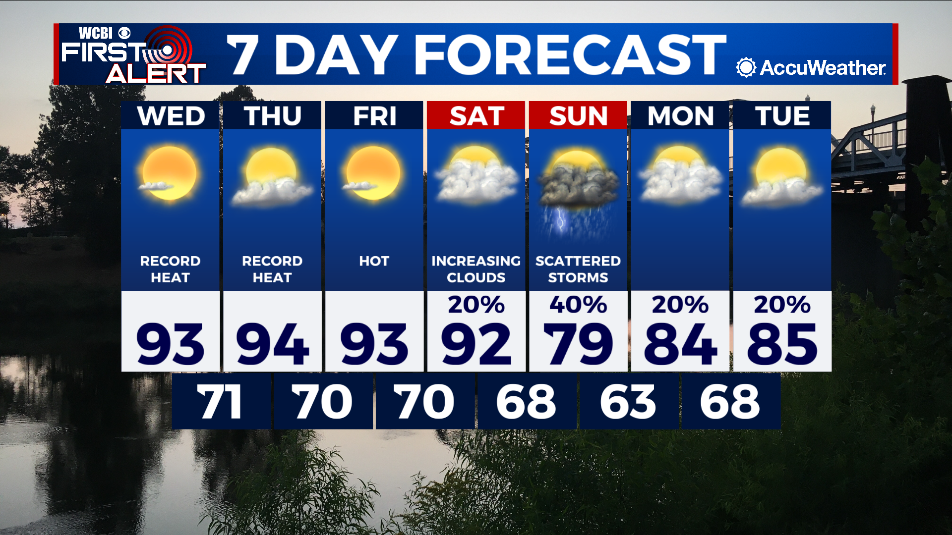
COLUMBUS, Mississippi (WCBI) – SUMMARY: Above average temperatures will return as we move through the week. Rain also returns just in time for the weekend…
TONIGHT: Mostly clear with lows in the low-60s. Calm wind.
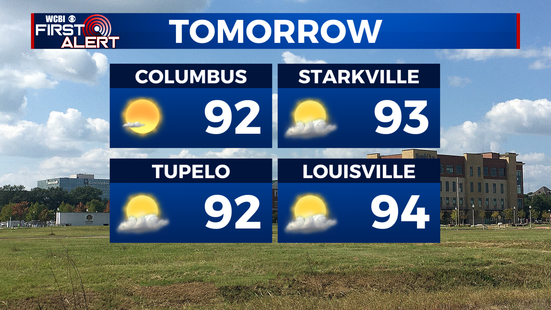
WEDNESDAY: Sunny and hot with highs in the low-90s. Heat index values between 93-97°. Southwest wind around 5 mph.
WEDNESDAY NIGHT: Mostly clear with lows in the low-70s. Calm wind.
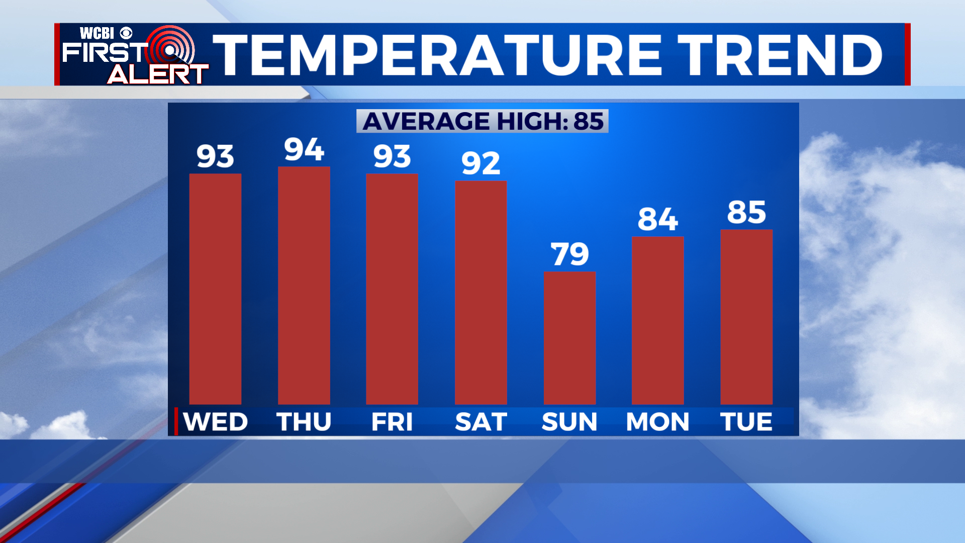
EXTENDED FORECAST: A cold front will arrive Saturday evening, then become stationary through Sunday. This will serve as the focus for shower and thunderstorm development. Rain may be heavy at times. A few showers or thunderstorms will also be possible Monday and Tuesday, but dry conditions will prevail for most of the region to start the week.