Round 3 of freezing temps Monday night
COLUMBUS, Mississippi (WCBI) – The first day of Spring will feel quite chilly, but a temperature rebound is on the way this week. Severe storms become possible Friday.
MONDAY: Despite full sun, highs will only recover into the lower and possibly middle 50s by afternoon with less wind!
MONDAY NIGHT: Round three of freezing temperatures is on the way! Most of the region is under yet another freeze warning as lows will drop into the upper 20s and lower 30s.
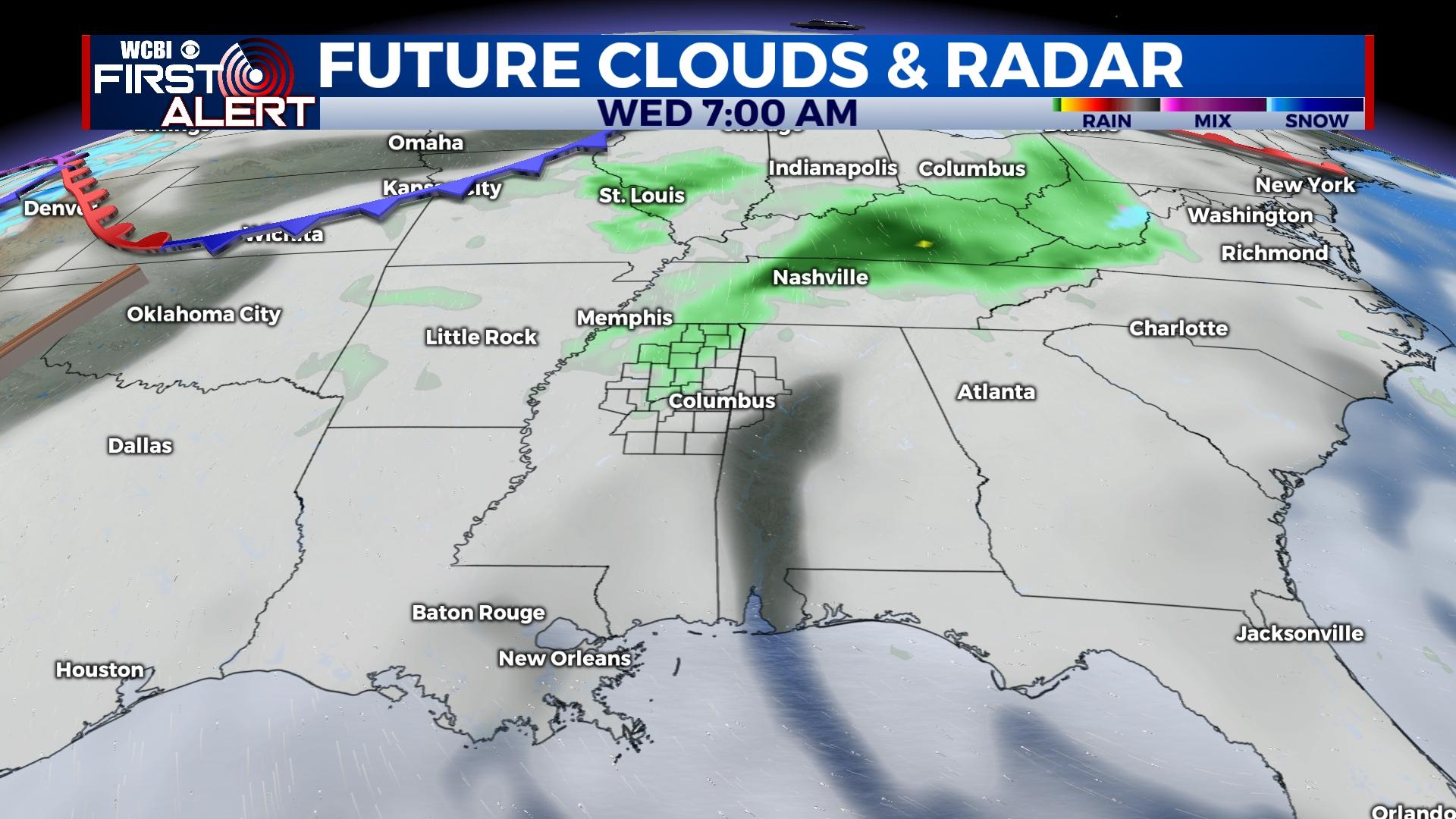
TUE/WED: The persistent high pressure responsible for the recent chill will move east, allowing warmer air to return. Tuesday stays dry with highs back in the 60s. Mostly cloudy sky conditions will prevail Wednesday along with a small chance of a few showers. Highs will reach the low 70s Wednesday afternoon.
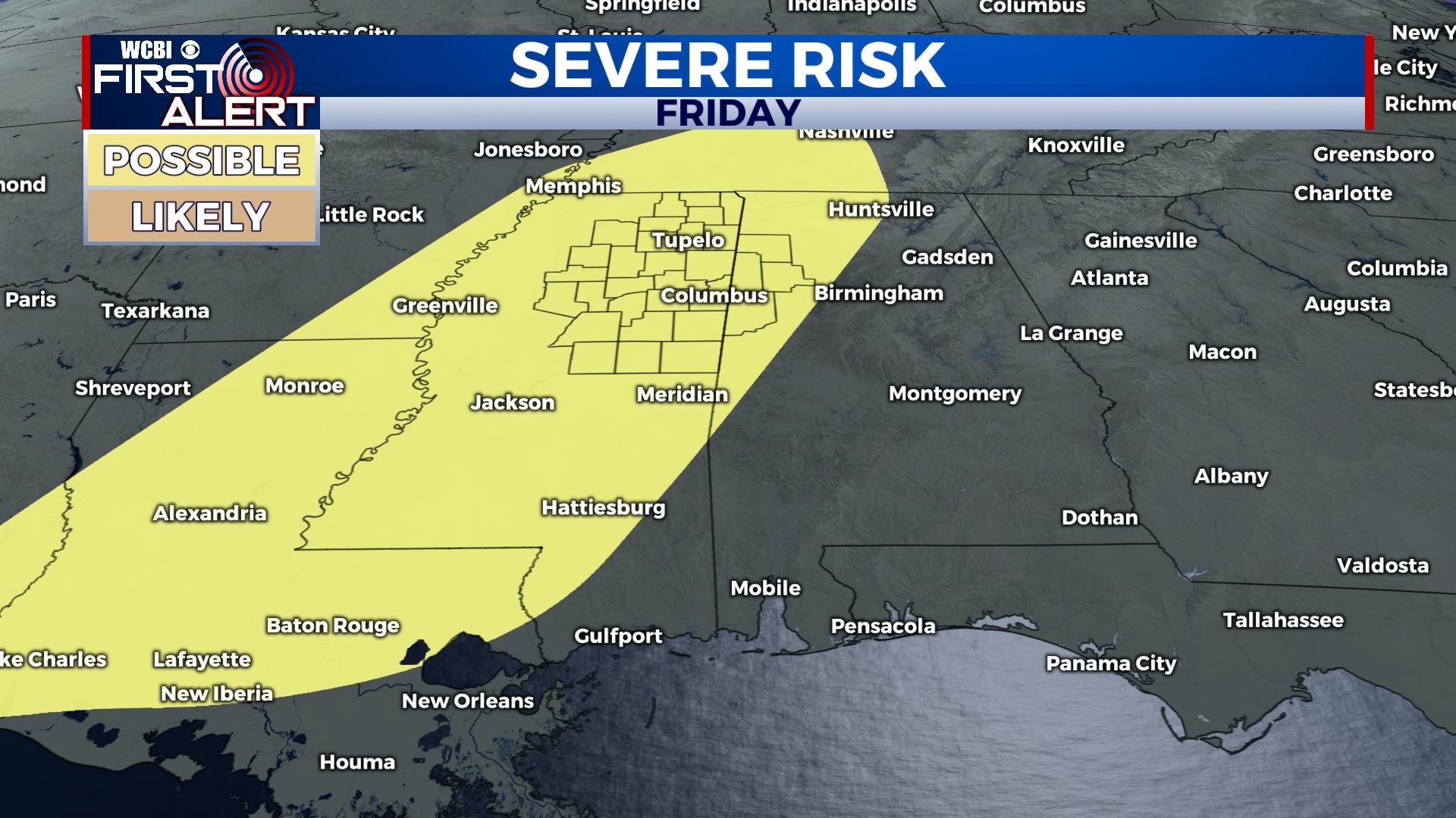
THU/FRI: As a strong ridge becomes briefly established across the Gulf, Thursday looks quite warm with highs in the middle 80s and a mostly sunny sky. Moisture will also be surging northward as well, paving the way for Friday’s severe potential. A strong front will make its way into the area Friday afternoon, triggering a good chance of showers and thunderstorms. Severe weather remains a possibility as most ingredients will be in place; stay tuned for further updates!
WEEKEND: Saturday looks mostly sunny and dry with highs dropping back into the 60s. There remains a chance of a renewed rain/storm chance Sunday, but inconsistency remains in the forecast…stay tuned!


