Sct’d storms, watching TS Cristobal
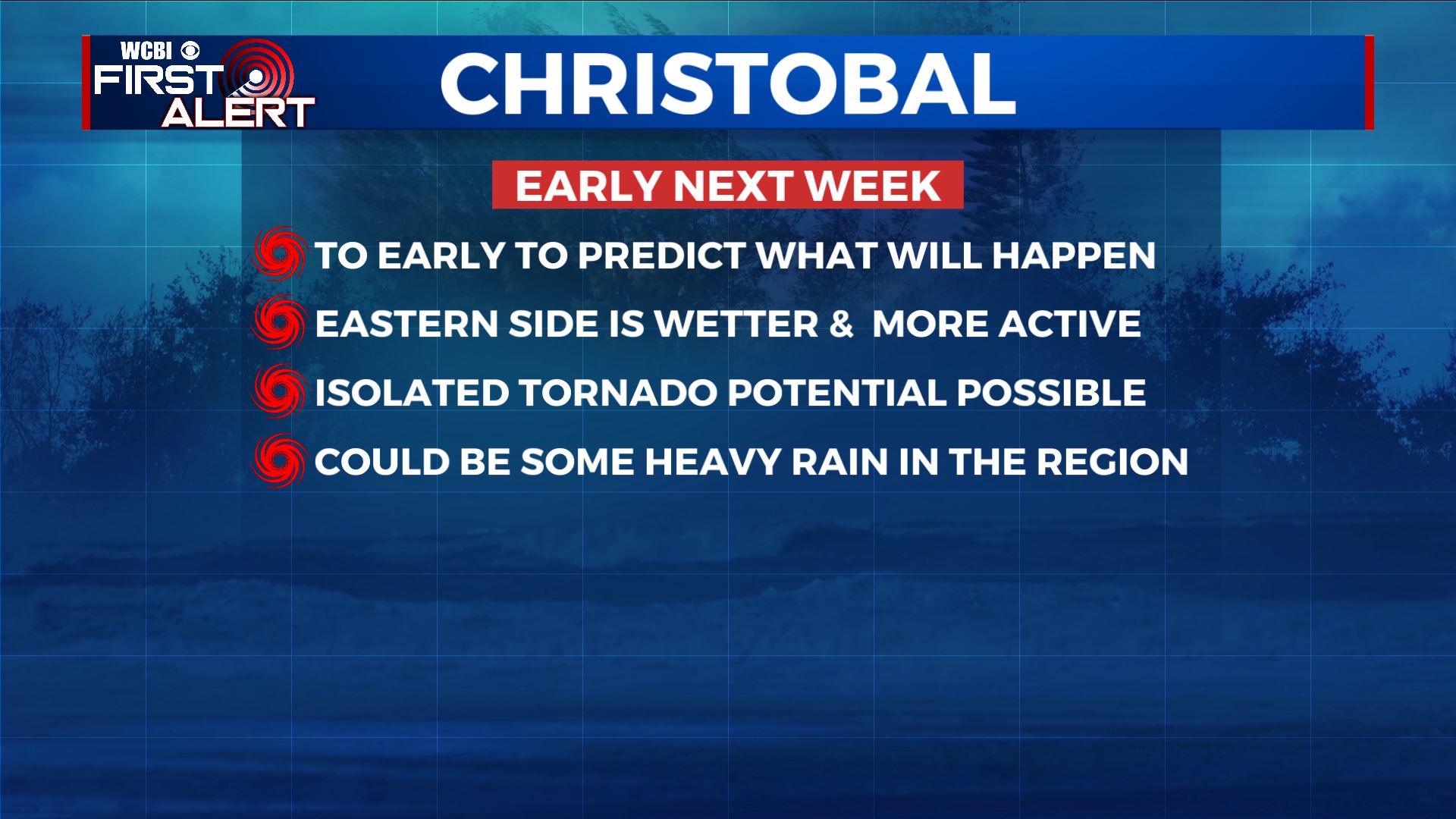
SUMMARY: Fairly standard summer weather can be expected for the rest of the work week. That means plenty of heat, humidity, and scattered storms during the heating of the day. Things should settle down for the weekend but by that time Tropical Storm Cristobal will be approaching the Northern Gulf Coast. It’s too early to tell exactly where the storm will end up but if the center tracks to our west we could have some heavy rain in the area and an isolated tornado threat. Stay tuned for more info in the coming days.
TUESDAY NIGHT: Variably cloudy, quiet, and muggy. Lows in the upper 60s to around 70.
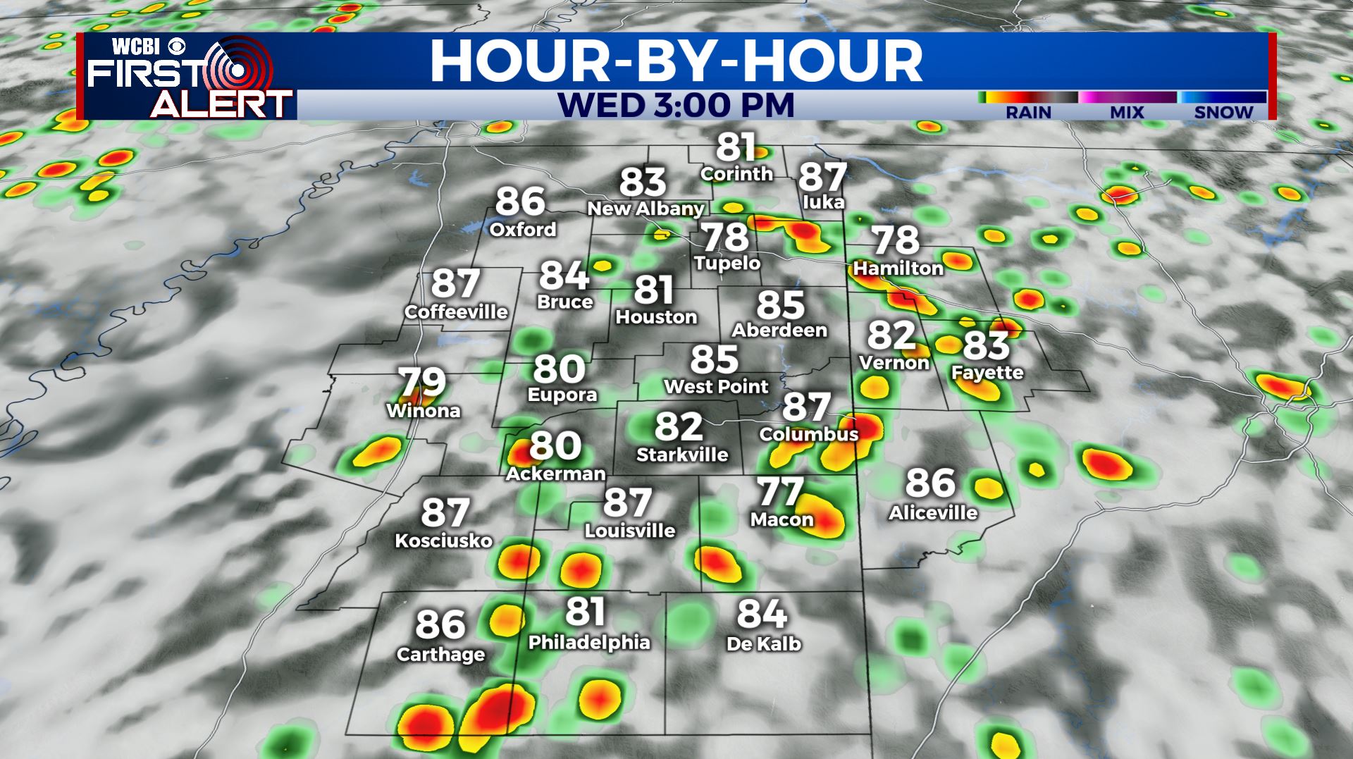
WEDNESDAY: Scattered rain and storms with the highest coverage during the heating of the day. Any storm this time of year may produce gusty breezes, heavy downpours, and lots of lightning. Highs top out in the upper 80s. Winds SW 5-10 mph.
WEDNESDAY NIGHT: Showers and storms end during the evening with muggy conditions taking hold overnight. Lows will be in the upper 60s to around 70 again.
THURSDAY: More scattered showers and storms are possible. Look for highs in the mid to upper 80s. Things settle down Thursday night with muggy lows in the upper 60s.
FRIDAY: Pop-up showers and storms remain possible as temperature top out in the upper 80s. Not everyone will get a storm.
WEEKEND: Overall quiet conditions are currently anticipated in our area but some rain or storms can’t be ruled out. Tropical Storm Cristobal will approach the Northern Gulf Coast by late Sunday.
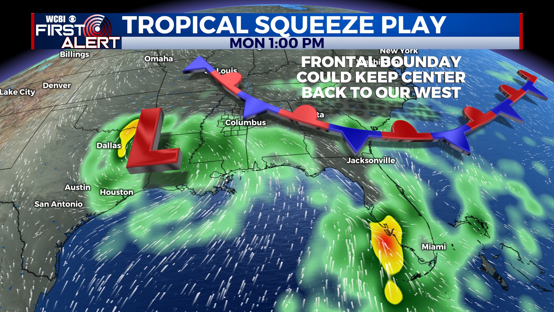
MONDAY-TUESDAY: The forecast will be determined where the center of Tropical Storm Cristobal ends up. If we are east of the center then heavy rain and isolated tornadoes will be possible depending on things set up. If it goes farther west then influences will be minor. If it goes farther east the opposite will hold true. It’s a waiting game and we’ll just have to take it day by day.
Follow @WCBIWEATHER on Facebook, Twitter, Instagram, and the WCBI News App


Leave a Reply