Seems like several seasons
COLUMBUS, Mississippi (WCBI)- Looking at the forecast, you would think Mississippi is trying to put as many seasons into this first week of April. Hot temperatures begin the week, storms and rain showers expected mid-week and on, and a big temperature drop.
TUESDAY NIGHT: Temperatures tonight are going to be mild and humid. The overnight temperatures tonight are going to be in the middle to upper 60s. Cloud coverage is going to hold heavy for the next several days.
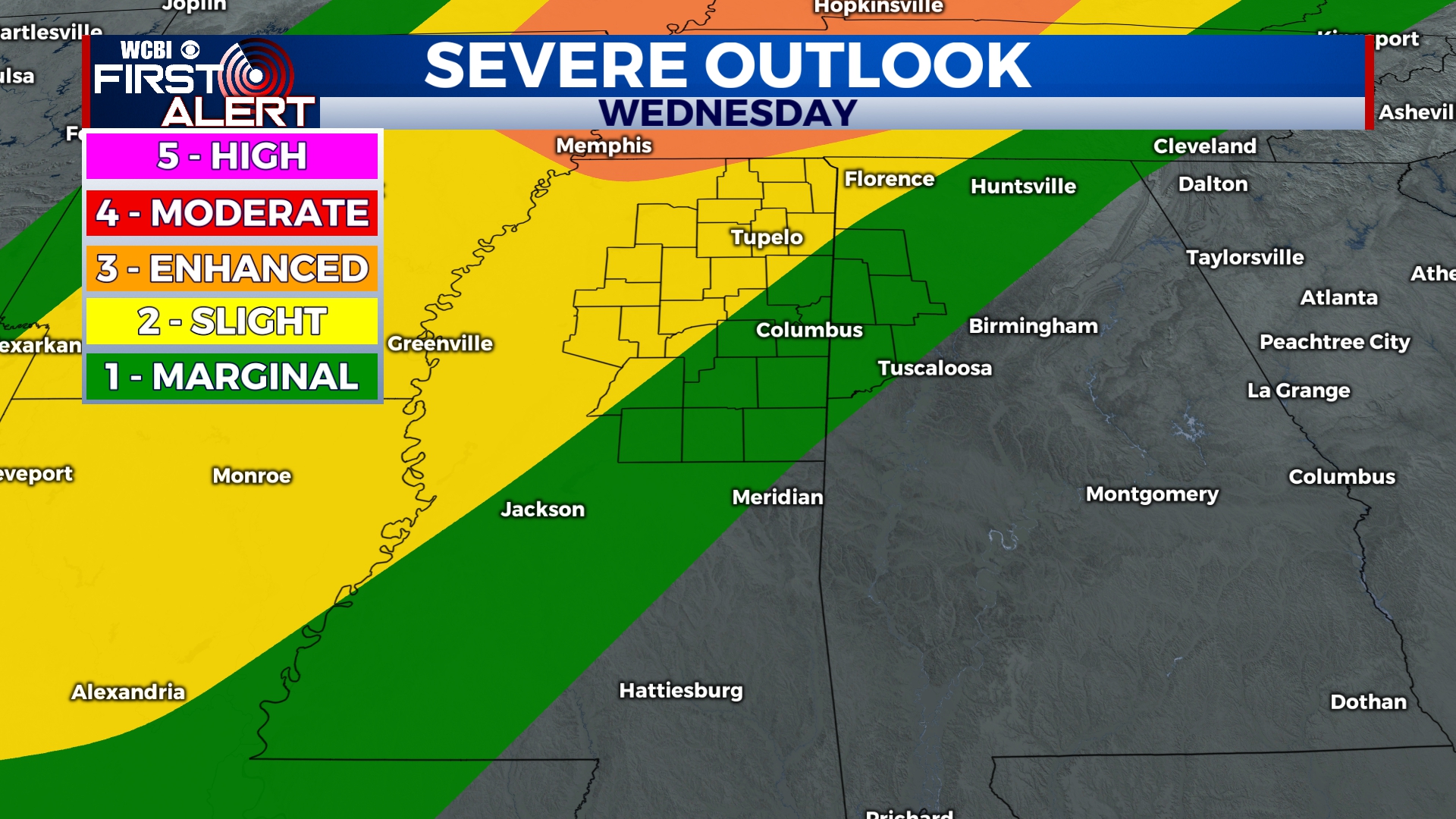
WEDNESDAY: Another hot day is in store! High temperatures are heading back into the 80s. Rain showers will be light and scattered for most of the morning. Heavier showers and storms will build in throughout the late afternoon and into the evening. NE Mississippi is split between a Level 1 and Level 2 severe risk. Gusty winds and heavy rain is likely. Hail is possible. There is a low possibility for tornadoes however, not zero. The WCBI weather team is keeping our eyes on this system.

END OF THE WEEK: Rain showers are going to continue, as the passing cold front turns stationary along the Gulf coast. Cooler air behind the front will have temperatures taking a nearly 20 degree drop compared to the beginning of the week. High temperatures will be in the low to middle 60s. Overnight temperatures will be fairly mild, in the low to middle 50s, due to continuing heavy cloud coverage.


