Several hours of dangerously cold weather
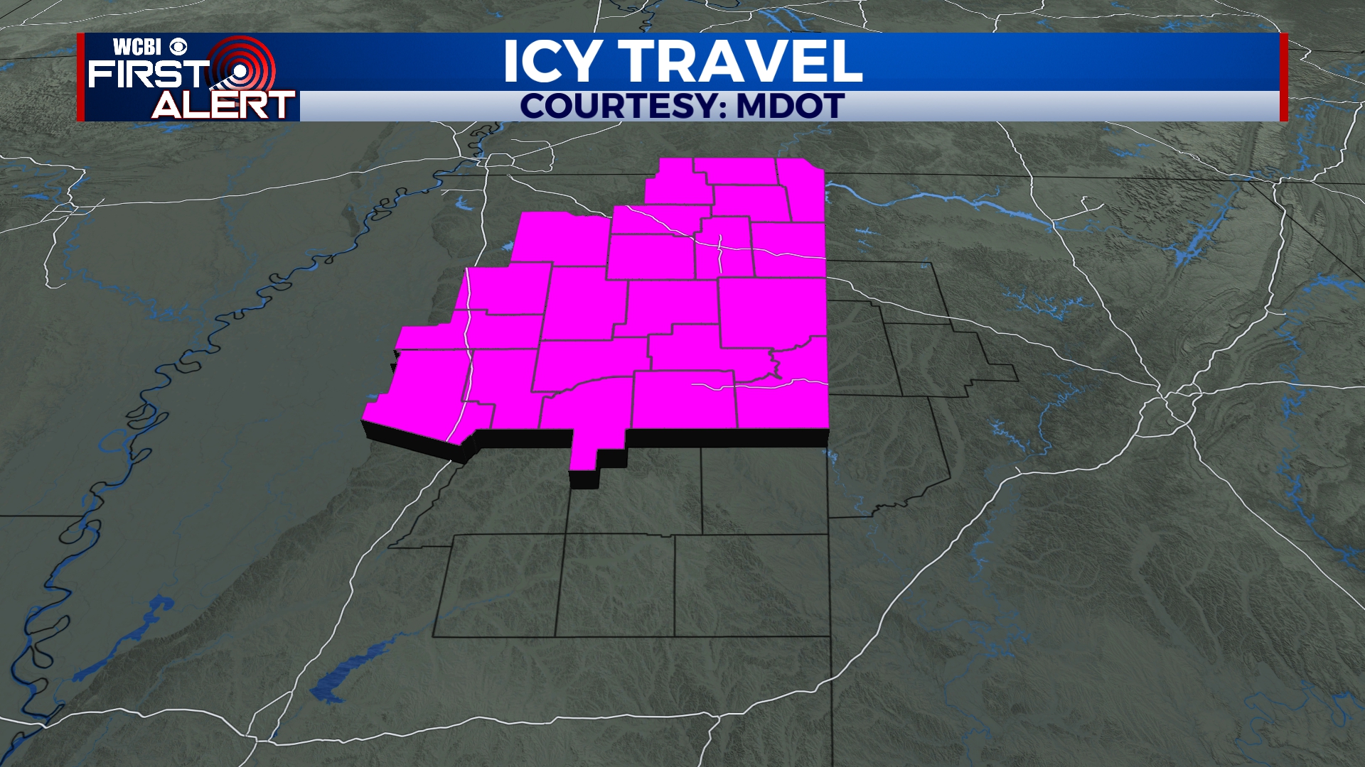
COLUMBUS, Mississippi (WCBI) – The snow, sleet, and freezing rain started up Sunday night and has continued throughout the day. Temperatures have not reached above freezing, nor will they for a couple of days. Be prepared for cold and harsh travel conditions for the next couple of days.
MONDAY NIGHT: Freezing weather will continue on through the night. While most of our northern portion of the viewing area has seen consistent winter precipitation, the lower half has been more isolated. Around 5/6PM, precipitation from around the Delta will be bringing more freezing rain/sleet across the southern half of our corner. There is a Winter Storm Warning that continues until Tuesday. Road conditions will become dangerous over the next several hours, as precipitation and temperatures continue to fall.
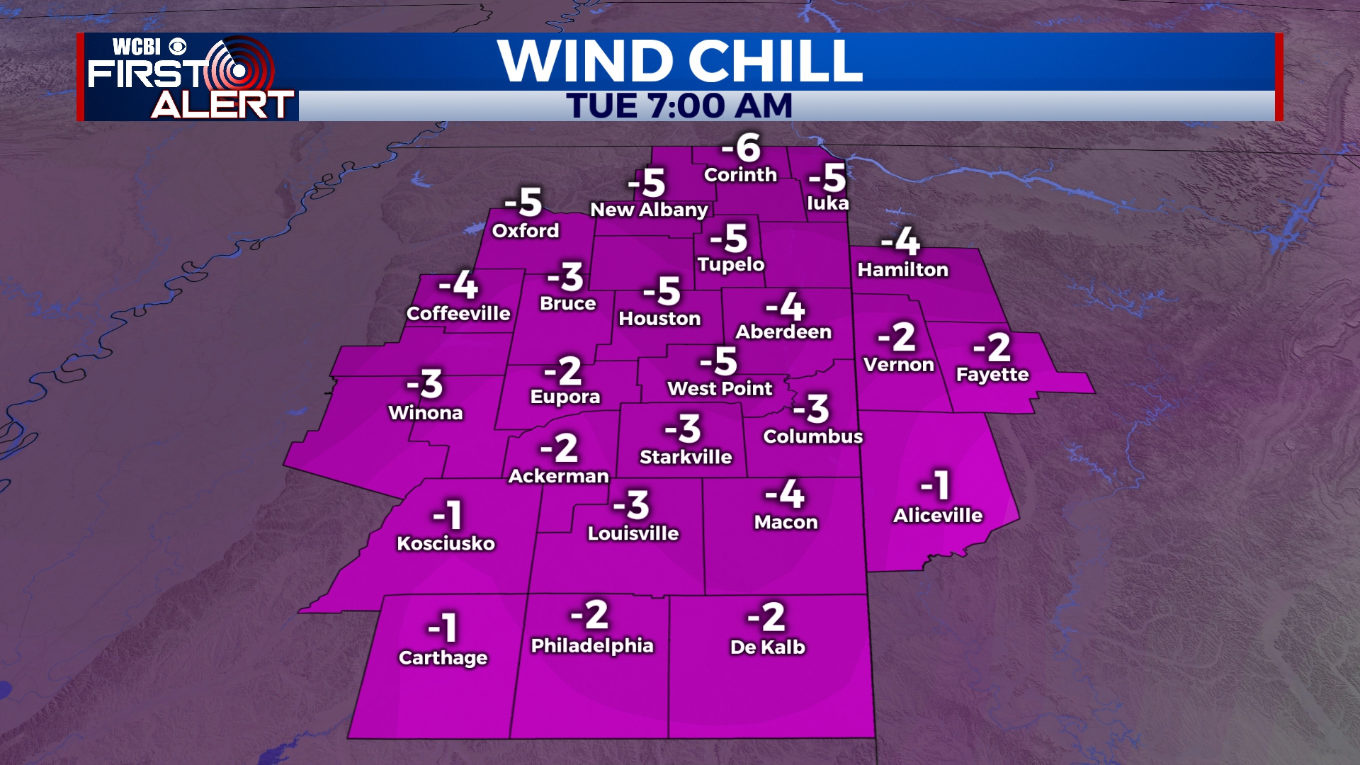
TUESDAY: We should see some clearing through the day, though a good amount of the cloud coverage will remain. Highs will continue in the 20s area-wide with wind chills hanging in the single digits. Travel difficulty could continue, especially in heavier precip. areas from Monday. Our COLDEST night moves in Tuesday night, where overnight lows in the single digits are likely…with sub-zero wind chills likely for most.
WEDNESDAY: Temperatures will try warming up a bit more, heading towards above freezing. High temps are looking to reach towards the upper 30s. The sky will become mostly clear from overnight gradual clearing. Overnight low temperatures will be sub-freezing again, dropping into the lower 20s.


