Severe Risk Tonight
COLUMBUS, Mississippi (WCBI) – A cold front will allow for some severe thunderstorms overnight and drop temperatures into the 80s tomorrow.
TONIGHT: A marginal (1/5) and slight (2/5) severe risk has been issued by the SPC for tonight into the early morning tomorrow. The main risk is damaging winds and small hail. These storms will be strong, so make sure to stay weather aware. One line of storms will develop around 9pm in our northern counties, while the main being in the early morning hours. A Severe Thunderstorm Watch is in effect for Tishomingo, Prentiss, Alcorn, and Tippah County until 12:00 AM.

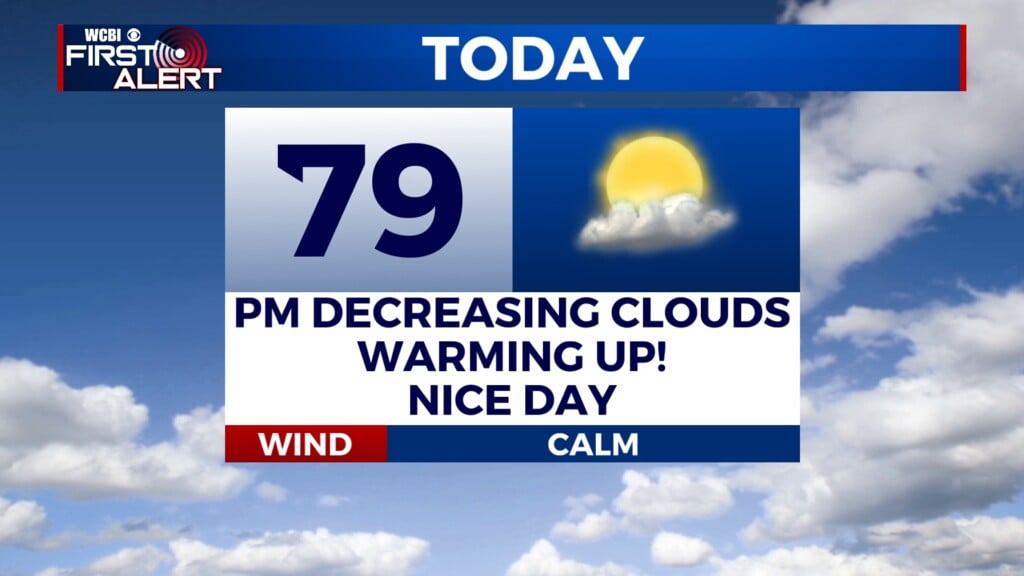
TOMORROW: The cold front will move through in the morning hours bring more rain and thunderstorms. Highs will be in the mid 80s for the day with the rain chances decreasing into the afternoon hours. By football kickoff, temperatures will be in the 70s with a partly cloudy sky overhead. Lows will be in the low to upper 60s.
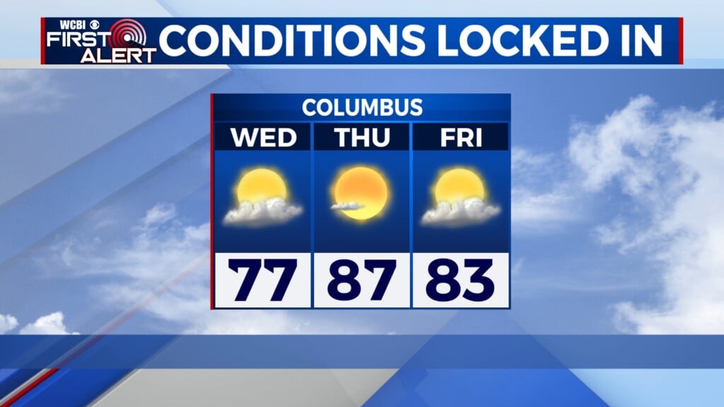
SUNDAY: Slim to no rain with highs in the mid 80s. It will cooler due to the cold front. Highs will remain in the 80s for the start of the work week.