Severe storms, flooding likely Tuesday
COLUMBUS, Mississippi (WCBI) – Strong to severe storms along with heavy rain/flooding are likely across the area Tuesday afternoon and early evening.
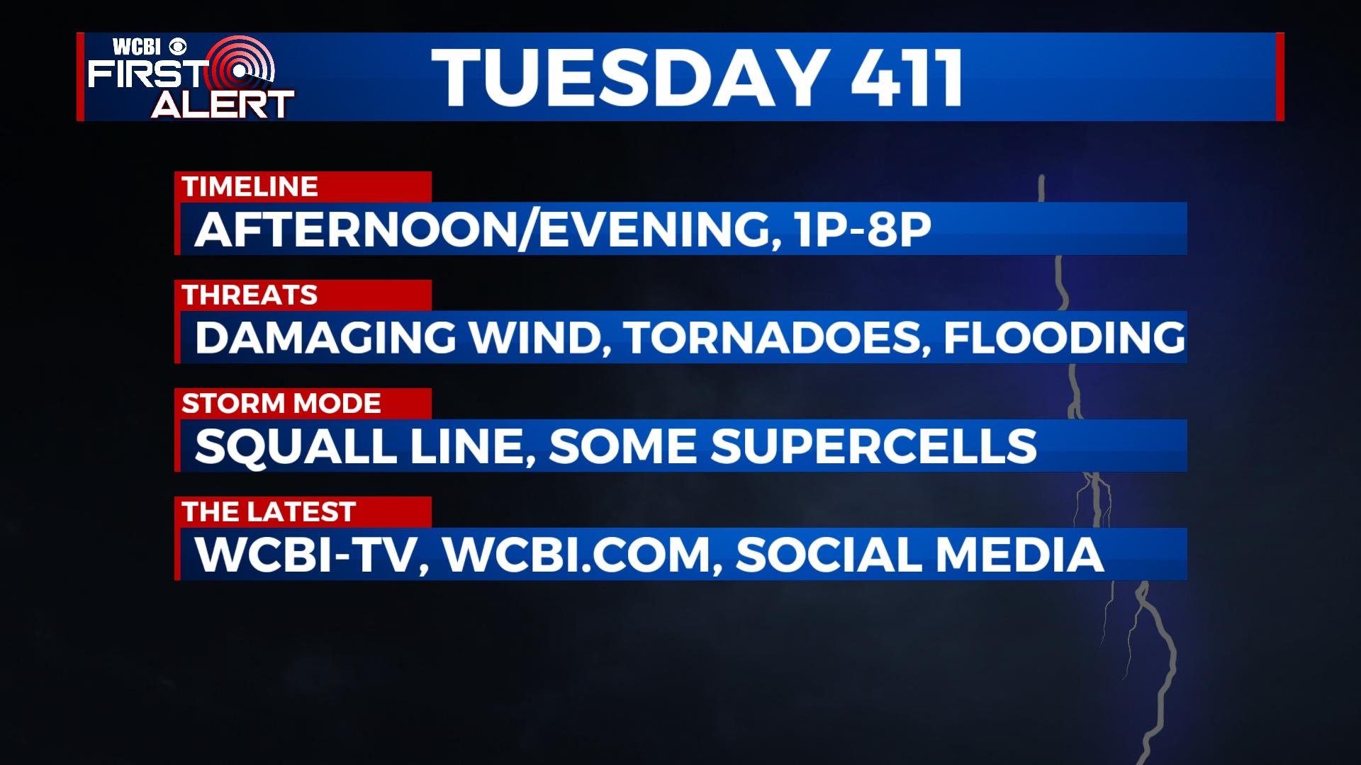
TUESDAY: While the day starts dry, clouds thicken up quickly in advance of an active afternoon and early evening. Before any rain or storms arrive, highs will reach the low to middle 70s with southeast wind gusts of 30-40 mph. This increase in warmth and eventually moisture will lead to an environment capable of sustaining both incoming storms as well as any developing storms. Increasing wind shear will promote all modes of severe weather in this afternoon’s storms, including the chance of a couple stronger-type tornadoes, damaging wind gusts, and hail. The primary time frame for this activity to occur is 1p-8p, so remain extra weather aware and be ready to reliably receive watch and warning information.
TUESDAY NIGHT: Storms should end well before midnight, but clouds and spotty showers stick around overnight. A strong breeze is expected as well as overnight lows drop into the upper 40s to lower 50s.
WEDNESDAY: Clouds continue much of the day along with an isolated shower, but most places will stay dry and breezy. Expect highs to hold near 60 degrees.
REST OF WEEK: Gradual clearing is on tap for Thursday and Friday with chilly nights and cool afternoons in the 60s.
WEEKEND: Lots of sunshine is expected both days with cool nights and increasingly mild afternoons. The weather should be fantastic for Wings Over Columbus!


