Severe storms possible Monday, much cooler Tuesday
SUMMARY: A cold front will slice through the region tomorrow, bringing a squall line with showers and storms. This will sweep across the entire area during Monday morning, with the potential for some damaging winds and a brief spin-up tornado. After the front clears the area, temps will get much cooler for Tuesday. We begin to warm by Wednesday, and we’ll be downright toasty by the end of the week ahead of yet another cold front. Some severe weather could be possible again by next weekend. After another round of rain and storms Friday into Saturday, things dry out and turn much colder for Sunday.

SUNDAY NIGHT: A very mild night in store with breezy winds from the south. A few showers or storms are possible, especially North and West and later on in the night. Temps will hold steady in the low to mid 60s.
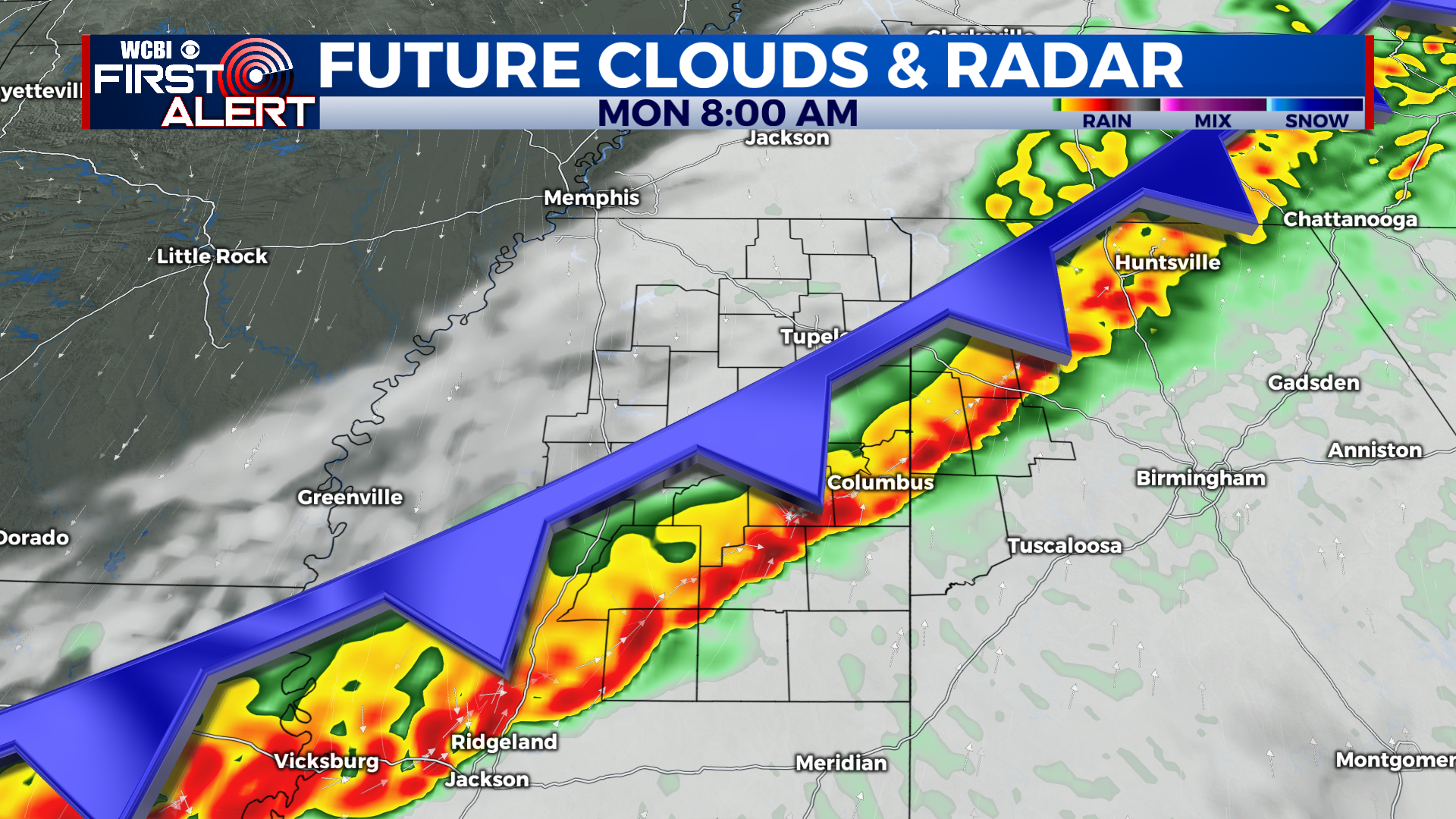
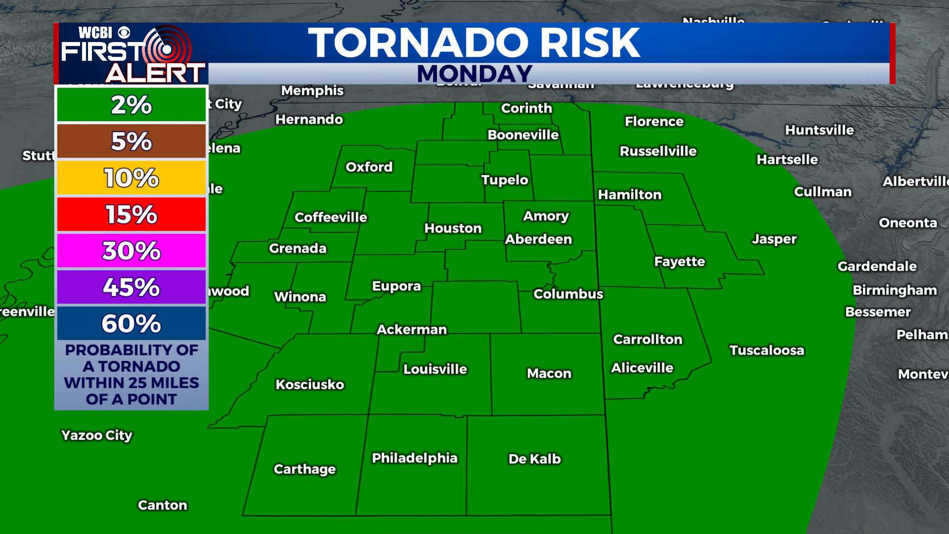
MONDAY: A squall line enters the area from the NW by around 4am on Monday morning. It will move through the entire area over the following few hours, bringing the potential for damaging winds and a brief spin-up tornado to the area. The best threat for a tornado will be north and west of Tupelo. After the line of storms moves through, temps fall for the rest of the day with breezy northerly winds- it’ll be in the 40s by dinner time!
MONDAY NIGHT: A return to chilly December temps comes Monday night. Lows will drop into the low to mid 30s, with a freeze possible in rural locations.
TUESDAY: A chilly and cloudy day for Tuesday, many of us won’t get past 50 degrees. Skies will be cloudy for much of the day, with a couple sprinkles or a light shower possible. Highs will be right around 50.
WEDNESDAY TO SUNDAY: Another cooler day Wednesday, but it will be much warmer than Tuesday. We could see a few rain showers to start off the day. Temps will stay mild Wednesday night, and Thursday we will warm into the upper 60s in the afternoon. We should stay dry and mostly cloudy on Thursday. Friday and Saturday will be very warm, we could even break record highs. Highs will be in the mid to upper 70s, possibly near 80 in spots. Saturday looks a touch warmer than Friday at this time. Showers and storms will be possible on Friday and likely on Saturday, with another powerful cold front bringing the potential for some stronger storms. Highs will drop all the way into the 40s or low 50s for Sunday, with clearing skies.
CONNECT WITH @WCBIWEATHER ON TWITTER, FACEBOOK AND INSTAGRAM