Severe storms possible Tuesday afternoon
COLUMBUS, Mississippi (WCBI) – A stormy Tuesday afternoon will give way to much cooler air through the rest of the week.
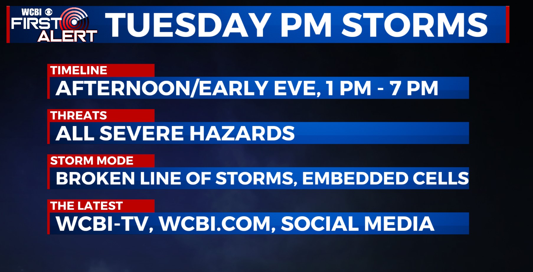
TUESDAY: The sky stays mostly cloudy through the day as temperatures climb into the upper 70s and low 80s area wide. Gusty south winds up to 20-30 mph will keep warm & increasingly unstable air flowing into our area as well. The end result will be a broken line of storms developing by late morning near the MS River, strengthening & developing into central and northern MS into the peak heating hours (2-6p). All modes of severe weather (hail, wind, tornado) are possible with these storms, so be extra weather aware!
TUESDAY NIGHT: Storms will clear out shortly after sunset, leaving the the rest of the night chilly but dry. Lows will end up dropping into the upper 40s after midnight!
REST OF WEEK: Days stay cool, and mornings will get increasingly cold by Friday morning where some frost is possible! We’ll also see decreasing cloud coverage through the week as well.
WEEKEND: Quiet weather sticks around Saturday, but clouds will quickly increase on Sunday ahead of the next system early next week.