Severe storms Wednesday afternoon and evening
COLUMBUS, Mississippi (WCBI) – Severe storms are likely across the region Wednesday late-afternoon into the evening. The weather is expected to clear for the end of the week.
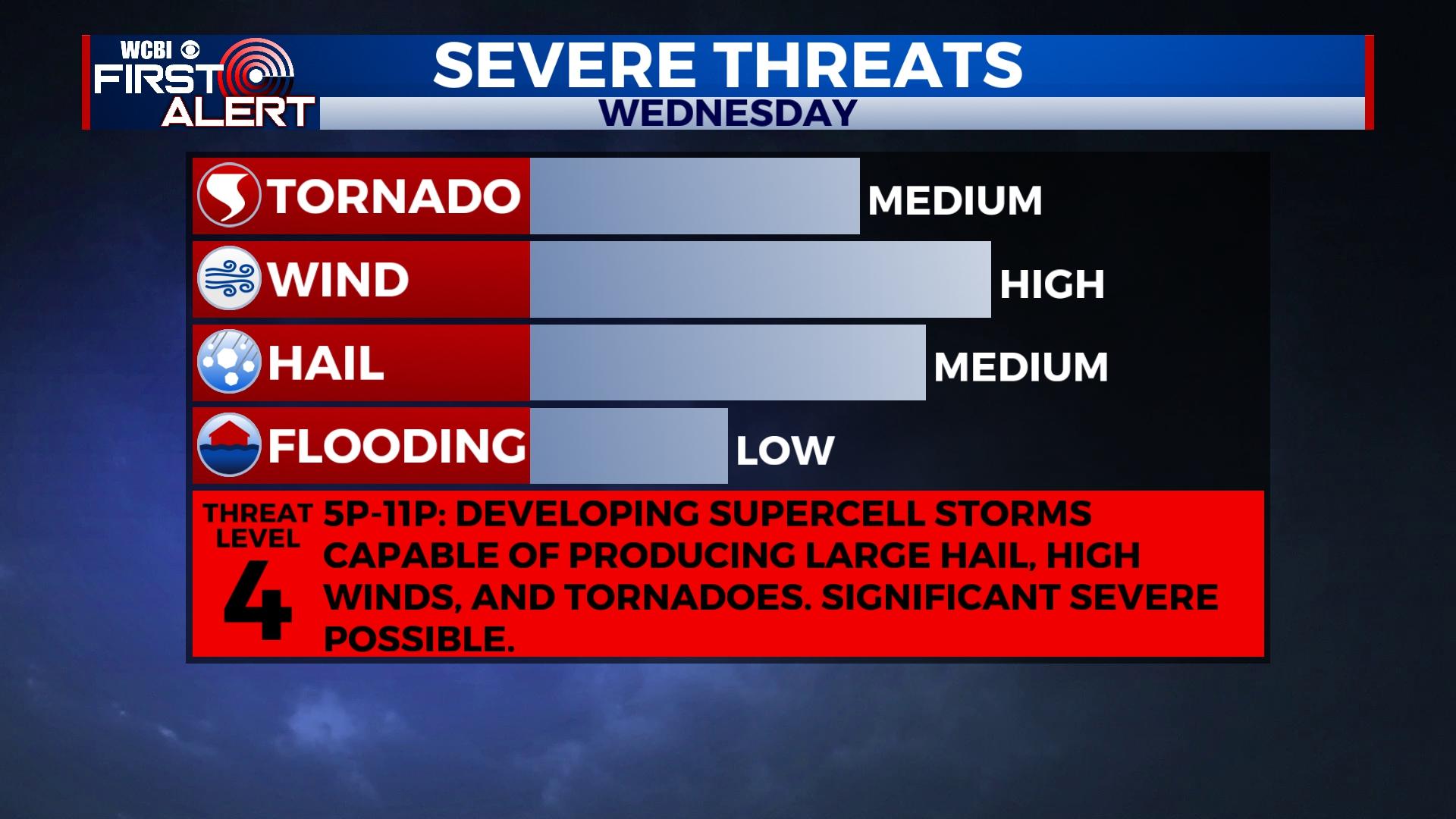
WEDNESDAY: New storm development is expected along the MS river by 4-5p, and these storms will quickly track into north MS after 5p. The environment across most of the region will be favorable for supercells capable of producing damaging winds, large hail, and tornadoes. Some of the hail stones could be significant (2″+), and a couple of tornadoes could be strong to significant. It is imperative for everyone to remain close to a reliable source of weather information through this event!
TIMELINE: Severe storm chances are highest across the viewing area from roughly 5p until 11p Wednesday.
THURSDAY: Quiet and mostly sunny weather returns along with less humidity! Daytime highs should reach the middle 70s -a pleasant day after a stormy Wednesday.
FRIDAY: Much of the day should be dry and increasingly warm/humid as highs return to near 80 degrees. Clouds will increase late in the day, and some showers are likely to move in after sunset into the overnight hours.
WEEKEND: A nearly-stalled front will help to pool up moisture near the region for Saturday and Sunday, and with an active zonal flow in the upper-levels, a few rounds of rain and isolated storms are expected. At this point, no severe weather is expected due to unfavorable wind shear. However, pockets of heavy rain are likely, and this could potentially lead to a few localized flooding issues.
NEXT WEEK: After an unsettled Easter weekend, the weather dries out for Monday and Tuesday with seasonable mid April temperatures.


