Severe weather threat Tuesday across Mississippi
COLUMBUS, Mississippi (WCBI) – A heightened threat for severe weather exists across much of the state today, including most of the WCBI coverage area. Colder air returns Wednesday.
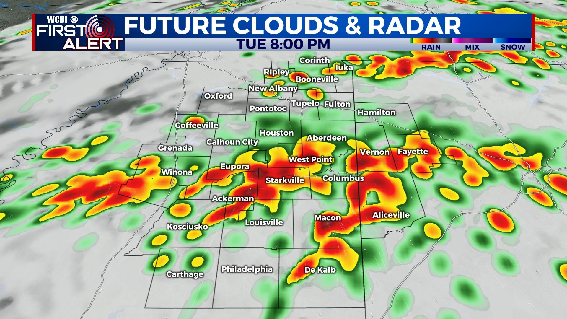
TUESDAY: Clouds will increase through the day as warm, southerly breezes develop. Expect highs near 70 degrees for most spots with wind gusts up to or exceeding 25 mph. Scattered showers and a few storms will likely break out by midday, and these storms will be generally non-severe…but a few instances of hail are possible. As the air continues to destabilize through the afternoon, chances of surface-based, stronger storms will increase. Parameters suggests supercell storms are possible, and this includes the threat for tornadoes. The highest tornado risk will develop after 3p and likely last into the evening hours. There is a chance of a longer-tracked, strong to significant tornado or two as well. Storms may form into a line late into the evening, but tornadoes will still be possible into west Alabama after 9p into parts of the overnight.
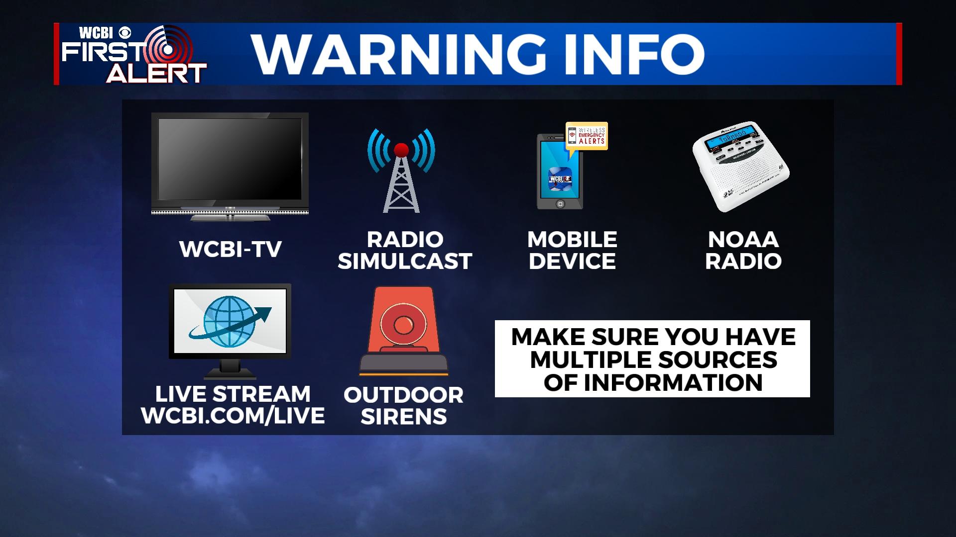
CALL TO ACTION: Review your severe weather plan. Know where to go and what to do. Have multiple ways to get watch & warning information, and make sure all batteries are charged and fresh.
WEDNESDAY: Storms end prior to daybreak Wednesday, and much colder air will rush into northeast MS during the day. Highs will struggle to the low 50s with brisk northwest winds up to 25 mph, making for quite a chilly day!
THURSDAY: After a freezing start to the day, temperatures will only rebound into the mid 50s but with sunshine.
FRIDAY: Clouds increase quickly ahead of the next cold front. A few showers are possible late-day, but widespread rain is not expected.
WEEKEND: A stalling front brings increased rain chances for Saturday & Sunday. While both days won’t be washouts, it’s looking rather cloudy with on and off rain both days. Highs will be in the 60s to near 70 degrees.