Showers and potentially severe storms Wednesday evening
COLUMBUS, Mississippi (WCBI) – Another front brings another risk of severe storms Wednesday night. Cooler weather will get us into the weekend.
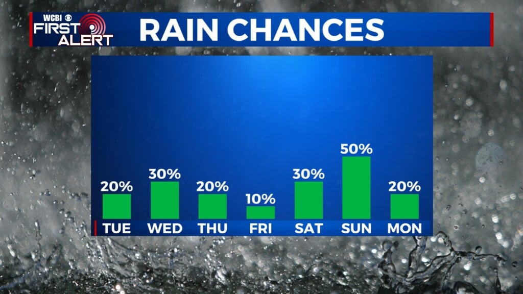
WEDNESDAY: Dense fog is widespread across most of the region this morning and will take some time to dissipate…likely not until 10 AM or longer. Then, the weather trends significantly warmer and breezier with highs in the 70s and wind gusts up to 20-30 mph. Spotty downpours are possible through the day, but any risk of severe weather should hold off until after sunset.
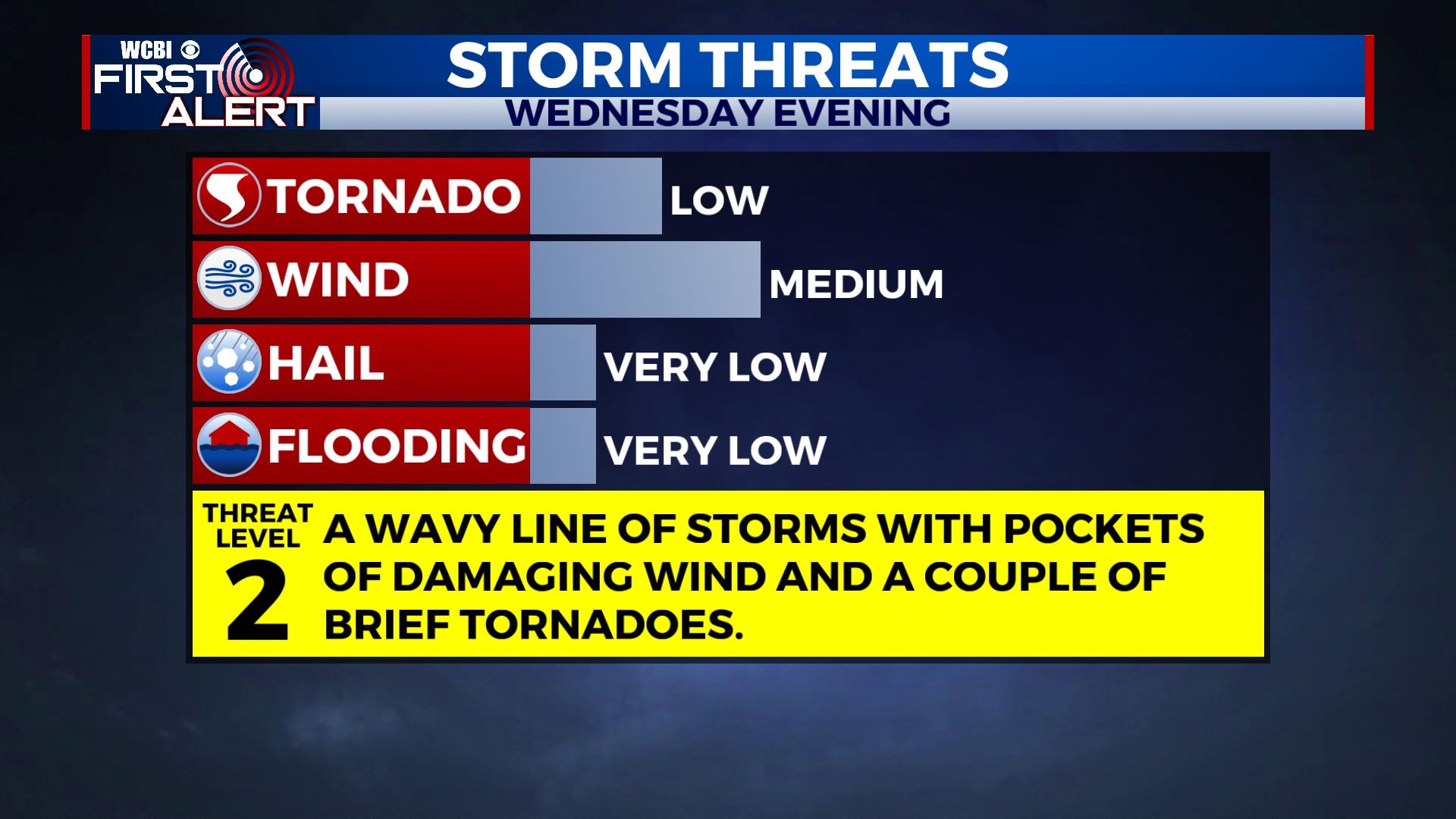
WEDNESDAY NIGHT: An approaching front and line of storms will pose some severe weather risk across northern MS after sunset. The overall setup is characterized by decent moisture, high amounts of wind shear, but limited instability or storm energy. With this in mind, potentially damaging wind gusts and a brief tornado or two are possible with the storms. The main time frame to watch is roughly 6p to midnight.
THURSDAY: As drier air filters in, sunshine returns with highs back in the mid to upper 60s. Winds will again be breezy, this time out of the west up to 20-25 mph.
FRIDAY: Expect a mix of sun and clouds with cooler weather as highs drop back into the 50s.
WEEKEND: Still a bit of uncertainty, though forecast models are finally coming into better agreement. Cloud coverage will build Saturday, and widespread and locally heavy rain will spread across the region Saturday night into early Sunday. Rain coverage should gradually decrease by Sunday afternoon. Highs will stay in the 50s both days.
NEXT WEEK: The wave train of systems will continue, though uncertainty remains quite high. Monday looks to stay dry, but Tuesday into Wednesday brings the next system and next chance for rain. Stay tuned for updates!