Showers end tonight, but rain returns in the forecast
The remnants of Nicholas continue to slowly move through Louisiana. Ahead of the low pressure center, a large mass of rain continues to extended through the Mississippi Valley and southeast U.S.. As a result, a tropical airmass is expected to remain in place with scattered showers and thunderstorms possible daily through at least the beginning of next week.
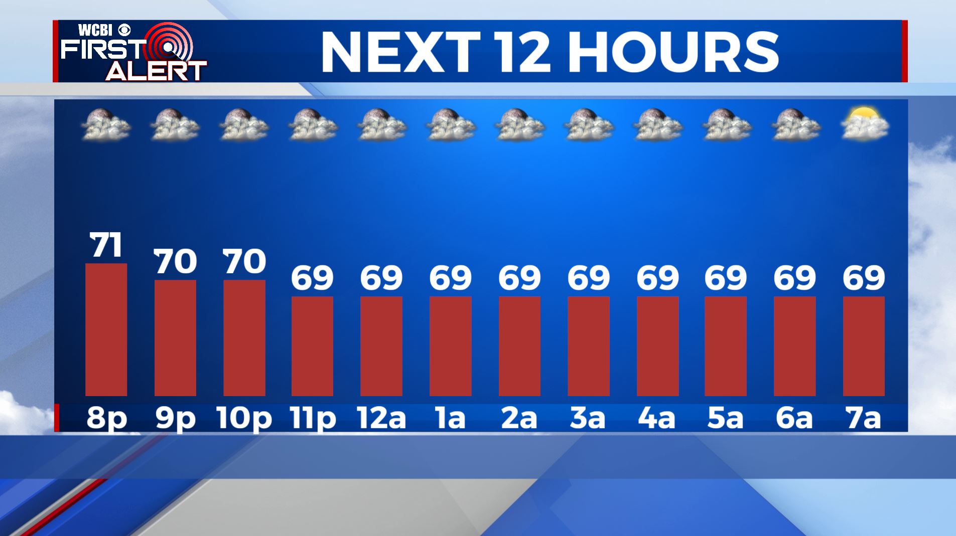
TONIGHT: Overcast with a few isolated showers. Overnight lows in the upper-60s. Chance of rain: 20%.
THURSDAY: Overcast with isolated showers. Afternoon high temperatures in the low-80s. Chance of rain: 30%.
THURSDAY NIGHT: Overcast with scattered showers. Overnight lows in the upper-60s. Chance of rain: 40%.
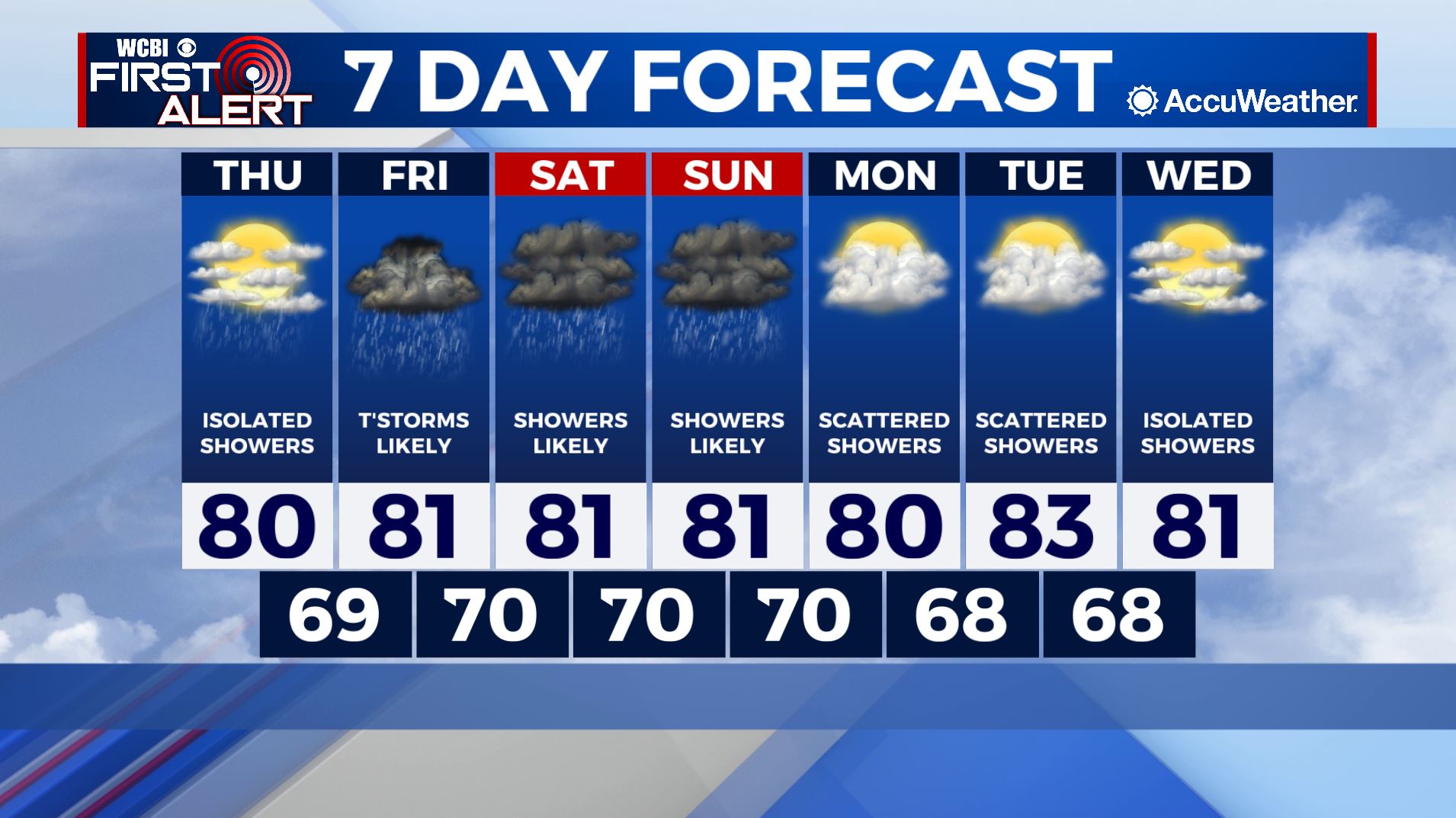
THIS WEEKEND: A few changes are ahead as we move into the weekend. Upper level dynamics will become more supportive of widespread rain Friday, and the potential exists for a few scattered thunderstorms as well. We will go with about a 70% chance of rain for Friday then 60% likely Saturday and Sunday. A warm and humid airmass will remain in place through the end of the forecast period with scattered showers possible to start next week. A trough will dig through central parts of the country, and hopefully deliver drier air by the middle of next week.