Showers & storm chances will continue to increase
SUMMARY: Scattered showers and storms will continue through Thursday. On Friday, a cold front will approach the area and it is looking like a washout, but much cooler temperatures. The cold front should be out of here by Saturday afternoon, so that means a pretty nice & dry holiday weekend. Shower and storm chances will return early next week.
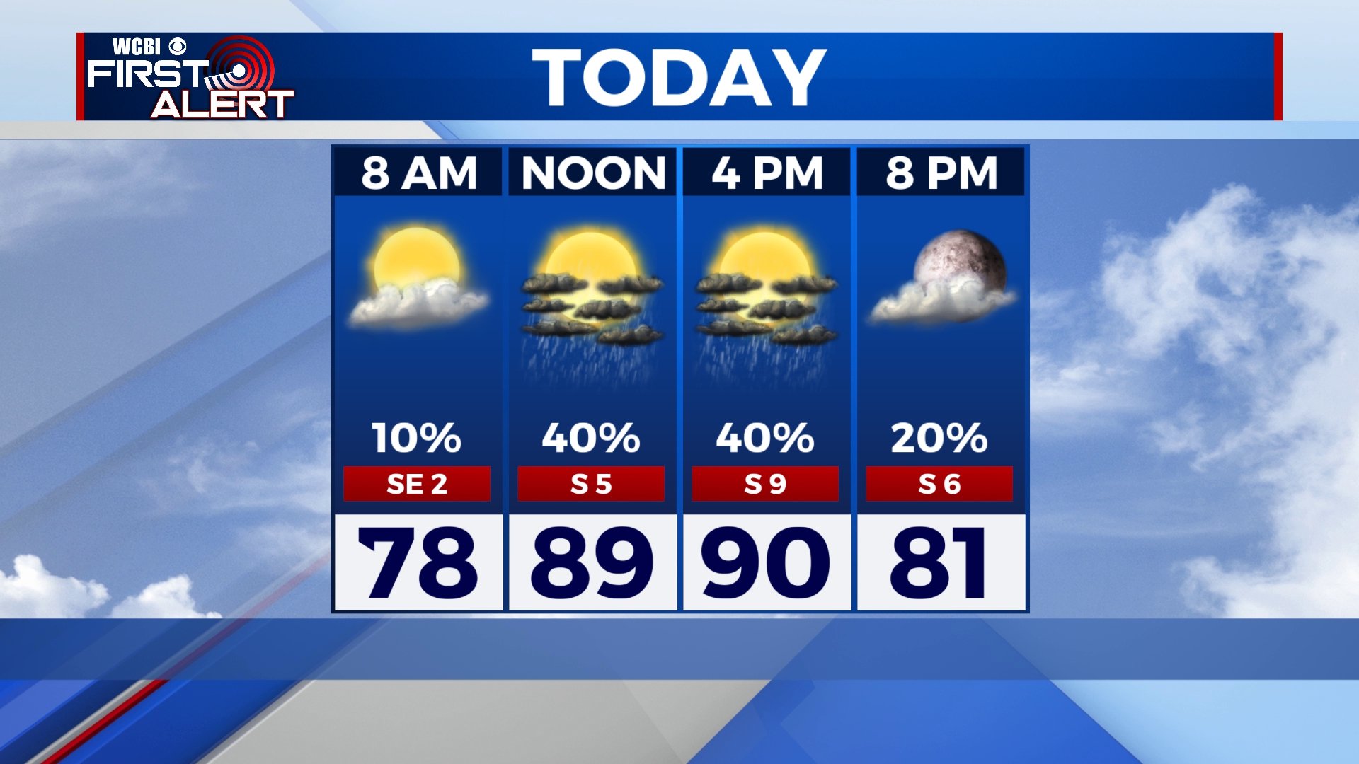
WEDNESDAY: A mix of clouds & sun with pop-up afternoon showers and storms in the forecast again. Highs remain seasonable & humid around 90 degrees. Southerly winds 5-10 mph.
WEDNESDAY NIGHT: Showers and storms will dissipate as the sun sets and lose the daytime heating. Staying muggy & mild with partly cloudy skies and overnight lows in the lower 70s.
THURSDAY: Better chances of showers and storms as we begin the month of July. Highs around 90 degrees.
FRIDAY: Rain & storm chances will continue to increase with scattered to widespread showers and storms as a cold front will be pushing through north Mississippi and west Alabama late Thursday into Friday. High temperatures Thursday will remain near 90 degrees before cooling down into the lower to mid 80s on Friday.
HOLIDAY WEEKEND: Rain chances will continue into Friday night. The front will push out of here, leaving us with a dry and pleasant late Saturday afternoon into the 4th of July holiday on Sunday with a mix of sun & clouds. High temperatures less humid & nice in the lower to mid 80s. Overnight lows will also be pretty nice in the low to mid 60s.
EARLY NEXT WEEK: Humidity and heat returns as we start the new workweek. Highs will be rising back to the mid to upper 80s. Scattered storm chances return for Tuesday.
Stay connected with @WCBIWEATHER on Facebook, Twitter, Instagram and the WCBI News App


Leave a Reply