Spotty to scattered storms returning
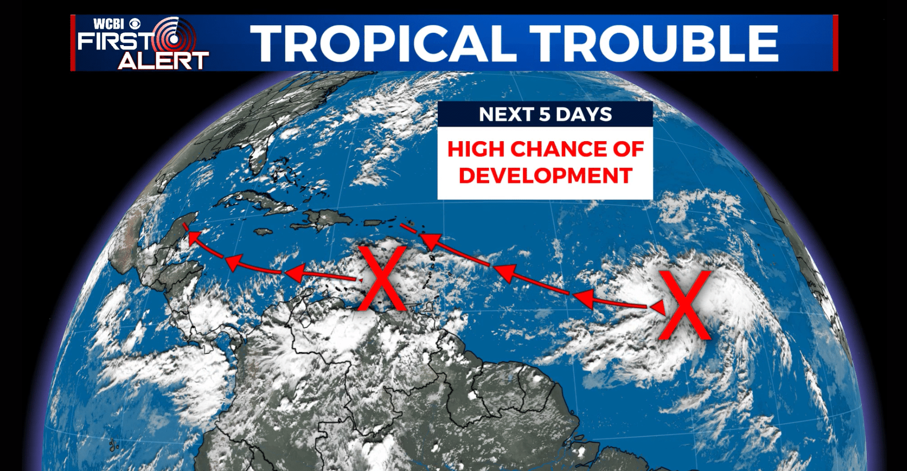
SUMMARY: A few spotty showers or storms are once again possible on Wednesday. The highest odds and coverage of rain/storm should come Thursday & Friday as an upper level disturbance moves through the region. We continue to monitor 2 tropical entities and they could have some impact on the Southeast in the next week or so.
TUESDAY NIGHT: Mostly clear to partly cloudy. Lows in the mid to upper 60s. Winds NW 2-5 mph.
WEDNESDAY: Partly cloudy with a 20-30% chance of a shower or storm. Highs in the upper 80s to lower 90s. Winds N 4-8 mph.
THURSDAY-FRIDAY: Variably cloudy, warm, and humid. Highs in the upper 80s. Scattered showers and storms are possible each day with the chance of rain about 50%. Lows in the upper 60s.
SATURDAY: Partly cloudy with a 30% chance of showers and storms. Highs around 90.
SUNDAY-MONDAY: Sun & clouds. A few isolated showers or t-showers can’t be totally ruled out but rain chances are 20% or less. Highs climb back into the low to mid 90s with overnight lows in the low 70s.
TROPICS: There are two items of interest that need to be watched closely. One is moving through the eastern Caribbean Sea and another one is out in the open Atlantic. Both features are drifting back to the WNW and have a good chance of development over the coming days.
Follow @WCBIWEATHER on Facebook, Twitter, Instagram, and the WCBI News App


Leave a Reply