Spring-like temps, rain, and storms
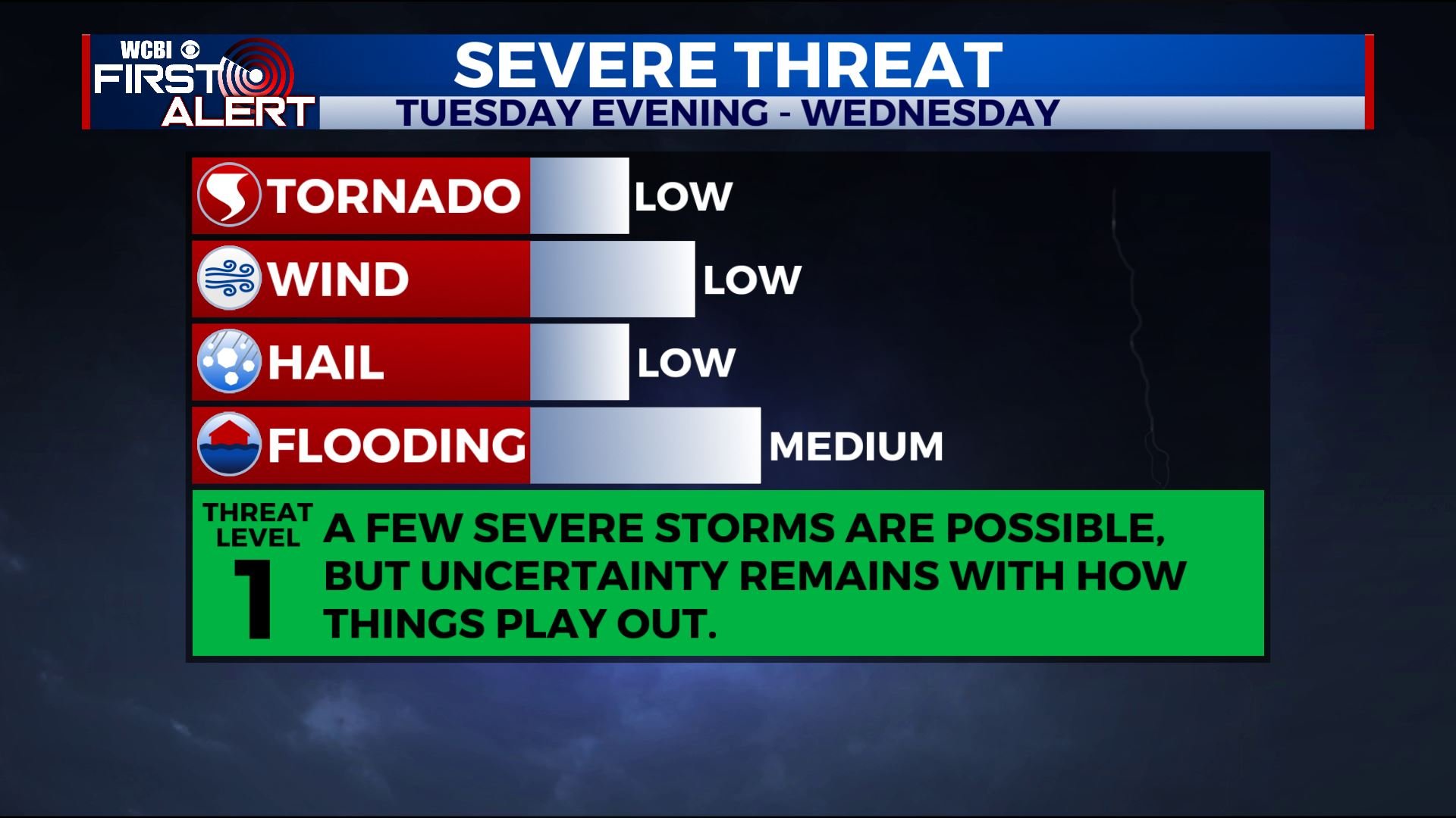
SUMMARY: Unseasonably mild air will continue through the middle of the week. Shower chances return tonight and rain opportunities stick around into Thursday. The heaviest rain and storm activity is likely on Wednesday. Some strong to severe storms are possible during this time as well.
MONDAY NIGHT: Clouds fill in with showers becoming possible. Breezy southerly winds around 10 mph should keep temperatures in the upper 50s.
TUESDAY: Mostly cloudy, breezy, and mild with highs around 70. Passing showers with southerly winds between 10 and 15 mph.
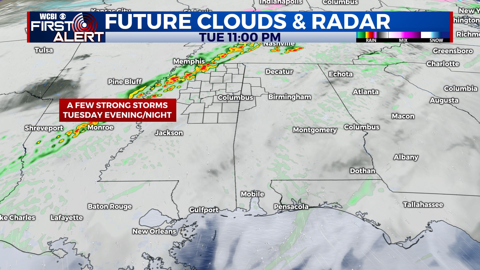
TUESDAY NIGHT: Mild lows in the low 60s. Scattered showers and storms are possible. While a strong storm can’t be ruled out near I-55 most locations will likely have any intense activity to worry about.
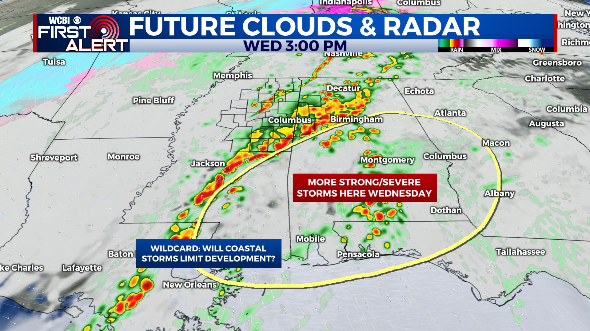
WEDNESDAY: Areas of rain and storms. Some could be strong with gusty winds and heavy rain being the primary threats. An isolated tornado can’t be ruled out depending how things set up. A big wild card will be whether or not a coastal storm complex develops. If they do then strong/severe storms this far north would be unlikely. However, if they don’t then we’ll have to watch the situation a little more closely. Highs remain in the 60s to lower 70s.
WEDNESDAY NIGHT: Lingering showers. Lows in the upper 40s.
THURSDAY: Mostly cloudy with lingering showers. Afternoon temperatures mainly in the 40s to around 50.
THURSDAY NIGHT: Variably cloudy and colder. Lows in the low 30s.
FRIDAY: A mix of sun and clouds. Highs in the 50s.
FRIDAY NIGHT: Not as cold with lows around 40. Clouds thicken with a few showers possible by Saturday morning.
SATURDAY: Mostly cloudy with a 40% chance of showers. Highs in the lower 50s. Mid 30s for lows Saturday night.
SUNDAY: Partly cloudy. Highs in the upper 50s to low 60s.
MONDAY: Mostly cloudy with a 30-40% chance of showers. Highs in the mid 60s.
Follow @WCBIWEATHER on Facebook, Twitter, Instagram, and the WCBI News app


Leave a Reply