Stay cool from the summer heat all this week
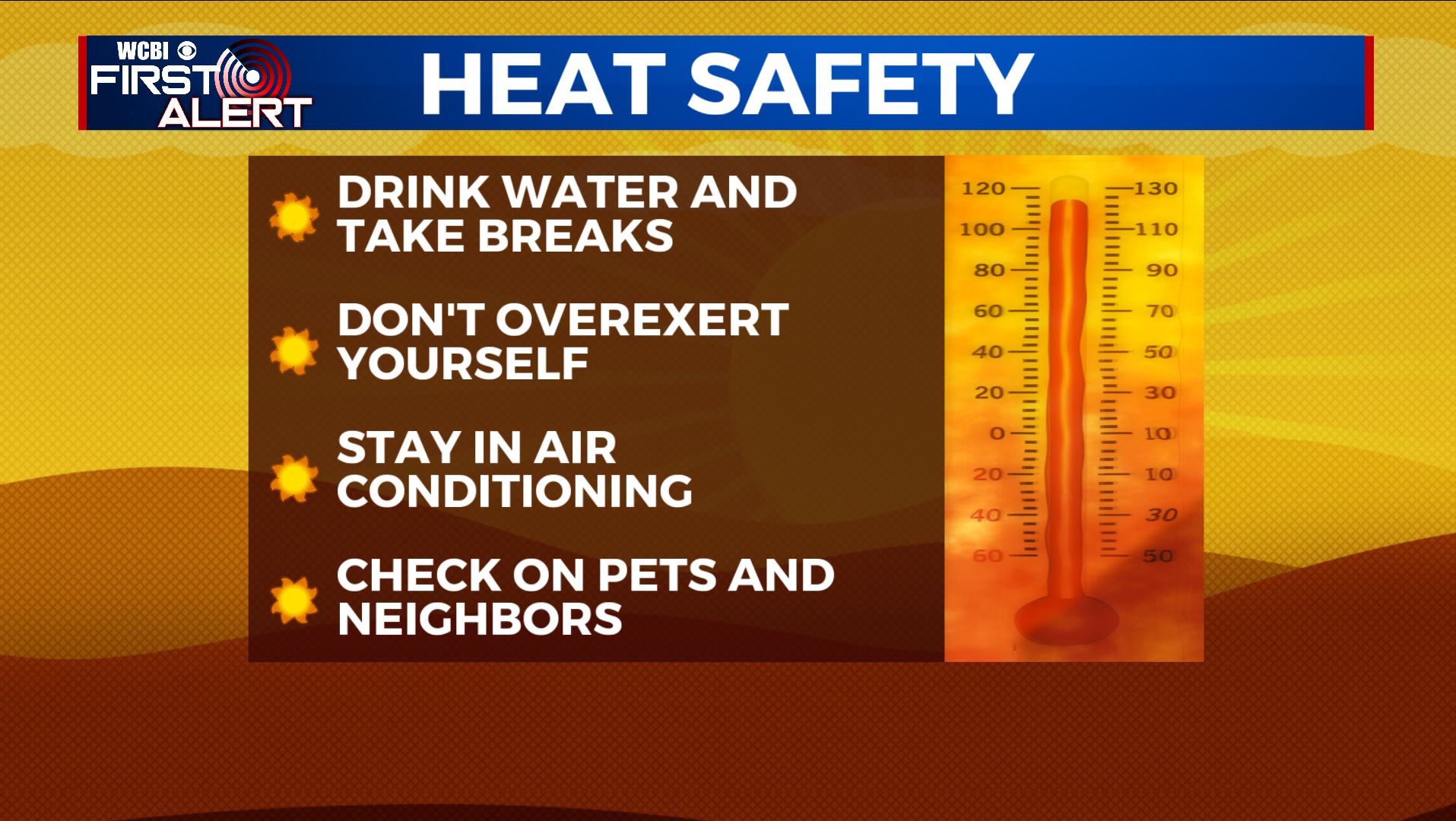
SUMMARY: The summer heat & humidity has returned to north Mississippi & west Alabama and it’s not going anywhere anytime soon. Take the proper precautions to stay cool & hydrated to help prevent heat stress or heat exhaustion issues. We’ll remain mostly dry but can’t rule out the chance of those afternoon showers & storms all week long.
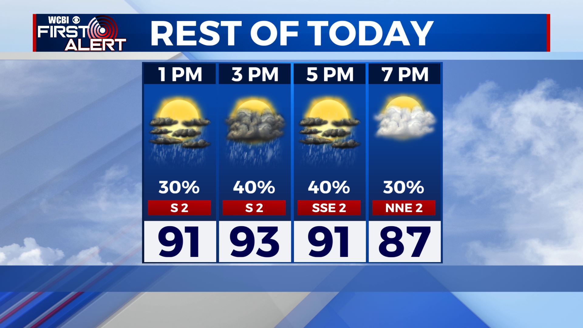
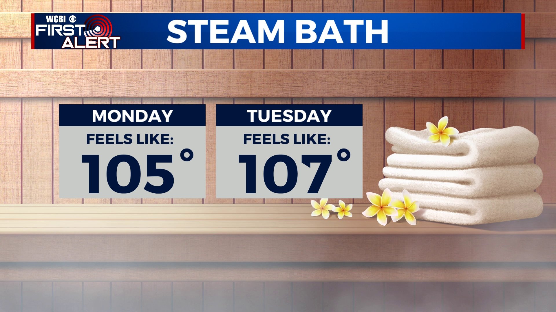
MONDAY: Another hot & humid summer day is in store for our Monday, Highs should stay in the lower to mid 90s. Scattered showers and storms around the area in the afternoon, with a mix of sun & clouds. Heat index values making it feel like 100-105 degrees.
MONDAY NIGHT: Showers and storms once again dissipate early evening, making way for partly cloudy skies overnight. Muggy & mild lows in the mid 70s.
TUESDAY: Scattered showers and storms are likely throughout the day with a mix of sun & clouds. High temperatures in the lower 90s. Hot & humid with heat index values making it feel like 105-110 degrees.
MID TO LATE WEEK: Most of us will stay dry with mostly sunny skies. Maybe a few spotty afternoon showers or storms are possible. Highs in the mid 90s.
WEEKEND: The summer heat sticks around into the weekend, with a mix of sun & clouds and highs in the mid to upper 90s. Still can’t rule out afternoon pop-up showers & storm chances. Heat index values making it feel like 100-110 or even higher than that, so take it easy outdoors!
Stay connected with @WCBIWEATHER on Facebook, Twitter, Instagram and the WCBI News App


Leave a Reply