Staying unseasonably warm for a few more days
COLUMBUS, Mississippi (WCBI) – Expect late October heat to continue through Sunday. Then, a strong front will bring the coldest air we’ve seen this season next week.
FRIDAY: Expect a mix of sun & clouds with highs right back in the middle 80s. While a shower or two is possible over northwestern MS, we’ll stay generally dry.
WEEKEND: Our last two warm days for a while! Highs each day will reach the middle 80s with a variably cloudy sky. A strong front will be approaching the region late Sunday night.
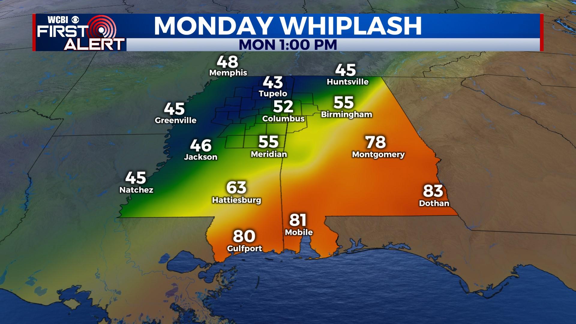
NEXT WEEK: Said strong front will move through early Monday, bringing scattered light showers through the region and colder air! Monday will likely be a day where the high temperature technically occurs before sunrise, then temperatures will fall steadily through the day. Expect low 50s or even upper 40s after 3 PM Monday with chilly northwest winds. Halloween looks dry with slow clearing and highs in the upper 50s. Then, the really cold stuff arrives! Tuesday night brings temperatures to near freezing, and it looks like we could have our first freeze by next Wednesday night…stay tuned!