Storm chances continue into next week
COLUMBUS, Mississippi (WCBI) – A second round of severe storms will push through overnight Saturday into Sunday with a level 2 – SLIGHT RISK. We have the potential to see severe storms for Sunday and Monday before a more summer-like storm pattern sets up for the rest of next week.

SATURDAY NIGHT – We had a brief break from storms earlier today and now we are preparing for our next round of severe storms pushing through tonight. We’ll start to see these storms pushing through after sunset with a rough timeline of 9PM – 8AM. The SPC has downgraded the risk to a level 2/5 risk for this overnight round of storms. The primary risks will be heavy rainfall, small hail, and damaging winds. Although the tornado risk is low, it is not zero. So be sure to have multiple ways to receive warnings overnight!
SUNDAY – We’ll start off our Sunday with early morning severe storms with a level 1/5 MARGINAL RISK with the primary threats being damaging winds and hail. Most of us will be drier for Sunday afternoon with a few lingering showers staying primarily South of US 82.
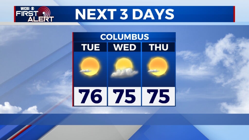
NEXT WEEK – We’ll have another round of severe storms on our Monday with a level 2 – SLIGHT RISK already in place. Then we return to a summer-like pattern of scattered showers and storms through the rest of the week. It will be hot and muggy with highs in the mid to upper 80s!