Storms arrive tonight as a rainy pattern sets in for the rest of the week
COLUMBUS, Mississippi (WCBI) – SUMMARY: Strong to severe thunderstorms will remain possible this evening and overnight. The greatest threat will be for damaging winds and large hail. A tornado or two will also remain possible.
TONIGHT: Thunderstorms likely. A few storms may be severe with damaging winds. South wind 10-20 mph with higher gusts in thunderstorms. Chance of rain: 90%.
THURSDAY: A few showers before noon will give way to a mostly sunny afternoon. Highs in the low-70s. Northwest wind 3-5 mph.
THURSDAY NIGHT: Isolated showers and perhaps a thunderstorm after 3am. South wind 3-5 mph. Chance of rain: 30%.
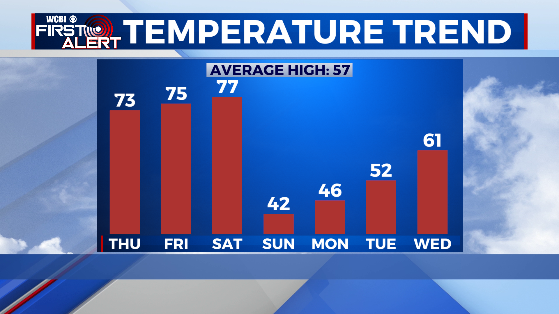
THIS WEEKEND: An unseasonably warm and moist air mass will remain in place through the beginning of this weekend. Scattered afternoon thunderstorms will be possible once again Friday with highs in the mid-70s. A strong cold front will approach the region by Saturday which will finally replace our Spring-like weather with more seasonable weather. Unfortunately, this also means the possibility of severe weather once again. We are continuing to monitor the severe weather threat for Saturday. Timing and intensity remain in doubt this far in advance, but we will update as we get closer to the end of this week. For now, our primary attention remains focused on this evening’s threat. Once the front passes the region, much colder air will arrive Sunday with highs in the low-40s.


