Storms cap beginning and end of otherwise sunny week
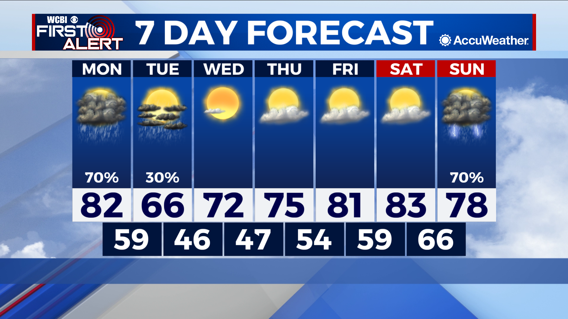
COLUMBUS – SUMMARY: Rain and thunderstorms will move into the region from the afternoon hours Monday until about lunchtime on Tuesday as part of a cold front turned stationary front moving through. The rain dies down afterwards, ushering in a mostly sunny week where highs will rebound into the 80s by Friday before yet another cold front Sunday brings the rain back.
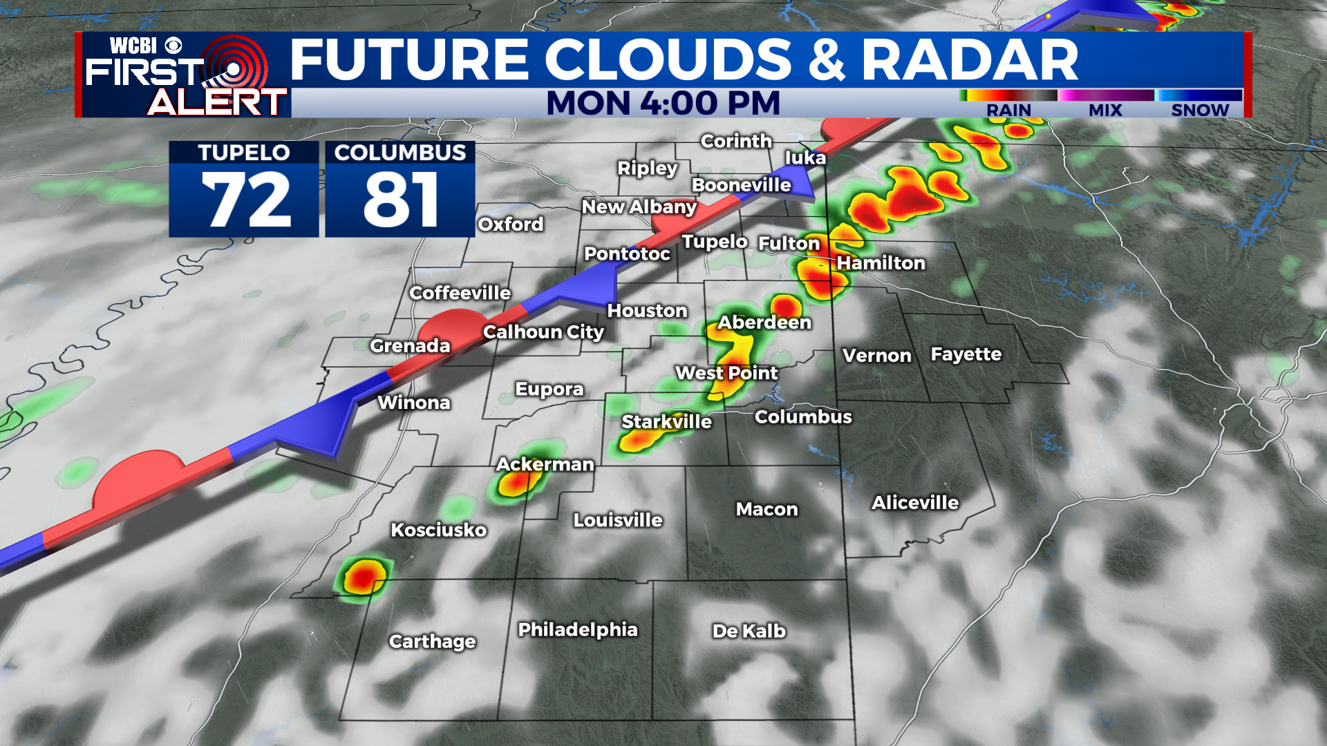
MONDAY: Isolated showers and thunderstorms early Monday will become more widespread in the afternoon as a cold front moves through. No severe weather risk is expected with these storms but the odd heavier downpour and more active cell is definitely possible. Storms will transition into more widespread rainfall heading into the evening and overnight hours as the cold front stalls out and turns into a stationary front. Highs will top out in the low 80s before the front arrives, while lows will sit in the upper 50s overnight.
TUESDAY: Some chance for lingering rain showers in the morning will make way for some clearer skies after lunch time. Highs take a noticeable hit and sit in the mid 60s in the afternoon. Lows likewise drop a bit into the mid 40s.
REST OF THE WEEK: Sunshine will rapidly take the place of storm clouds and bring temperatures back to the status quo within days. Highs will start out in the low 70s Wednesday, climbing into the low 80s by Friday. Another cold front Sunday brings cool temperatures back to the region, along with more chances for storms.