Storms likely Wednesday, rainy and cooler end to week
COLUMBUS, Mississippi (WCBI – An active Wednesday is expected as heavy rain and storms return to the region. While rain will continue through the end of the week, cooler air also returns.
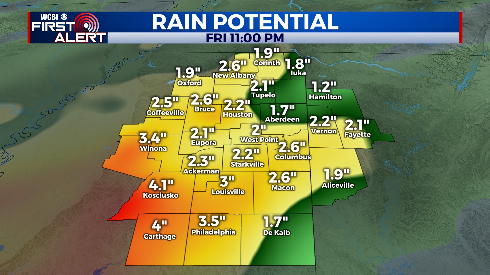
WEDNESDAY: Most of the morning will be dry as a slow-moving front approaches from the west. A warm, humid, and breezy afternoon brings storm chances back to the region…likely after 3-4p. Sufficient energy, moisture, and shear will promote severe storm potential…mainly in the form of large hail and damaging winds. While the tornado threat isn’t especially high, one or two cannot be ruled out as well. Eventually, the severe weather threat will end as heavy post-frontal rain acts to shift the front south of the WCBI coverage area.
THU/FRI: Wednesday’s front is expected to stall just south of the region, meaning rounds of locally heavy rain and embedded storms will continue. At least an additional 1-2″ of rain is possible, which could result in minor instances of flooding. Temperatures will actually fall through the day Thursday, reaching the upper 50s and low 60s by afternoon. Friday’s high temperature will stay close to 60° as well.
WEEKEND: On/off showers stay possible Saturday, but the bulk of the heavy rain should have ended. Easter Sunday looks to become at least partially sunny as the stalled front finally gets cleared to the southeast.
NEXT WEEK: Sprawling high pressure across the Mid-Atlantic states should keep the sky mostly sunny Monday & Tuesday. Highs will be in the 70s – very pleasant!