Storms to start the week; Fall-like temps on the way
SUMMARY: Warm and humid conditions continue for a few more days before BIG-time changes arrive with a strong cold front Wednesday. It will usher in the coolest air we’ve seen in quite some time.
MONDAY: Scattered showers and thunderstorms remain likely across the region today, and like previous days, some of the rain could be locally heavy at times. Highs will reach the lower 80s.
TUESDAY: Scattered showers will be possible through the day, but a strong front will arrive Tuesday evening and bring an increase in the number of showers and storms. Some of the storms could become locally strong with gusty winds, but the severe weather threat doesn’t look too high.

WEDNESDAY: A few showers could linger to start the day, but cooler and drier air will be rushing into the region behind the cold front. The sky will gradually clear into sunshine during the afternoon with highs in the 70s!
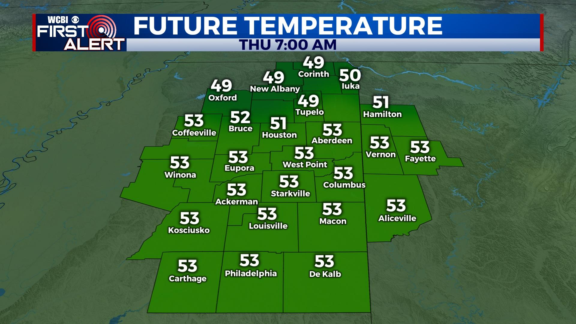
REST OF WEEK: Chamber of commerce weather – plenty of sun with mild days and clear, cool nights. Highs will be in the 70s and overnight lows will dip into the lower 50s Thursday morning and into the 40s Friday morning! You’ll definitely need to consider a jacket or sweater!
WEEKEND: The pleasant nights continue, but the days will trend warmer. Overall, the nice weather looks to continue!