Storms Tomorrow, Rainy and Cooler Next Week
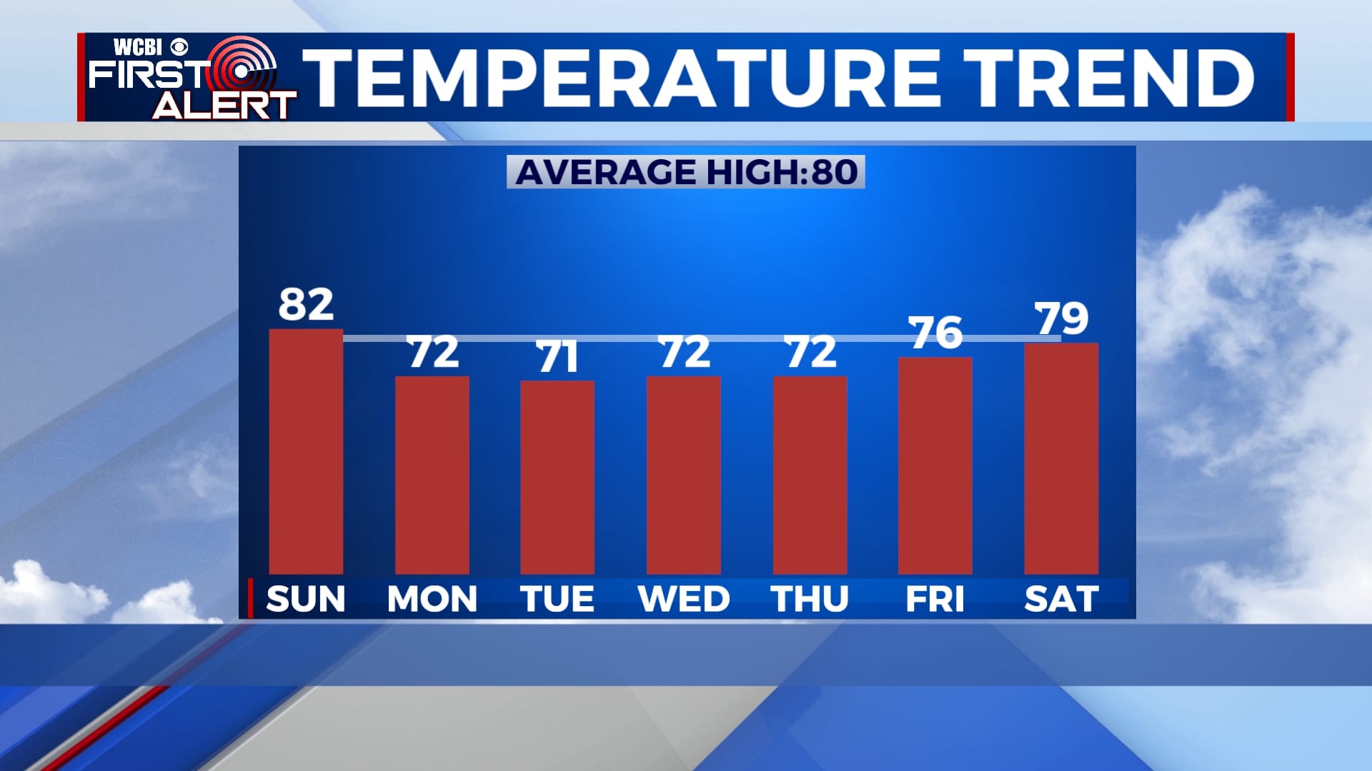
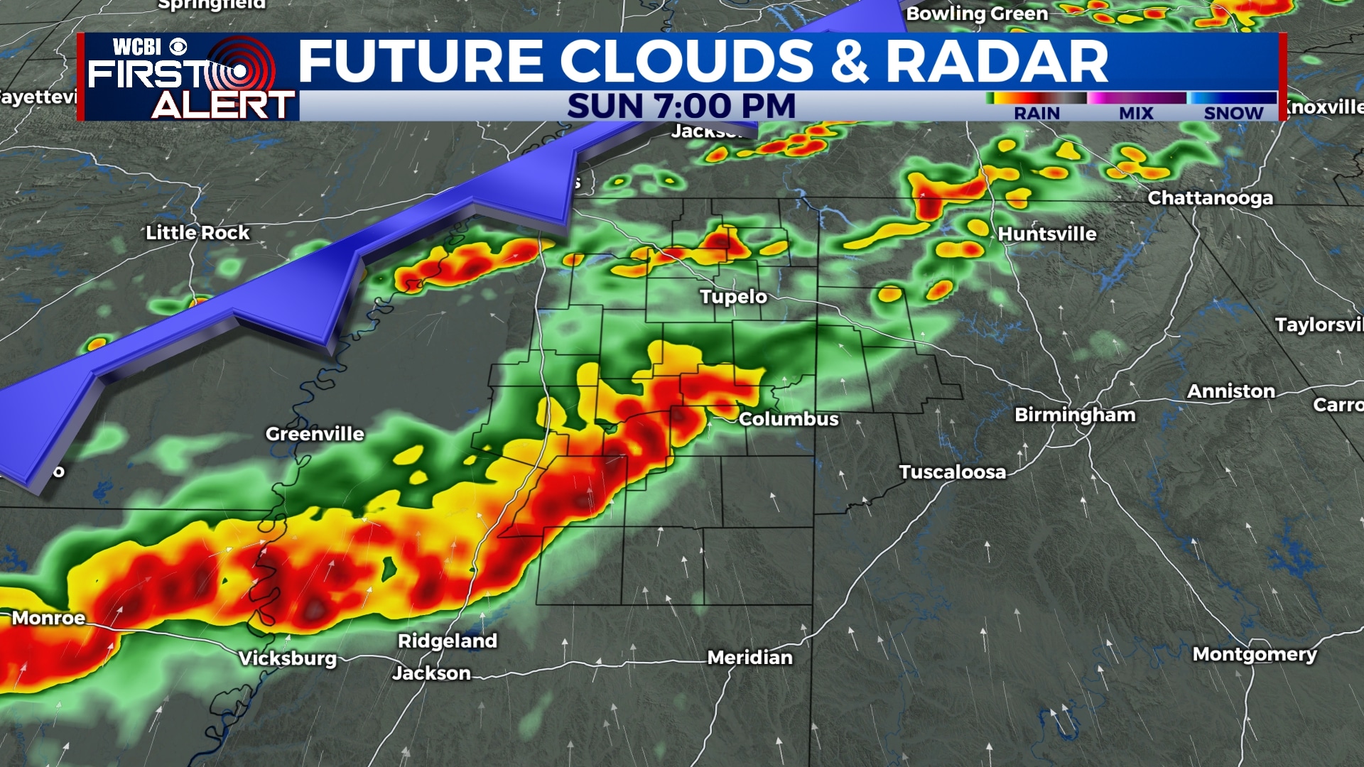
SUMMARY: We’ll see partly cloudy skies tonight with increasing clouds tomorrow morning. Our chance for showers and thunderstorms tomorrow is expected for most of the afternoon into the late evening. Storms will enter the area around lunchtime and continue into the overnight. Some isolated storms could be strong or severe. Main threats look to be damaging wind gusts, quarter size hail and a low chance for tornadoes. Cloudy skies will stick around for much of the work week with more chances for some showers Monday morning through Wednesday. We look to dry up by Thursday with returning sunshine before the weekend. Winds continue out of the north allowing our high temperatures to be below average for much of next week. We start to warm back up into the upper 70s by next Saturday.
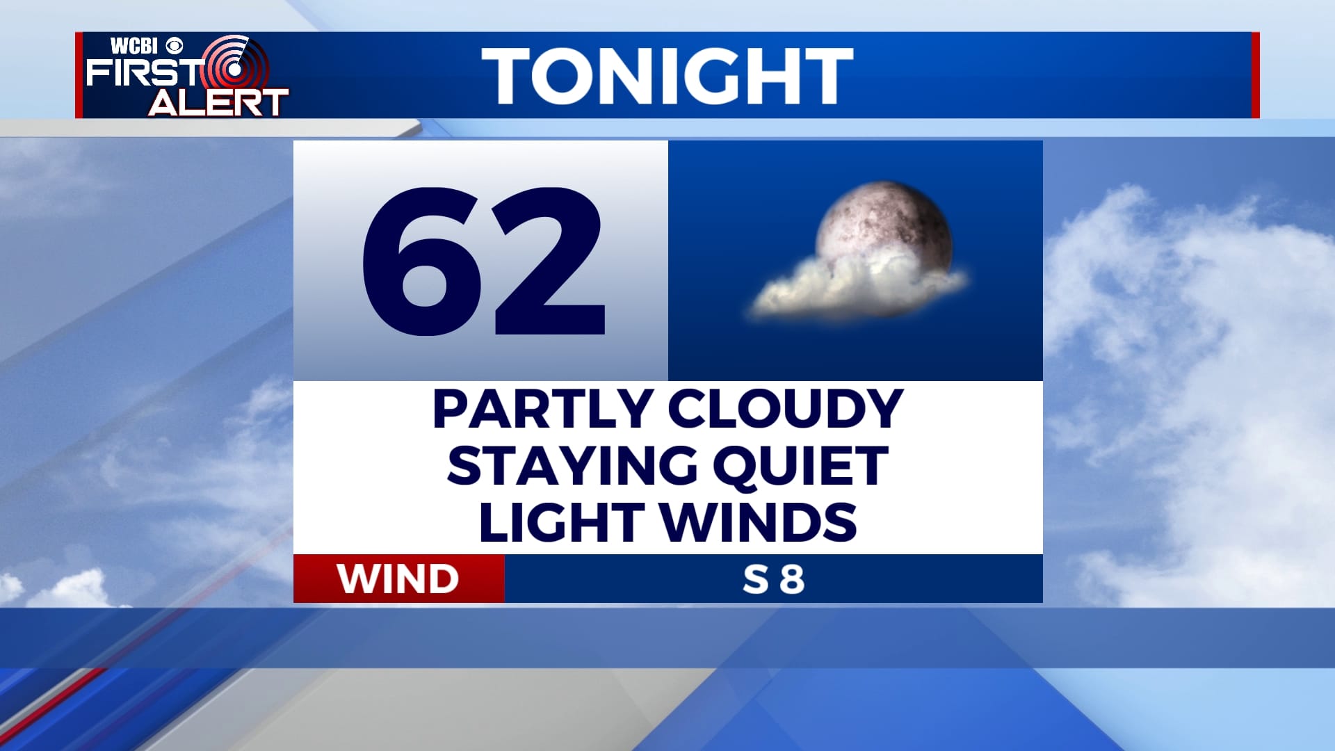
SATURDAY NIGHT: Clouds will move into the area tonight into tomorrow morning. No rain is expected. Overnight lows will be in the lower 60s.
SUNDAY: Some strong, possibly severe thunderstorms will move into the area ahead of an approaching cold front. These storms will last for most of the afternoon into the overnight. Main threats look to be damaging winds and hail. The threat for a tornados is on the lower end but cannot be ruled out. Highs will be in the low 80s and overnight lows in the 60s.
MONDAY: Kicking off the work-week with some morning showers in the area as the cold front continues to move off to the southeast. Mostly cloudy skies likely for most the day. Highs will be in the low 70s and overnight lows in the 50s.
TUESDAY: On-and-off showers likely for most of the day. Highs will be in the low 70s and overnight lows in the 50s.
WEDNESDAY: Clouds will still be in the area with another chance for some showers throughout the day. Highs in the low 70s and overnight lows in the 50s.
THURSDAY-SATURDAY: We begin to dry out from the rain with returning sunshine Friday and warming temperatures through Saturday.


Leave a Reply