Storms tonight, sun coming in tomorrow
COLUMBUS, Mississippi (WCBI)- Wednesday has been fairly calm. It has been mild with temperatures and humid. Rain showers and storms are pushing into the Deep South tonight and will continue into Thursday.
WEDNESDAY NIGHT: The line of showers and storms will keep making its way into the South. Northern Mississippi continues to be split between the Level 1 and Level 2 severe risk categories. Gusty winds and heavy rain are likely. The risk for hail and tornadoes is low, but not impossible. That being said, ingredients have stuck around and a tornado watch has been issued for several of our western counties until 8:00 PM CST. There could be an extension of the coverage of the tornado watch as the line continues to progress East. Showers and storms should reach the GTR by around 11PM. Temperatures tonight are mild again and only dropping in the middle 50s.
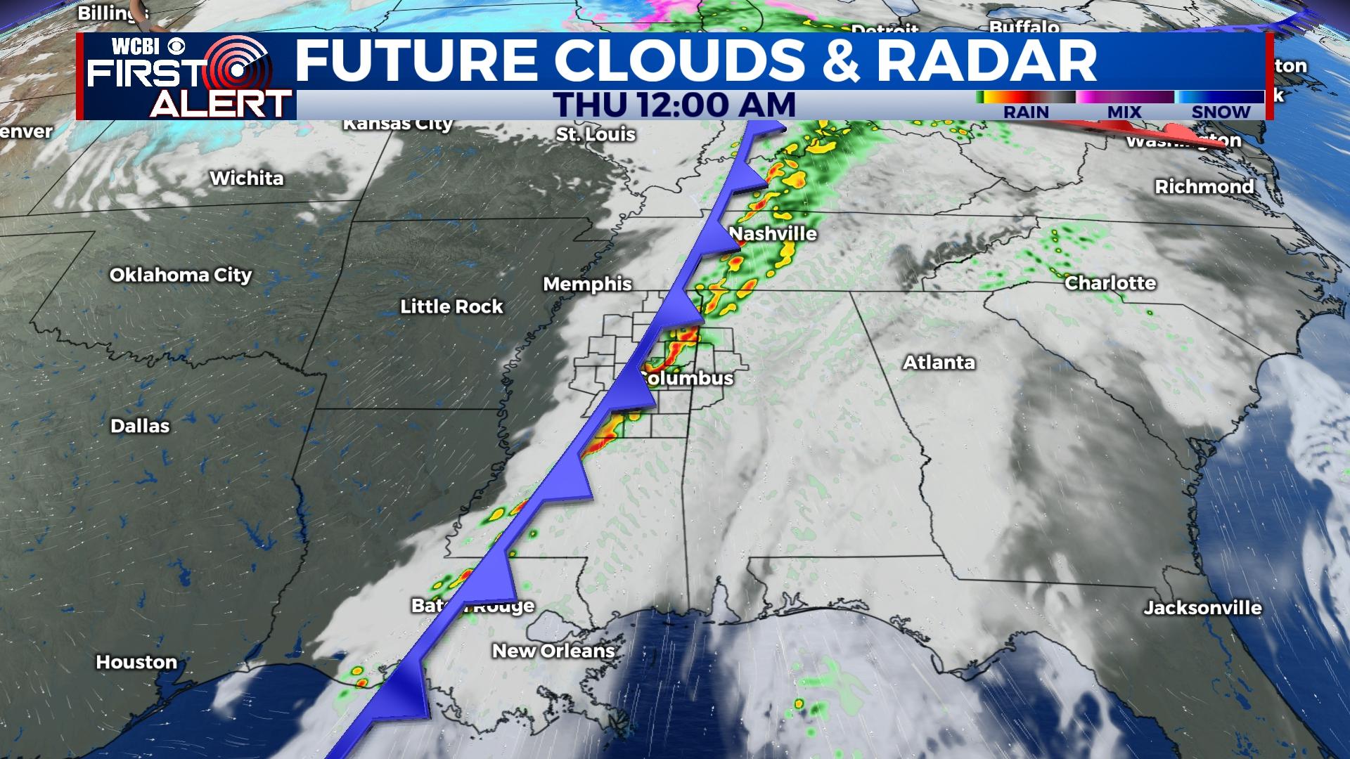
THURSDAY: The line of showers and storms will continue to push into the Deep South throughout the day Thursday. Once the line clears Mississippi and western Alabama, sky coverage will become a whole lot brighter. A high pressure system is moving in behind and will help to clear away a lot of the heavy cloud coverage the last half of Thursday. High temperatures will be in the upper 60s. Low temperatures will fall into the middle 30s, with help from the clearer sky.
FRIDAY: Lots of sun will continue for the end of our week! High temperatures will be cooler, in the middle 50s. Overnight temperatures in the middle 30s again. Go out and enjoy your sunny Friday before the Round 3 of rain over the weekend.


