Stormy night leads to HOT temperatures
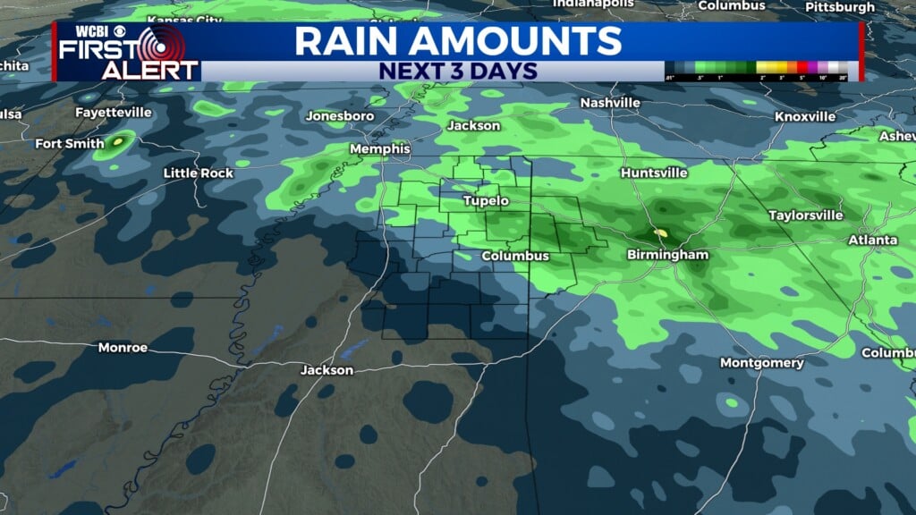
COLUMBUS, Mississippi (WCBI)- Tuesday storms will be starting up during later evening hours. Hot temperatures will be getting hotter for the middle of the week. End of the week/early weekend showers and storms are in the forecast.
TUESDAY NIGHT: Watching a system moving slowly to the ESE, from Arkansas, will be heading towards northern Mississippi. Showers and storms are expected late tonight. There is a SEVERE THUNDERSTORM WATCH in effect until 12AM Wednesday morning. Overnight lows will be warm and muggy, in the middle 70s.
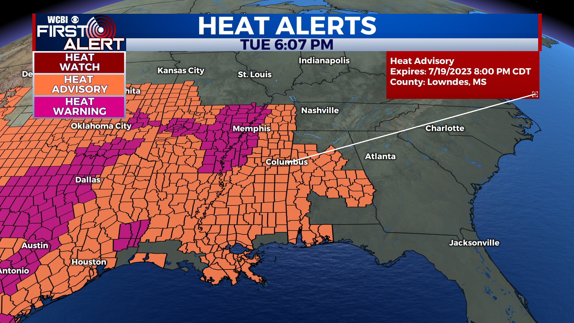
WEDNESDAY: High temperatures continue heating up! The middle of the week will see temperatures in the middle 90s. A HEAT ADVISORY is in place from 11am- 8pm. Lots of sun is expected, with partly cloudy coverage. Mild and muggy conditions continue for Wednesday night, in the middle 70s.
THURSDAY: The morning will begin with heavy cloud coverage. The clouds will be clearing out by the afternoon. Temperatures are going to be staying HOT, in the middle to upper 90s. Though cloud coverage will be clearer, overnight conditions remain humid! Low temps will stay in the middle 70s.