Stormy start to the work week
SUMMARY: Rain and storms are likely Monday and Monday night as a cold front pushed across the region. Slightly cooler & drier air builds in for the middle of the week before the humidity returns (along with storm chances) for the upcoming weekend.
SUNDAY NIGHT: Partly cloudy during the evening with clouds increasing overnight. Lows in the lower 70s. Winds SW 5 mph.
MONDAY: Scattered rain and storms. Some could produce gusty winds and heavy downpours. A few strong to severe storms are possible. Highs in the upper 80s. Winds SW 10-15 mph.
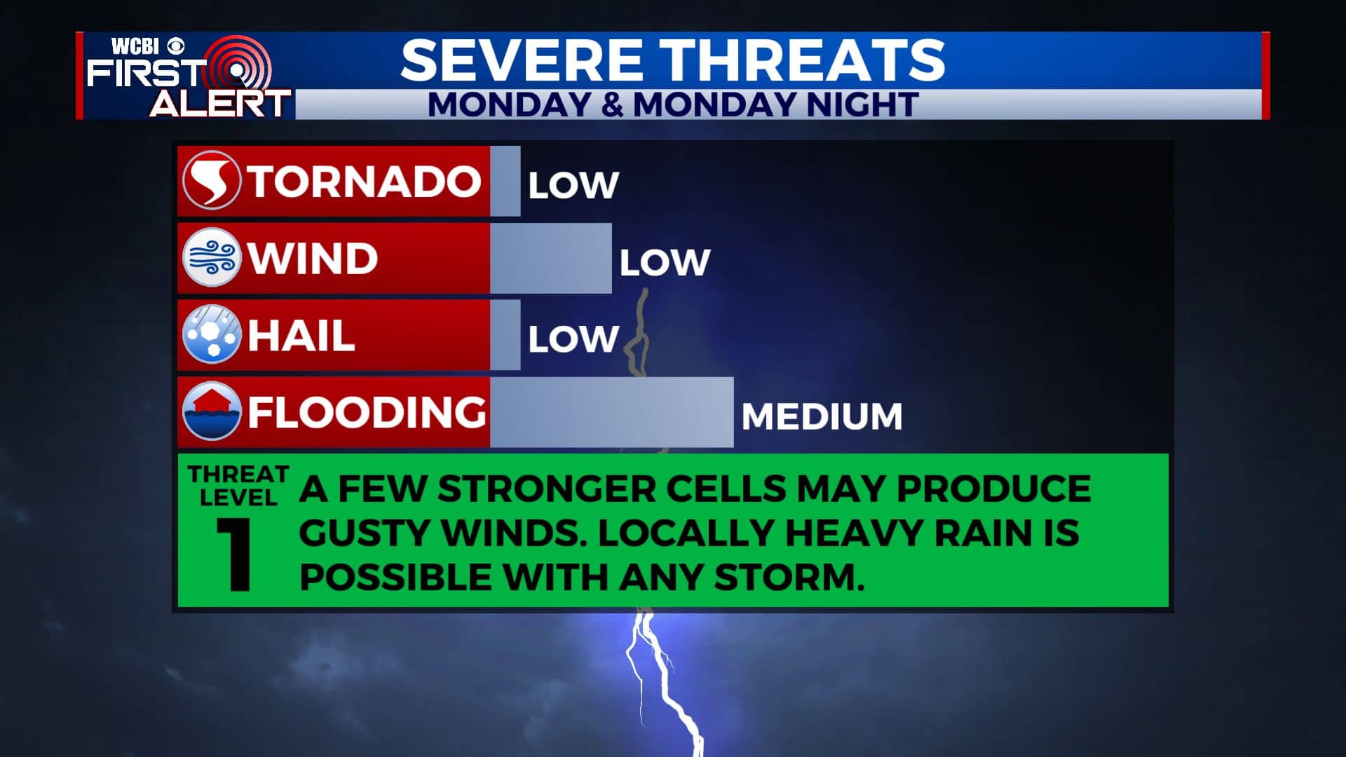
MONDAY NIGHT: Areas of rain and storms. Lows in the mid 60s.
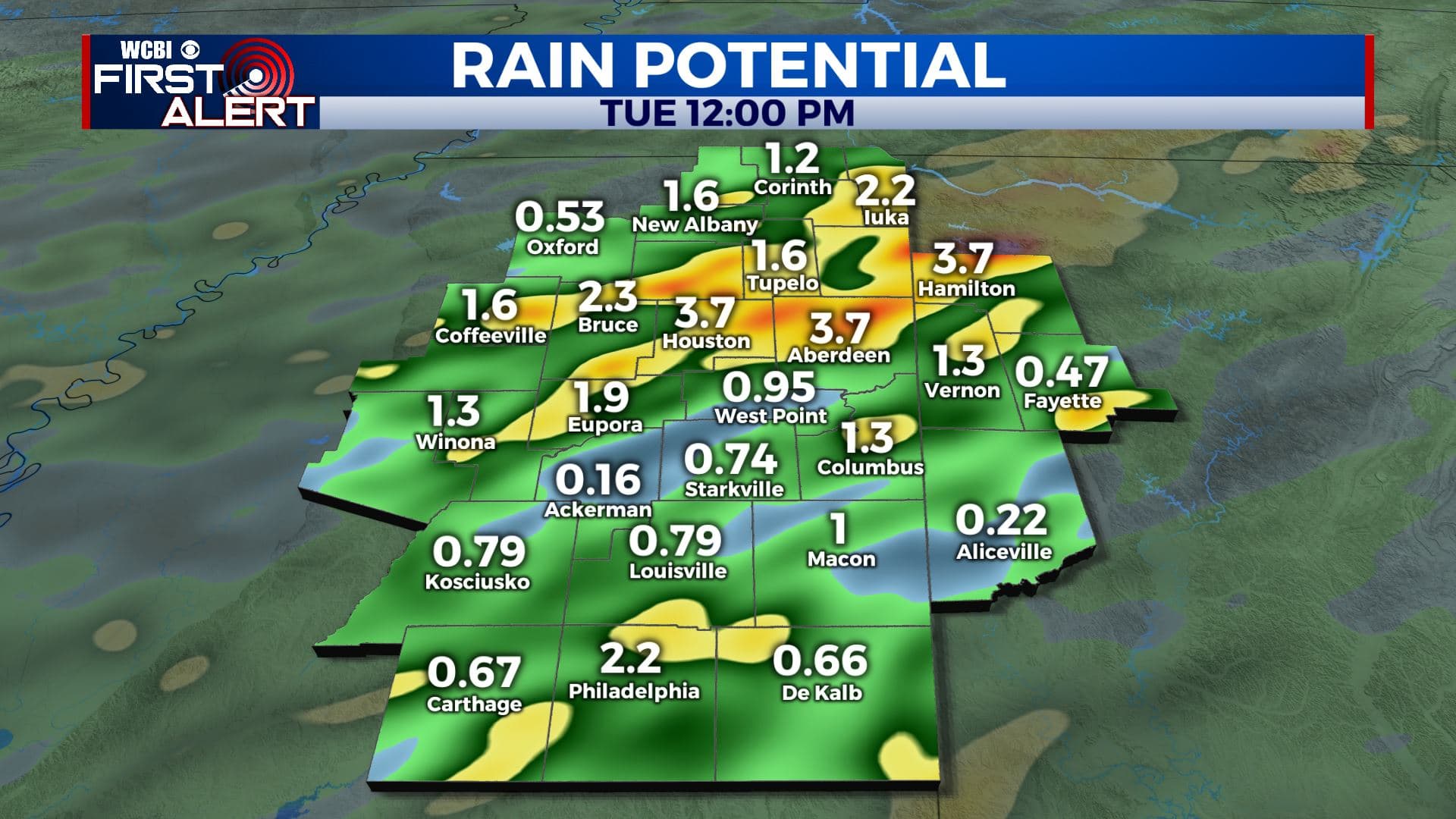
TUESDAY: Mostly cloudy with lingering showers during the morning. Gradual clearing and drying out during the afternoon. Highs in the upper 70s to around 80.
TUESDAY NIGHT: Mainly clear and quiet. Lows in the lower 60s.
WEDNESDAY & THURSDAY: Partly cloudy. A few stray showers and storms are possible. Highs in the upper 80s. Lows around 70.
FRIDAY – SUNDAY: Partly cloudy with a 30% chance of showers and storms each day. Highs near 90. Lows in the lower 70s.
Follow @WCBIWEATHER on Facebook, Twitter, Instagram, and the WCBI News App


Leave a Reply