Strong storms late Wednesday night
COLUMBUS, Mississippi (WCBI) – An active next 24-36 hours is expected over the Mid-South/Southeast region. Quieter weather moves in just in time for Mother’s Day weekend.
WEDNESDAY: Expect a variably cloudy sky and highs pushing into the upper 80s and low 90s by afternoon. Gusty southwest winds up to 20-25 are also expected. While most of the day will be dry, a rogue shower or storm is possible late-day.
WEDNESDAY NIGHT: The weather stays generally quiet before 10 PM, but areas of showers and storms will be moving into northern MS closer to and after midnight. The exact trajectory of the storms remains a little unclear, but the higher severe potential looks to set up along and north of US 278 in our viewing area. This would include hail, wind, and tornado potential. South of US 278, storm coverage becomes more uncertain as does severe potential…but we’ll be here watching things all night into Thursday morning!
THURSDAY: Ahead of the actual front, the airmass will “recover” to support additional storm development. However, it remains unclear as to the coverage the developing storms will have. Should a few storms manage to develop by afternoon, hail & gusty winds will be the primary concern as there is little to no low-level shear.

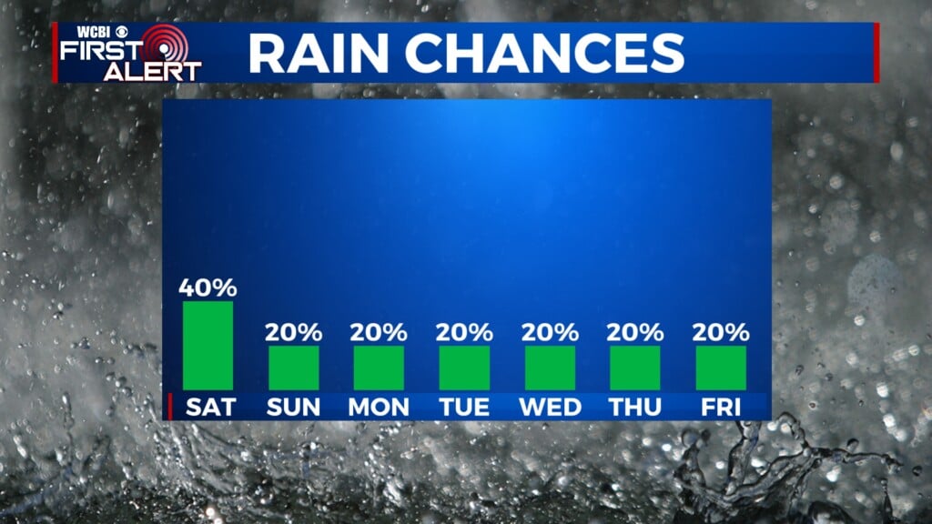
FRI/WEEKEND: Thursday’s front still looks to usher in drier air for Friday and most of the weekend. This means the days will be less humid and more pleasant! Rain chances do return late Sunday into early next week.