Strong Storms Possible Again on Sunday
COLUMBUS, Mississippi (WCBI) – Another Sunday with a risk for severe storms. Hey, at least the storms have kept temperatures cooler!
TONIGHT: For the most part, rain and storms will come to an end by 11 PM, but I can’t rule out an isolated shower after midnight. Most of us will briefly dry out tonight before another active day of storms on Sunday. Low near 71° with calm winds.
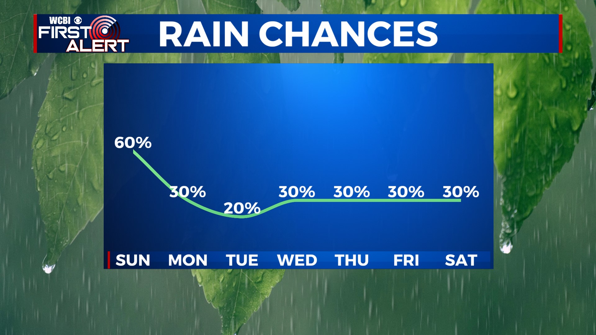
SUNDAY: Storm evolution will be tricky to pinpoint on Sunday. It all depends on when and where storms weaken Saturday night, as well as how quickly the air can destabilize through Sunday morning. Heat and humidity should help us quickly destabilize Sunday morning, so storm fuel shouldn’t be an issue tomorrow. Upper-level winds will also be stronger, so that will likely help storms become strong to severe later in the day. Overall, we expect another stormy day, particularly in the afternoon and evening. Some storms could be strong to severe with damaging wind gusts. Outside of thunderstorms, we’ll have mostly cloudy skies overhead, so afternoon high temperatures should stay well below average in the mid- to upper 80s.
MONDAY: A front will sag southward and move through the area late Sunday night/early Monday morning. This will keep storm chances lower and confined further south on Monday. South of Highway 82 and central Mississippi has the best chance of getting an isolated storm. Behind the front, air temperatures will be slightly “cooler”. Highs only reach the mid- to upper-80s with a mix of sun and clouds.
REST OF NEXT WEEK: Tuesday is mainly dry and sunny aside from a stray shower. A warm front will lift northeastward through the region on Wednesday, and that will allow for warmer temperatures and deep moisture to return. We’re back in the 90s on Wednesday, with a daily chance for afternoon pop-up storms going forward.