Strong storms possible tonight as we ring in 2021
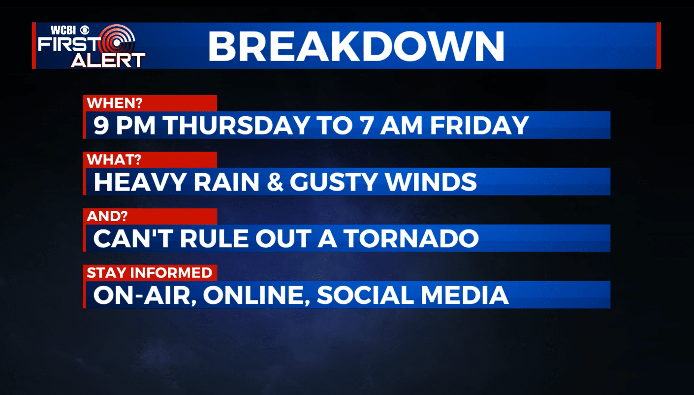
A storm system will move through the area overnight tonight into early Friday, bringing heavy rain and gusty winds to many areas. While we’re not expecting a major severe weather situation, a few storms could be on the stronger side and we can’t even rule out an isolated tornado. Be sure to have a way to get weather alerts overnight tonight if one is issued for your area.
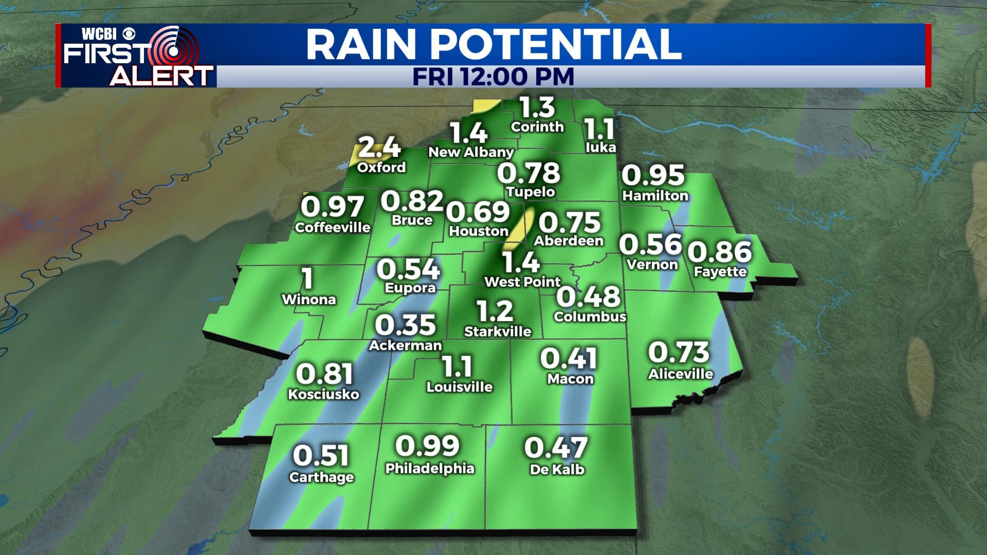
THURSDAY: Cloudy with areas of rain & showers during the day. Some thunder is possible in the afternoon. Daytime high temperatures ranging from the low 50s north to the low 60s south. Winds E 5-20 mph with higher gusts.
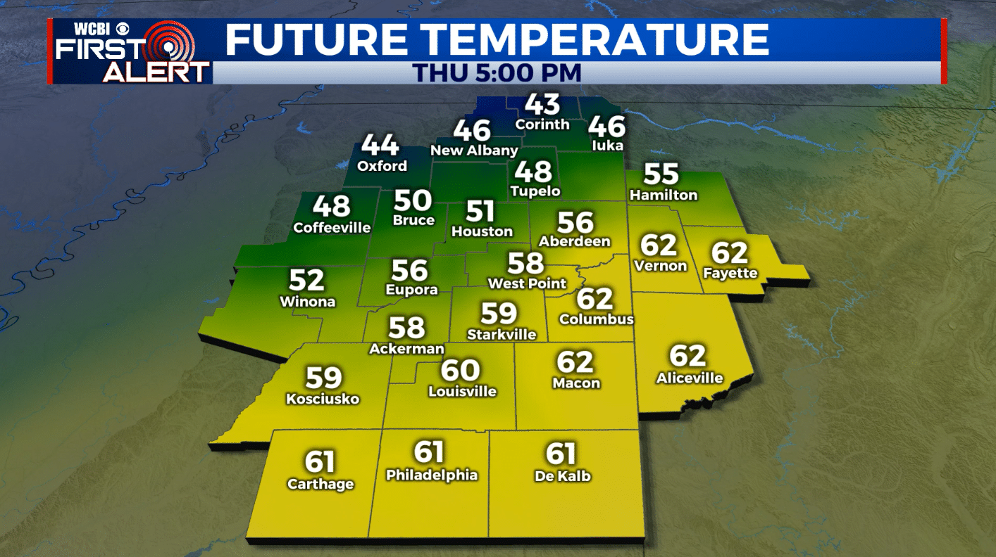
THURSDAY NIGHT: Rain and storms. Some storms could be severe with damaging wind gusts and perhaps even an isolated tornado. Temperatures will rise overnight into the mid 60s. Breezy SE winds 15-25 mph with gusts over 30 mph possible.
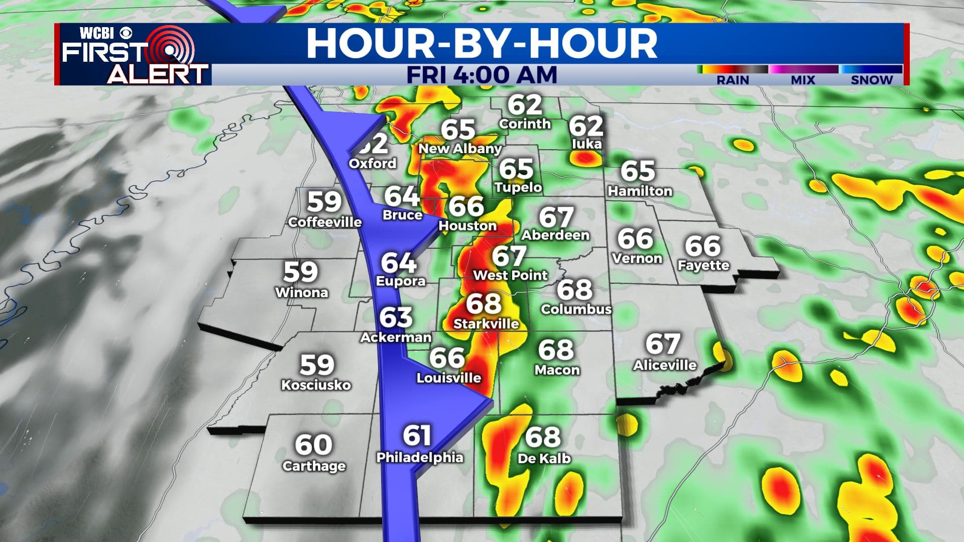
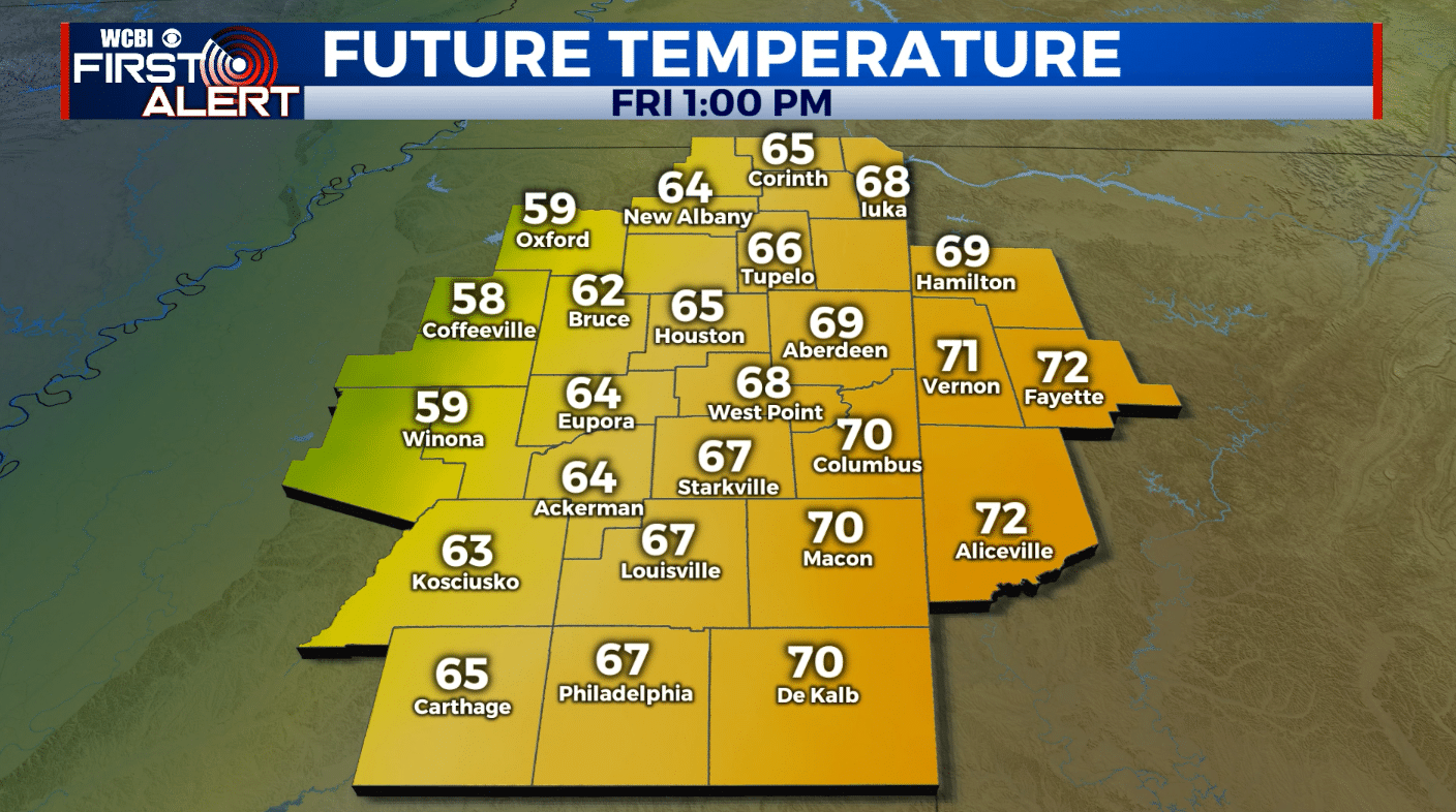
FRIDAY: Storms will be exiting the area by sunrise on New Year’s Day, leaving us dry for the rest of the afternoon. We’ll likely even see some sunshine later in the day which will help bump temperatures into the 60s and 70s in many locations.
FRIDAY NIGHT: Cooler with a few passing clouds. Lows near 40.
SATURDAY: A mix of clouds and sun with a slight chance of a shower or two in the afternoon. Highs in the low to mid 50s.
SATURDAY NIGHT: Colder. Lows in the mid 30s.
SUNDAY: Partly cloudy. Highs in the 50s.
MONDAY-TUESDAY: Temperatures will warm back into the low 60s with a few passing clouds.
WEDNESDAY-THURSDAY: Clouds will begin to move back into the area by the middle of the week with a few rain showers possible Wednesday and Thursday. Highs will be near 60.
Follow WCBI Weather on Facebook, Twitter, and Instagram
Follow Meteorologist Trevor Birchett on Facebook and Twitter


Leave a Reply