Strong storms Thursday morning, cooler and breezy Thursday night
COLUMBUS, Mississippi (WCBI) – A strong front brings storms Thursday morning before cooler air follows into Friday morning.
THURSDAY: Ahead of a cold front, showers and a few strong to severe storms are likely to form after sunrise through early lunch. These storms will be capable of damaging wind gusts, hail, and even a brief tornado. Most if not all storms will push out of the WCBI coverage area by Noon, leaving some afternoon sun and spotty redeveloping showers…especially in far northern MS. Temperatures will hold steady in the 60s to near 70 degrees, falling late into the 50s.
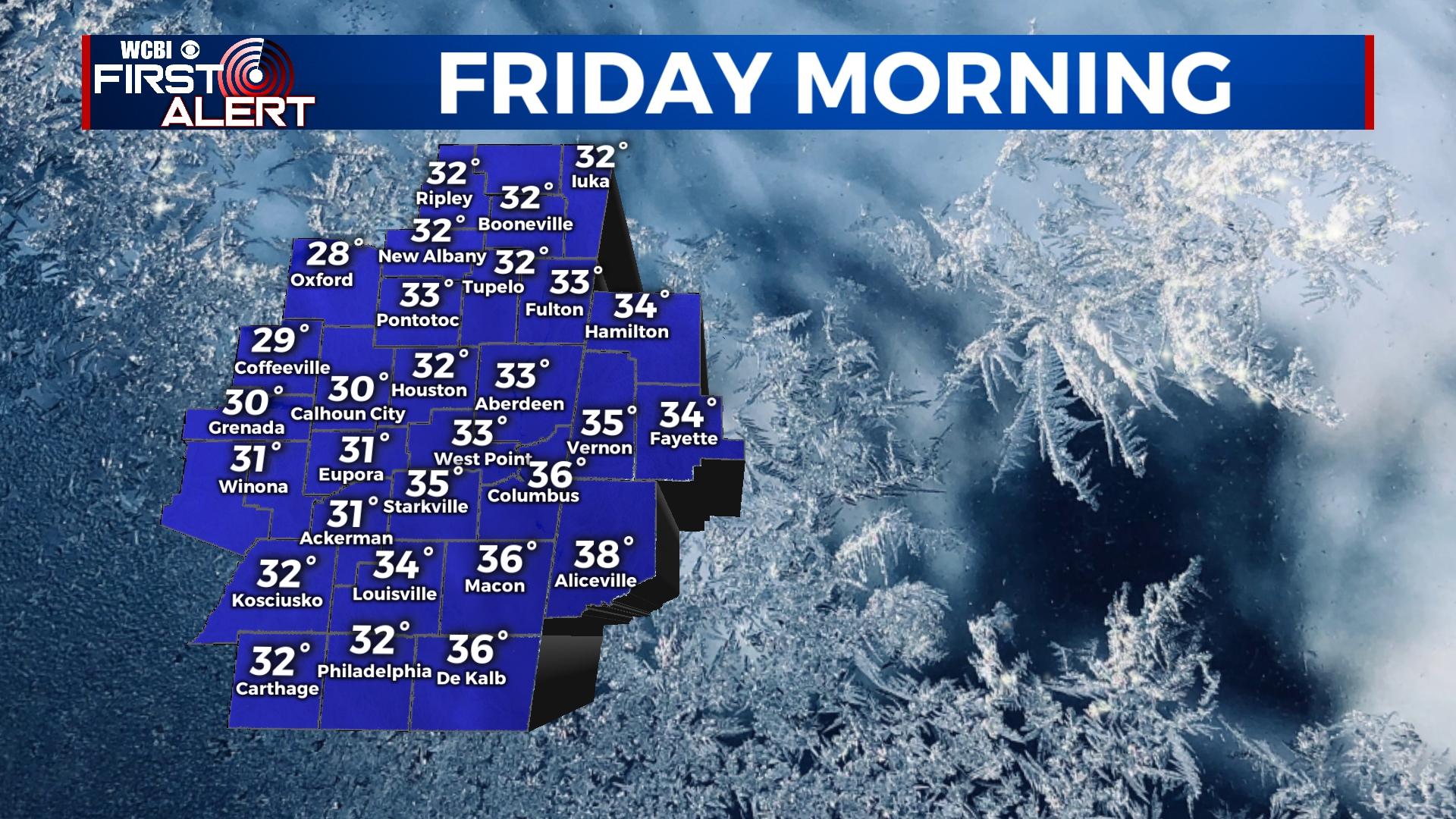
THURSDAY NIGHT: Temperatures will continue falling overnight despite clouds filling back into the region. Lows should drop into the 30s but should stay above freezing. With added wind gusts overnight, wind chills in the 20s are likely into Friday morning.
FRIDAY: Cloud coverage is likely to persist much of the day, though some breaks are possible. Highs should reach the low 40s, but scattered flurries are possible through the day.
WEEKEND: Sunny, chilly weather still looks to take hold Saturday & Sunday. Each morning will bring temperatures in the 20s, but sunny afternoons will bring temperatures back to the upper 40s Saturday and mid/upper 50s Sunday.
NEXT WEEK: Clouds increase Monday ahead of the next system, but upper-level energy is pulling away from the region. Scattered showers are possible along a weakening front, but no storms are expected. A stronger system looks to move in by Thursday of next week, which could bring another round of heavier showers or storms…stay tuned!