Summer humidity and spotty storms making a return
SUMMARY: It’s been getting warmer here, but the humidity has been tolerable to be outside. Now get ready for that summer humidity to move into the region for the rest of the workweek along with those spotty summertime showers & storms.
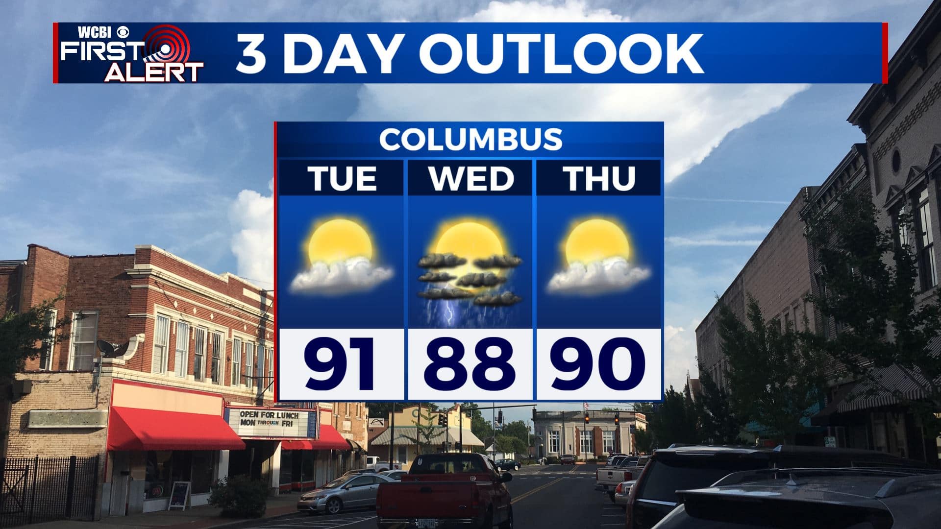
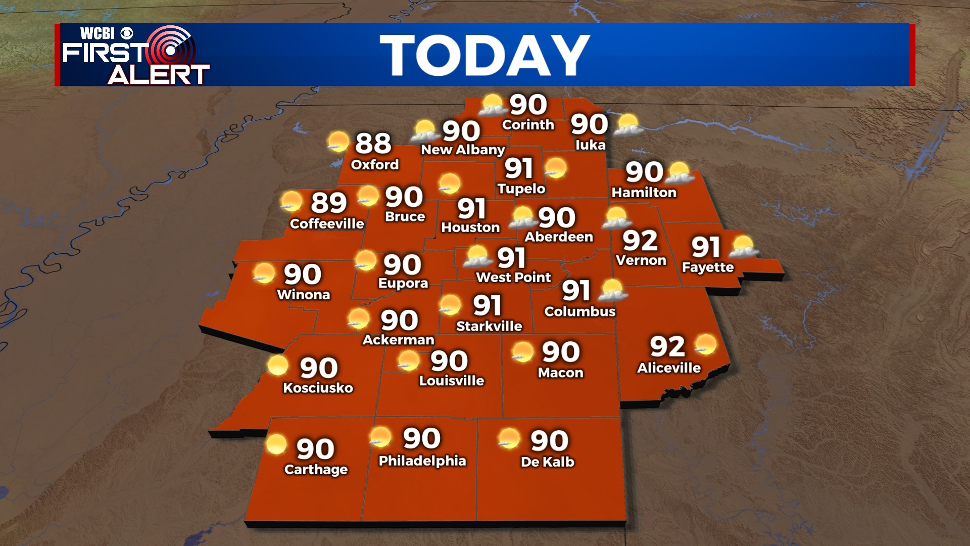
TUESDAY: Another warm day ahead for us with highs in the lower 90s with a mix of sun and clouds. SW winds 5-10 mph.
TUESDAY NIGHT: Partly cloudy skies. Mild overnight lows in the mid to upper 60s.
WEDNESDAY: A few more clouds will start building back in. Could see a few pop-up showers & storms with the daytime heating as the humidity and moisture levels start going up a bit. Highs in the upper 80s to around 90. Lows in the upper 60s Wednesday night.
THURSDAY:We’ll see a mix of sun & clouds with a spotty shower in the afternoon. Highs near 90. Lows in the upper 60s Thursday night.
FRIDAY: A chance of showers and storms. Warm highs in the upper 80s. Lows in the mid 60s Friday night.
SATURDAY-MONDAY: A mix of clouds & sun. On-and-off chances those summertime afternoon showers & storms can be expected for most of the long Memorial Day holiday weekend. Highs in the 80s. Lows in the 60s.
Stay connected with @WCBIWEATHER on Facebook, Twitter, Instagram, and the WCBI News App.


Leave a Reply