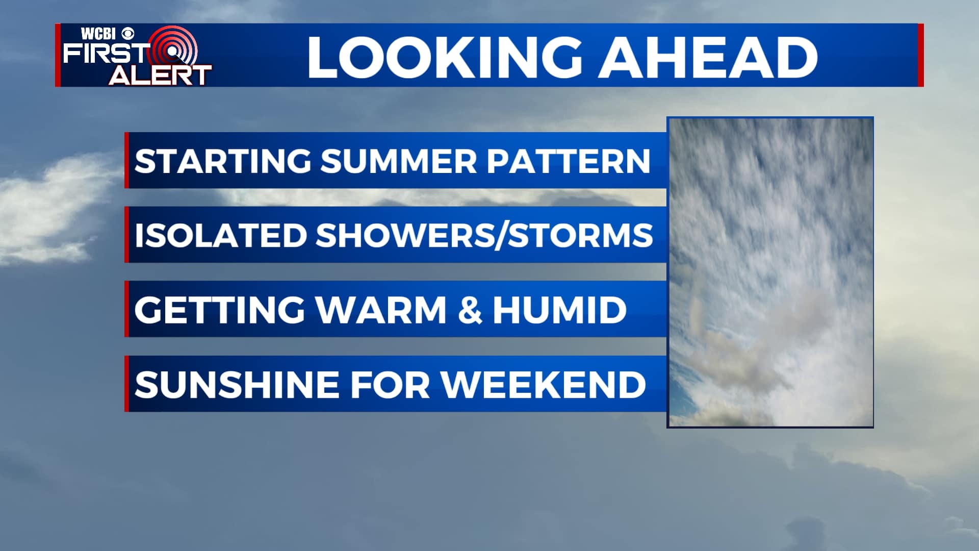
Summer weather pattern is starting to set in this week
SUMMARY: Warm & humid conditions will be on the increase ramping up our chances for spotty showers and thunderstorms to build in during the afternoon as our summertime pattern is beginning to settle into the region. We’ll see on-and-off showers and thunderstorms for most of the workweek before drying out Friday into the weekend. Expect temperatures to warm from the low 80s to upper 80s by the end of the week.
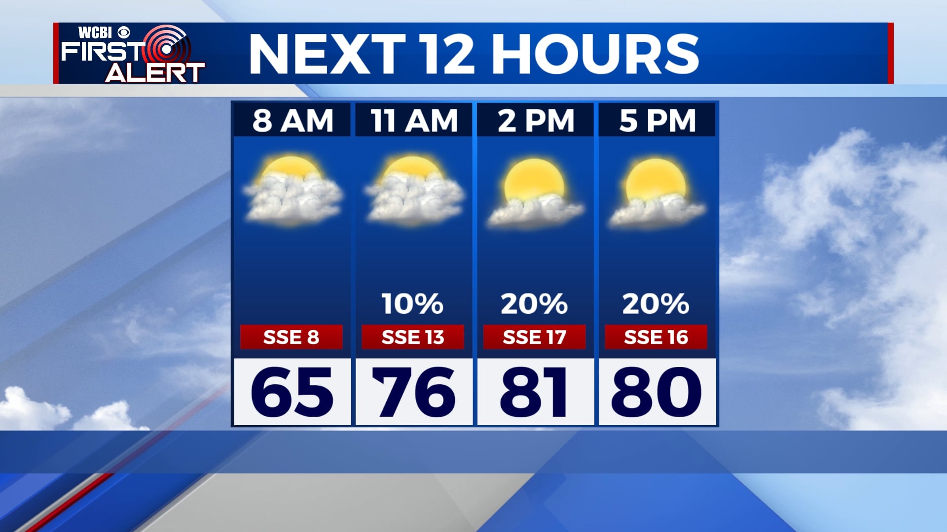
MONDAY: Mostly cloudy skies but a few breaks in the clouds may expose a bit of sunshine. Showers and a possible thunderstorm will move into the area closer towards the afternoon and evening with high temperatures in the low 80s and overnight lows in the 60s.
TUESDAY: Some spot showers in the area but mostly cloudy skies. Highs remain in the low 80s and overnight lows in the 60s.
WEDNESDAY: A bit warmer in the mid-80s with a slight chance for a passing shower or thunderstorm. Mostly cloudy to partly cloudy skies. Overnight lows will linger in the 60s.
THURSDAY: Another chance for a passing shower or thunderstorm. Partly cloudy to mostly cloudy skies expected with highs in the mid-80s and lows in the 60s.
FRIDAY-SUNDAY: Warm, with temperatures in the mid-to-upper 80s. A slight chance for showers Friday morning but looking to clear out by the afternoon. Sunshine returns Saturday and Sunday.
Stay connected with @WCBIWEATHER on Facebook, Twitter, Instagram, and the WCBI News App.


Leave a Reply