Sunday Rain & Storms
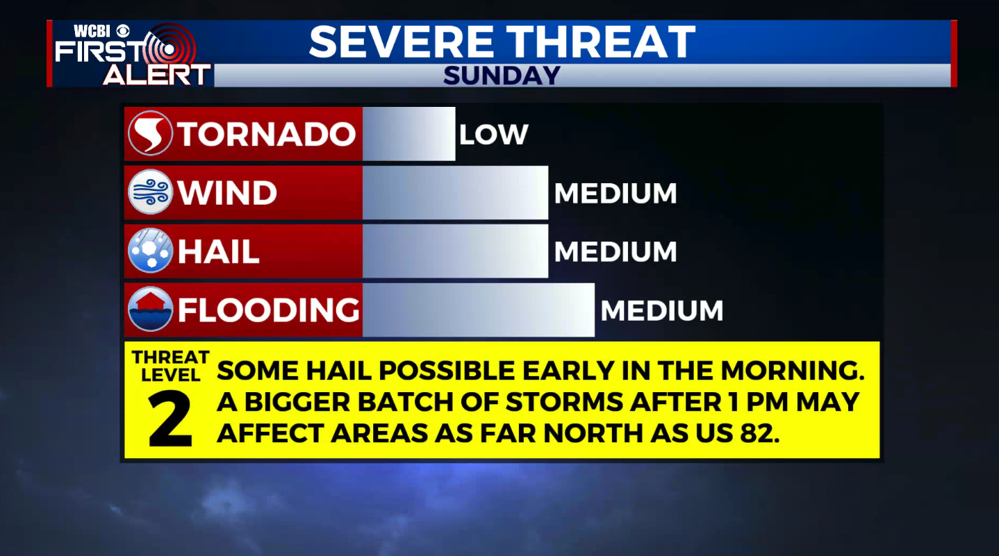
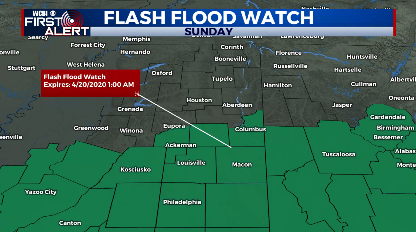
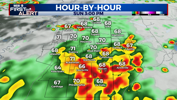
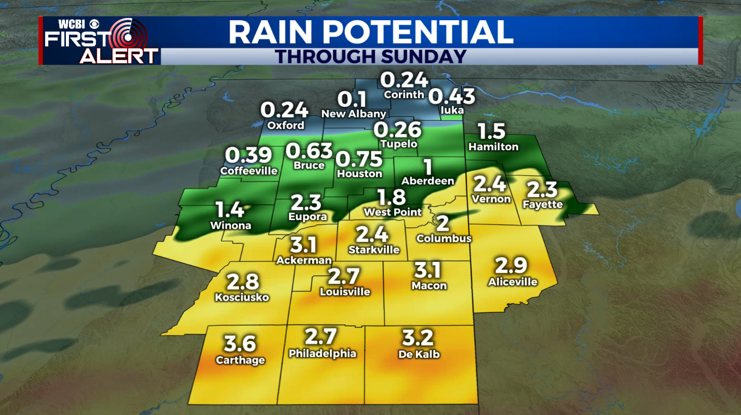
SUMMARY: For the 2nd Sunday in a row strong to severe storms are possible in the region. Some hail could fall during the morning but the bigger action is more likely after 1 p.m. We will continue to monitor areas along and south of US 82 for the strongest activity. Anywhere from 1/2 to over 4” of rain may lead to more flooding, especially across our southern counties.
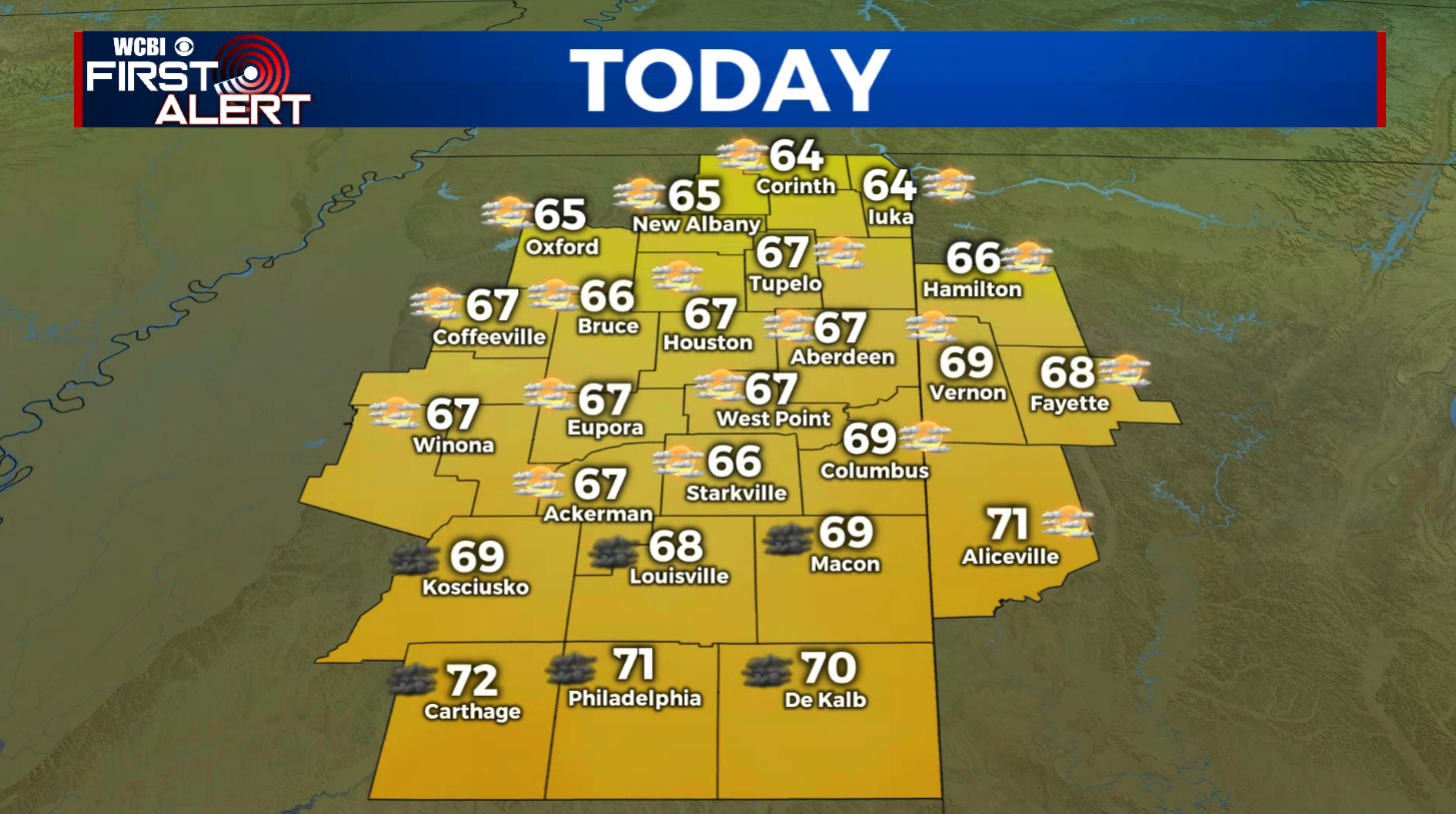
SATURDAY: Mostly cloudy early with sunshine developing during the day. Highs should top out in the 60s to around 70. Winds N 5-15 mph.
SATURDAY NIGHT & SUNDAY AM: Areas of rain and thunder. Lows in the 50s. Some isolated stronger cells could produce some hail. 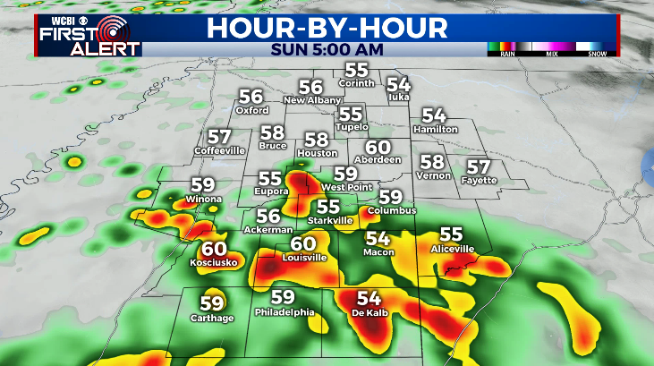
SUNDAY: A nearly 100% chance of rain and storms. Highs in the low 70s. Locations as far north as US 82 may be affected by severe storms during the afternoon after 1p.m. so we’ll be watching it closely. All modes of severe weather are possible. Flooding could also be an issue during the day with 1” to 4” not out of the question again.
MONDAY & TUESDAY: Mostly sunny to partly cloudy. Highs in the 70s with lows ranging from the upper 40s to mid 50s.
WEDNESDAY & THURSDAY: Another area of disturbed weather is expected to cross the Twin States. More severe weather and heavy rain could occur so stay tune for more details as we get closer.
Follow @WCBIWEATHER on Facebook, Twitter, Instagram, and on the WCBI News App


Leave a Reply