Sunny and Cool to End 2019
After some very active weather on Sunday, we’ll see a break as we round out the year with near-average temperatures and plenty of sunshine. Rain chances will slowly creep back up toward the end of the week, but the first weekend of 2020 is looking fairly nice.
MONDAY NIGHT: Clear, quiet, and cold. Lows in the low to mid 30s with westerly winds.
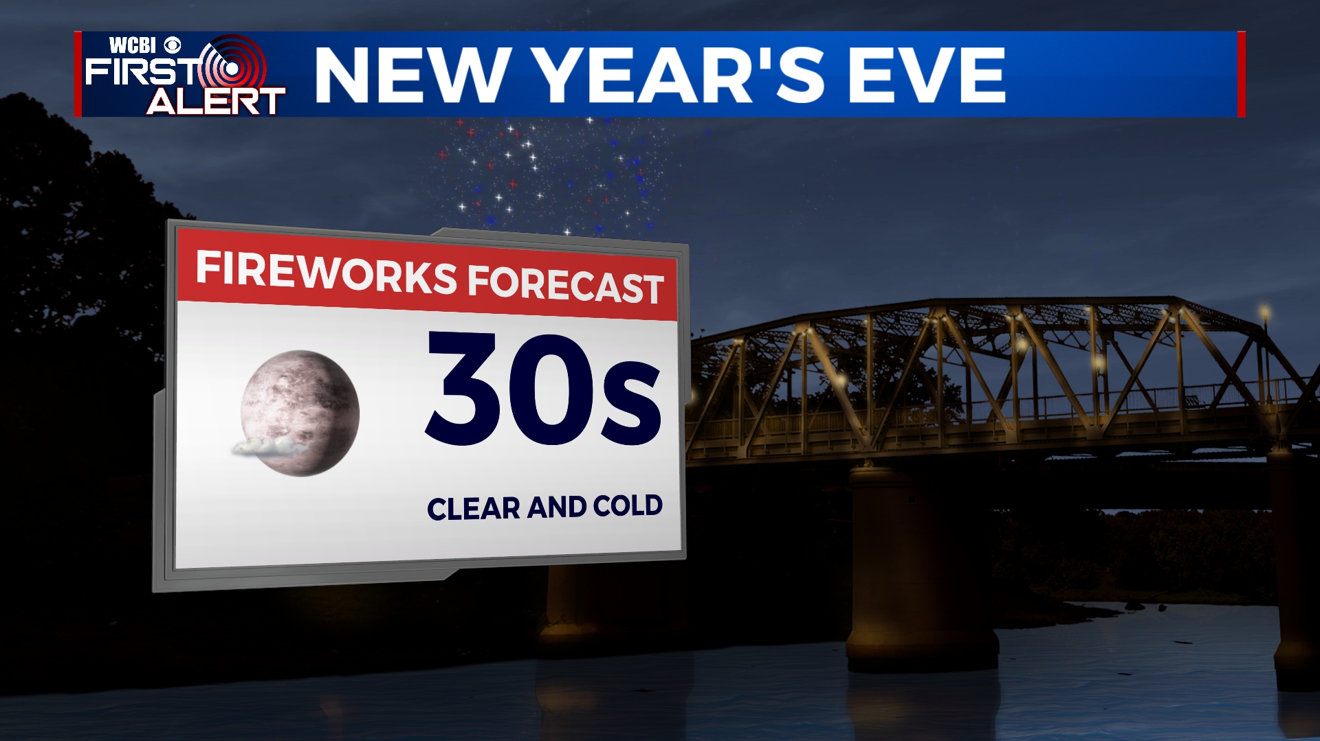
TUESDAY: New Year’s Eve is looking perfect with plenty of blue sky and afternoon highs in the 50s. Temperatures will be into the 30s by the evening, so bundle up if you’re headed out for any activities.
WEDNESDAY: Clouds will build through the day ahead of our next rainmaker. I think Wednesday will be dry aside from an afternoon sprinkle here or there. Temperatures will be in the low to mid 50s with morning lows near freezing.
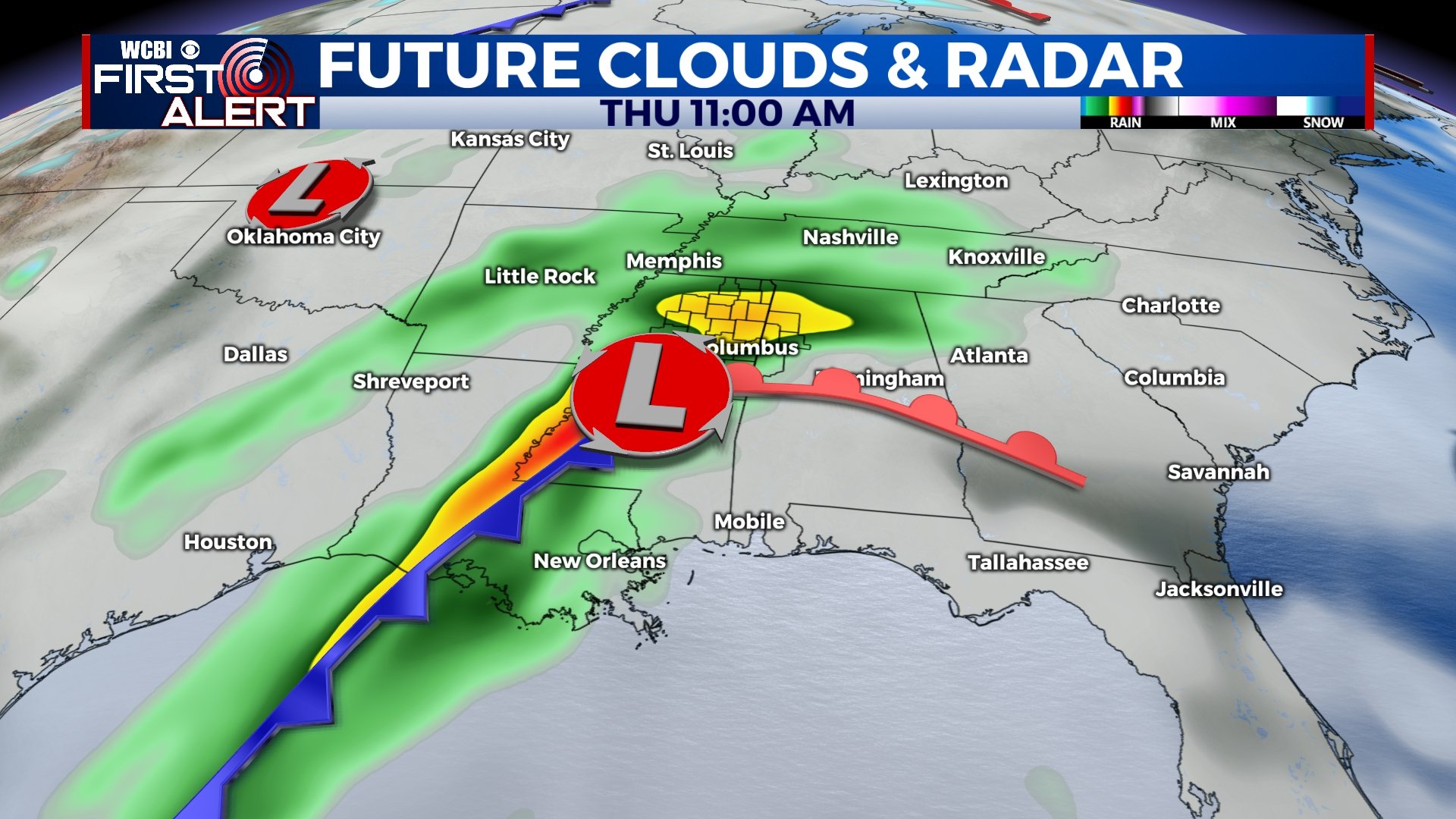
THURSDAY: We’re in for a pretty rainy and gloomy day on Thursday. Some areas could pick up an inch or two of rain before all is said and done. As of now, nothing in the way of storm activity or severe weather is expected. Highs will be in the upper 50s to near 60.
FRIDAY-MONDAY: Any leftover showers will exit the area by lunchtime on Friday, but clouds will linger through the day. Highs will be in the 60s on Friday before tumbling down into the 40s on Saturday. Clouds will start to break up through the weekend and we should be mostly sunny for Sunday. Highs will be back into the mid 50s on Monday with a few clouds.


Leave a Reply