Sunny, warmer Thursday ahead of wintry precip late Friday
COLUMBUS, Mississippi (WCBI) – A brief stretch of warm, sunny weather is in store before a strong cold front arrives late Friday.
THURSDAY: Expect plenty of sunshine (finally!) today as the weather pattern temporarily quiets down locally. Highs should reach the mid to upper 60s in the afternoon.
FRIDAY: Much of the day still looks quite decent with a mix of sun and clouds with highs in the 70s. Some rain and embedded thunder is likely to develop late in the afternoon.
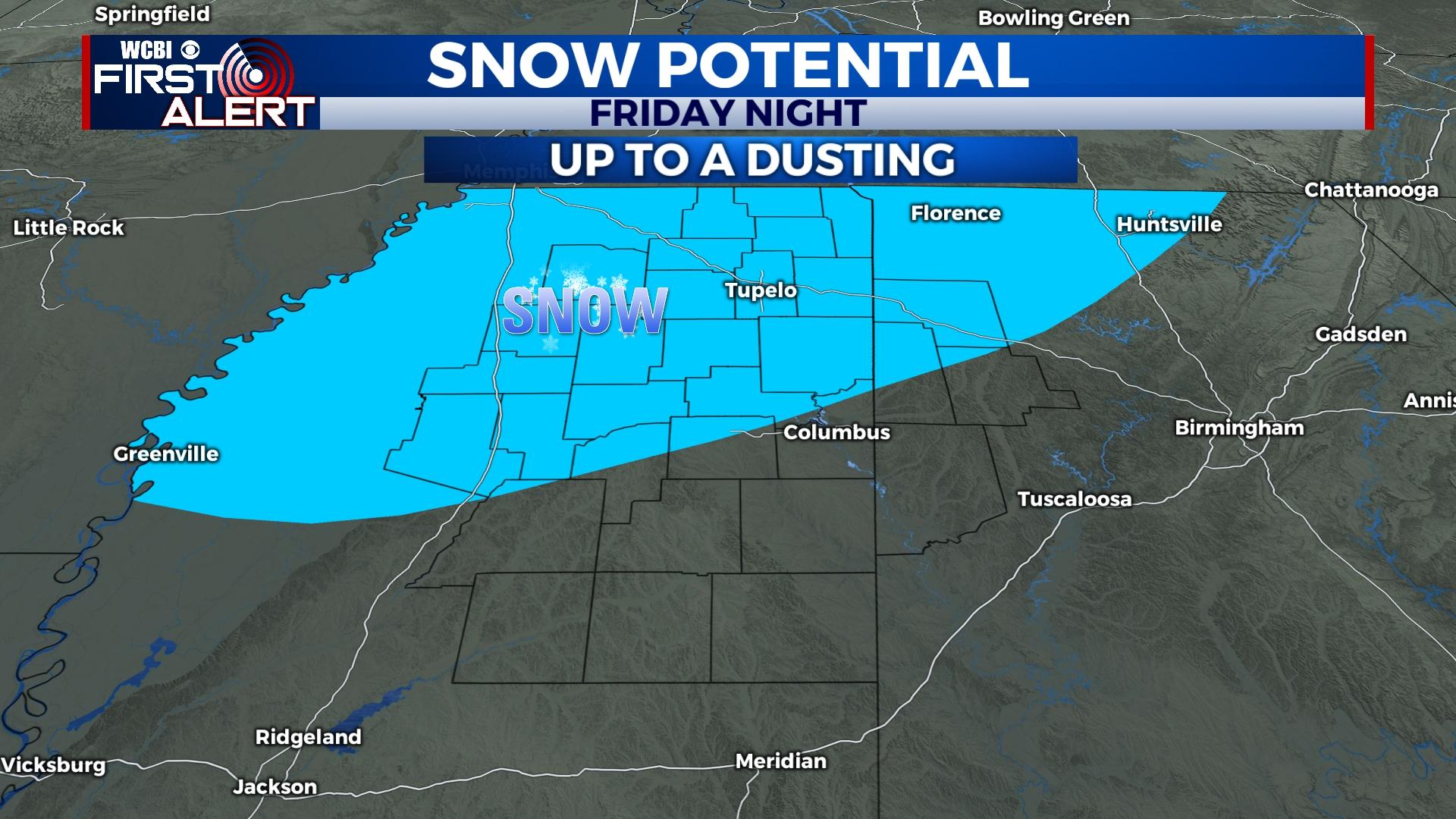
FRIDAY NIGHT: This is still when active weather ramps up across the region. Existing rain will have the potential to change over to sleet and then all snow as colder air rushes in from the northwest. Exactly how the moisture and cold air phase up will dictate accumulation potential; still, up to a dusting of snow is possible to likely across the Golden Triangle northward. Accumulations up to one inch are possible for areas north of Highway 8. Temperatures will also be plummeting to the upper 20s and low 30s with wind chills in the teens.
WEEKEND: Any wintry precipitation will end shortly after daybreak Saturday, leaving the rest of the day with a sunny sky and COLD air. Highs will hold in the 30s with wind chills near or below freezing. It gets much colder Saturday night with lows in the lower 20s for most. Sunday looks better with sunshine and highs in the 50s.
NEXT WEEK: The week starts dry on Monday, but another system is likely to bring scattered rain and embedded storms back to the forecast by Tuesday. Highs will stay near average for mid March – in the middle to upper 60s.


