Sunshine and the 60s return for Wednesday
SUMMARY: Look for the sunshine to return on Wednesday along with the 60s and mild, above average highs to make a comeback. A few showers are possible on Friday. A great weekend is ahead for us. Even better news, no severe weather is in the forecast for at least the next 7 days so enjoy the quiet weather pattern while we have it.

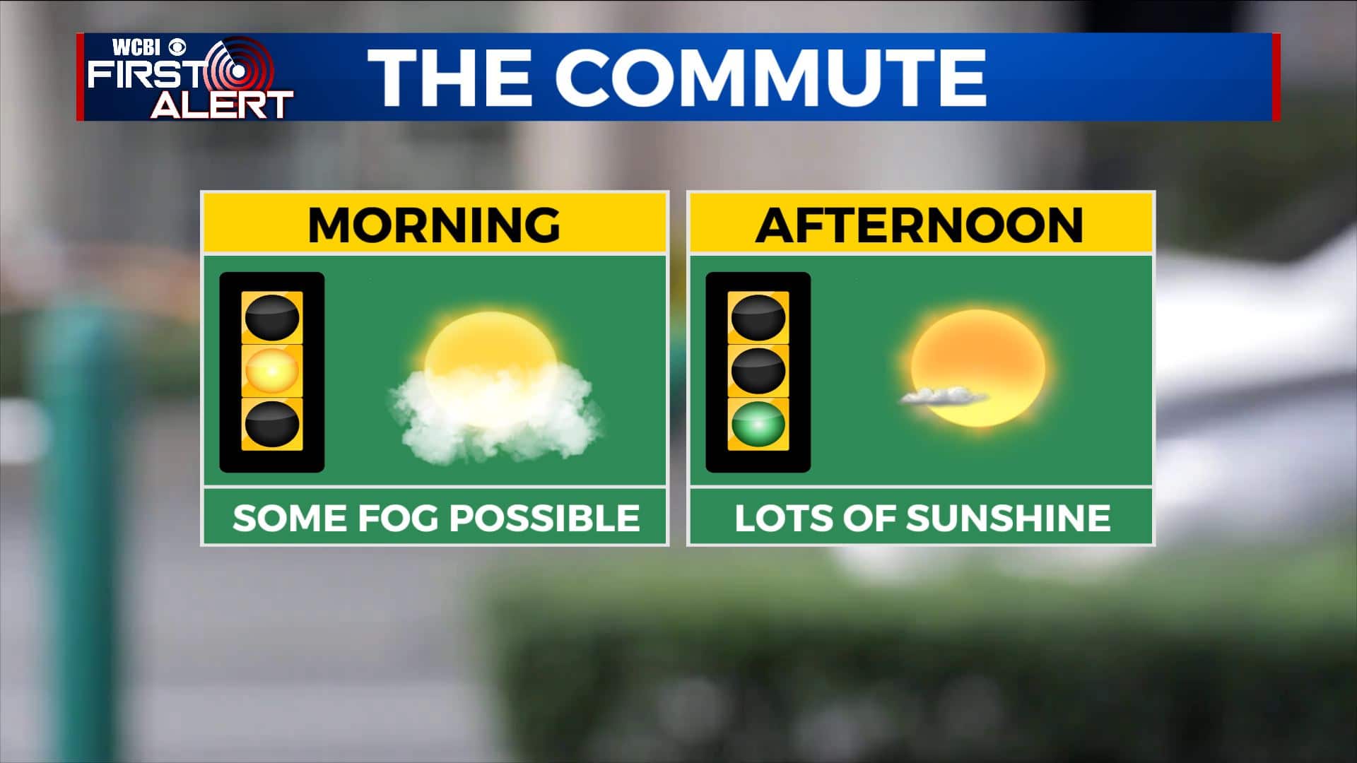
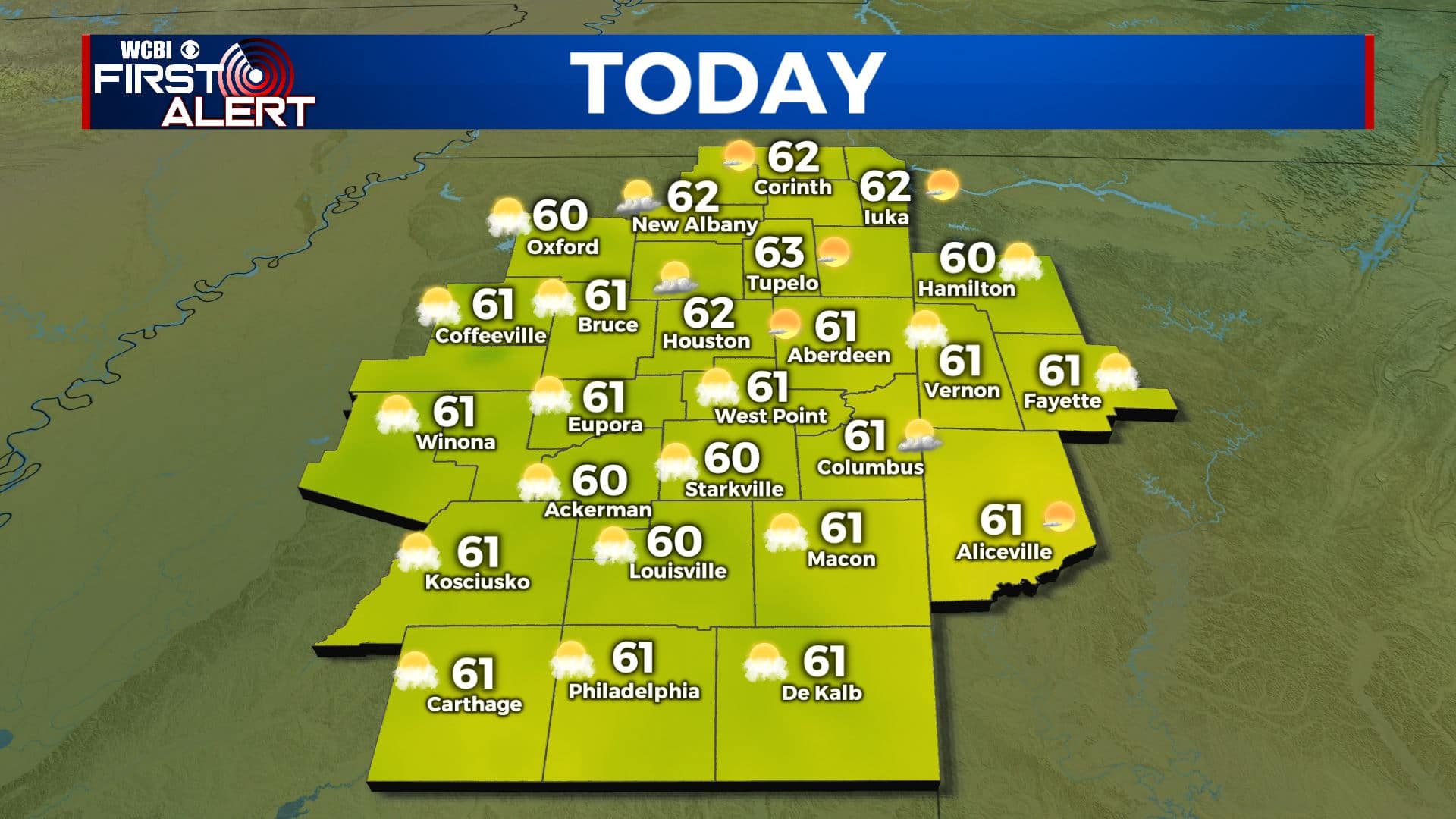
WEDNESDAY: We’ll start off the day with morning clouds or some patchy fog before we see more sunshine by the afternoon. Temperatures will warm back up to near average with highs in the lower 60s. NW winds 5-10 mph.
WEDNESDAY NIGHT: Mostly clear skies and a chilly night once again. Some areas of fog may try to develop as well. Overnight lows in the mid to upper 30s.
THURSDAY: Mostly sunny skies. A pretty nice and mild day is expected with highs in the mid 60s.
THURSDAY NIGHT: Mostly clear skies. Overnight lows near 40 degrees.
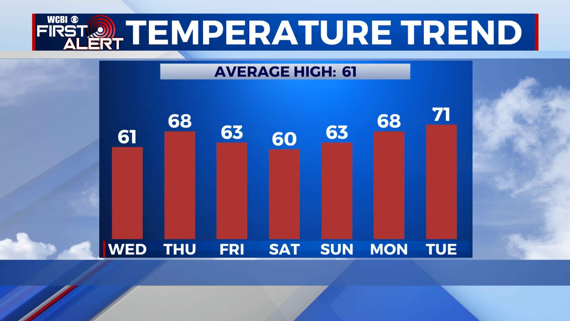
FRIDAY: Mostly cloudy with a few showers possible. Highs in the lower 60s.
FRIDAY NIGHT: Partly to mostly cloudy skies. Overnight lows in the lower 40s.
SATURDAY: A mix of sun & clouds. Highs near 60 degrees. Overnight lows for the weekend in the mid to upper 30s.
SUNDAY: Mostly sunny skies. Highs continuing to warm up into the mid 60s.
MONDAY: Mostly sunny skies. A much warmer day with in the upper 60s. Overnight lows in the 40s.
TUESDAY: Mostly sunny. Highs in the upper 60s to lower 70s.
Stay connected with @WCBIWEATHER on Facebook, Twitter, Instagram, and the WCBI News App


Leave a Reply