Temporarily calm before strong storm potential Friday
COLUMBUS, Mississippi (WCBI) – After a gloomy, soggy start to the week, we’ll see a brighter sky through mid-week. Friday brings storm potential, then much colder air arrives early next week.
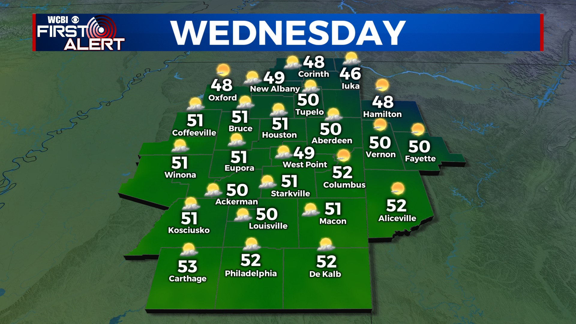
WEDNESDAY: Finally, some sunshine! We’ll see lots of it w/highs in the upper 40s to low 50s area-wide.
THURSDAY: Much warmer! With increased southerly breezes, some clouds will come and go as highs reach the low 60s. While the day will be dry, some late evening showers or even a few storms will be possible…especially after midnight.
FRIDAY: Showers and locally strong to severe storms will be possible during the morning hours to around midday, before the parent storm system lifts east/northeast. Since this will be a quick-moving system, only a portion of the WCBI viewing area (mainly areas along and south of Highway 8 in MS, US 278 in AL ) will have enough time to destabilize sufficiently for a severe weather threat to develop. The strongest storms will be capable of all severe hazards, so make sure you have ways to get watch & warning information. By Friday night, temperatures will sharply drop into the 20s…no more storms!
WEEKEND: Saturday still looks sunny and chilly with highs in the 40s. We should warm up into the low 50s Sunday as clouds slowly build, then we’ll see an Arctic front arrive late Sunday night.
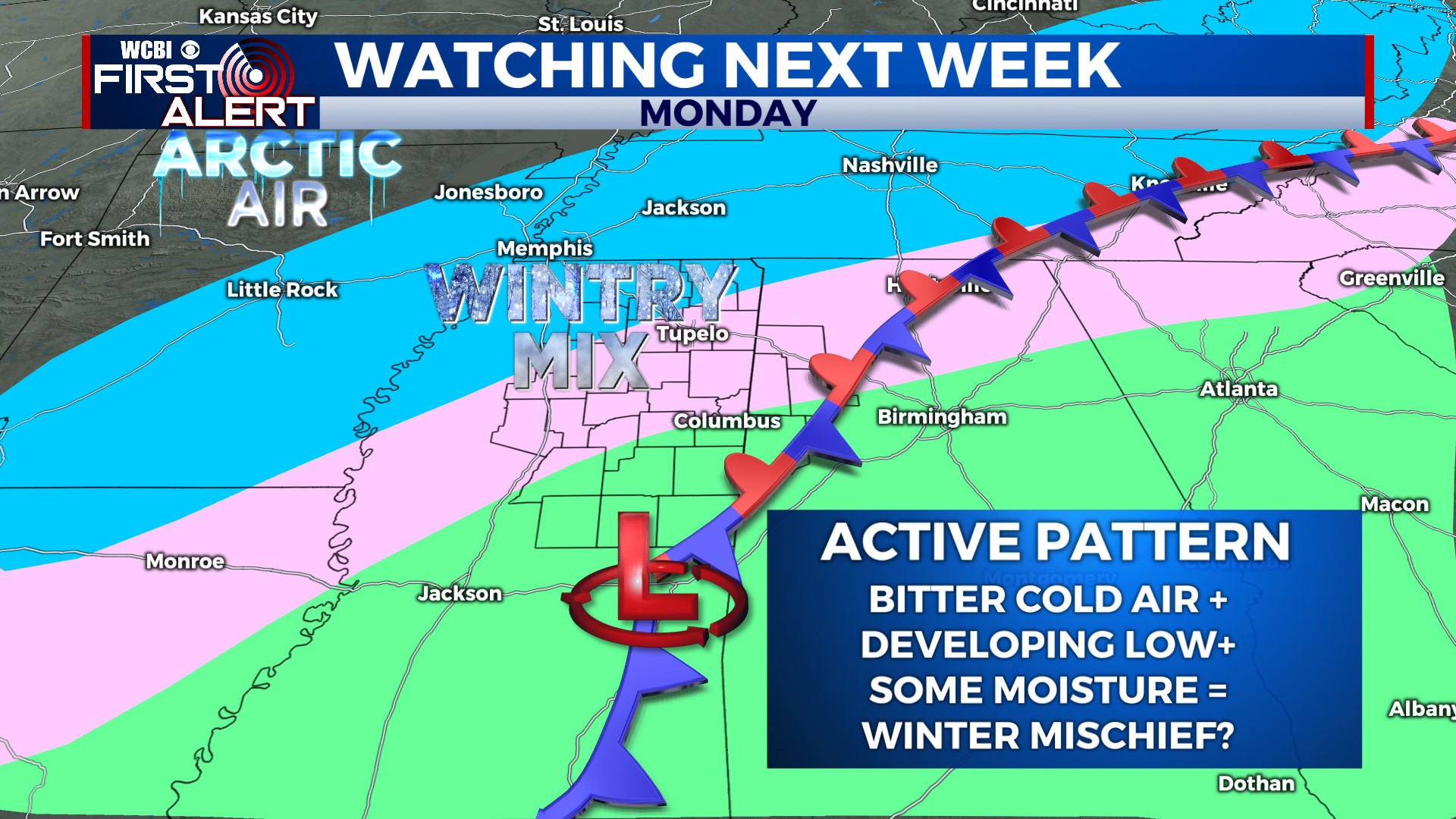
NEXT WEEK: For Monday, models continue to show some wintry precipitation across the northern third of MS, mainly along and north of US 82. Freezing rain, sleet, and even snow are all possible; however, we remain 5 days out and things will still change. Of higher confidence is crashing temperatures – once temperatures drop below freezing sometime Monday, we’ll likely not see temps above 32 degrees again until sometime Wednesday. Single digit temperatures are possible Monday night, with near or sub-zero wind chills possible.