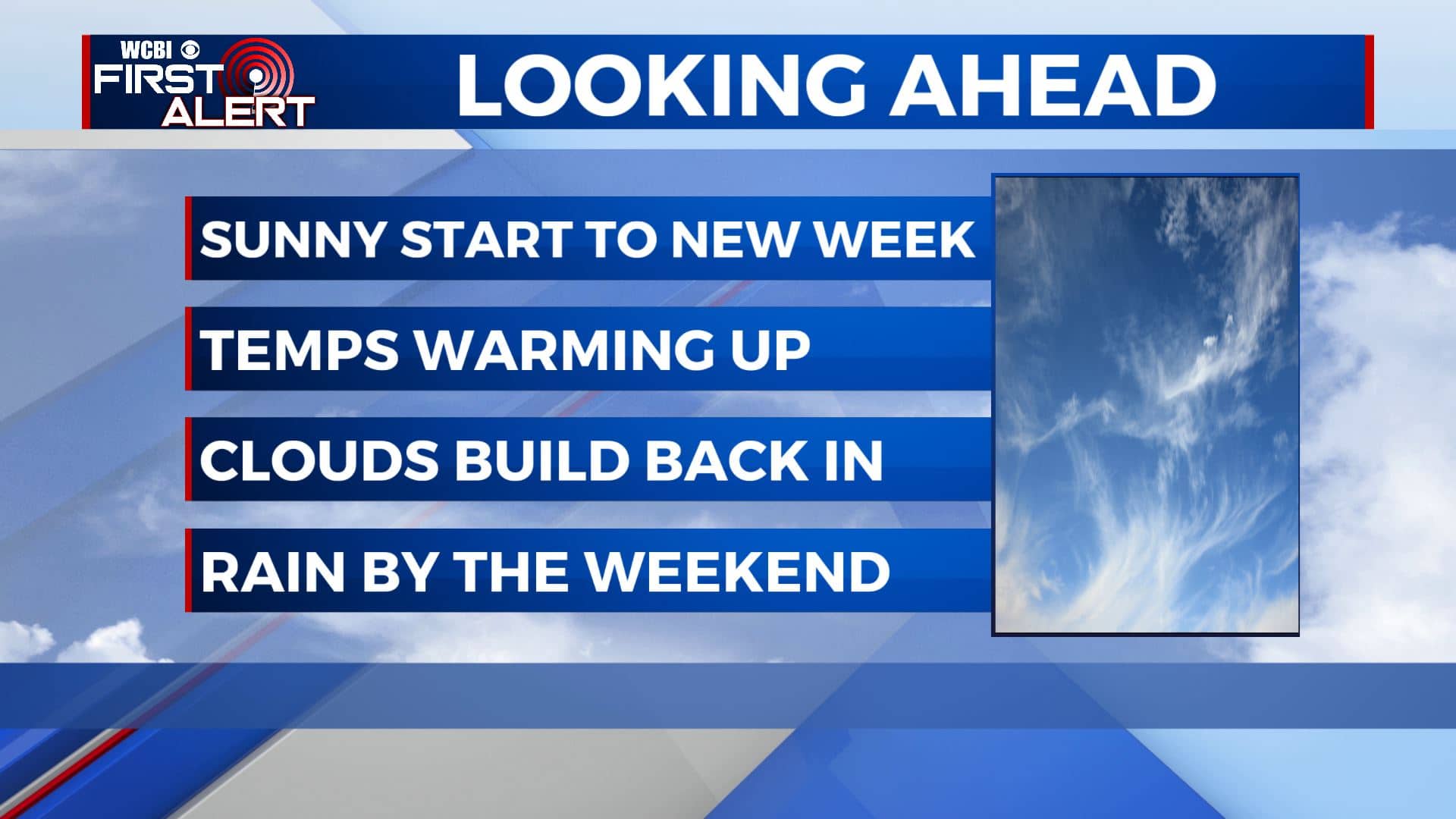
The 70s return and staying sunny as we begin a new workweek
SUMMARY: Temperatures will warm back up into the 70s as we begin the new workweek with lots of sunshine. Clouds will move back in by the middle of the week before rain chances return for the weekend. Our possible next storm system will be Sunday into Monday right now. Stay tuned!
MONDAY: Lots of sunshine and clear blue skies. A much warmer day with in the upper 60s to 70 degrees as our winds start switching up to the SW 5-10 mph. The dry conditions and low humidity/dew point levels will once again cause a fire danger outdoors, so refrain from outdoor burning.
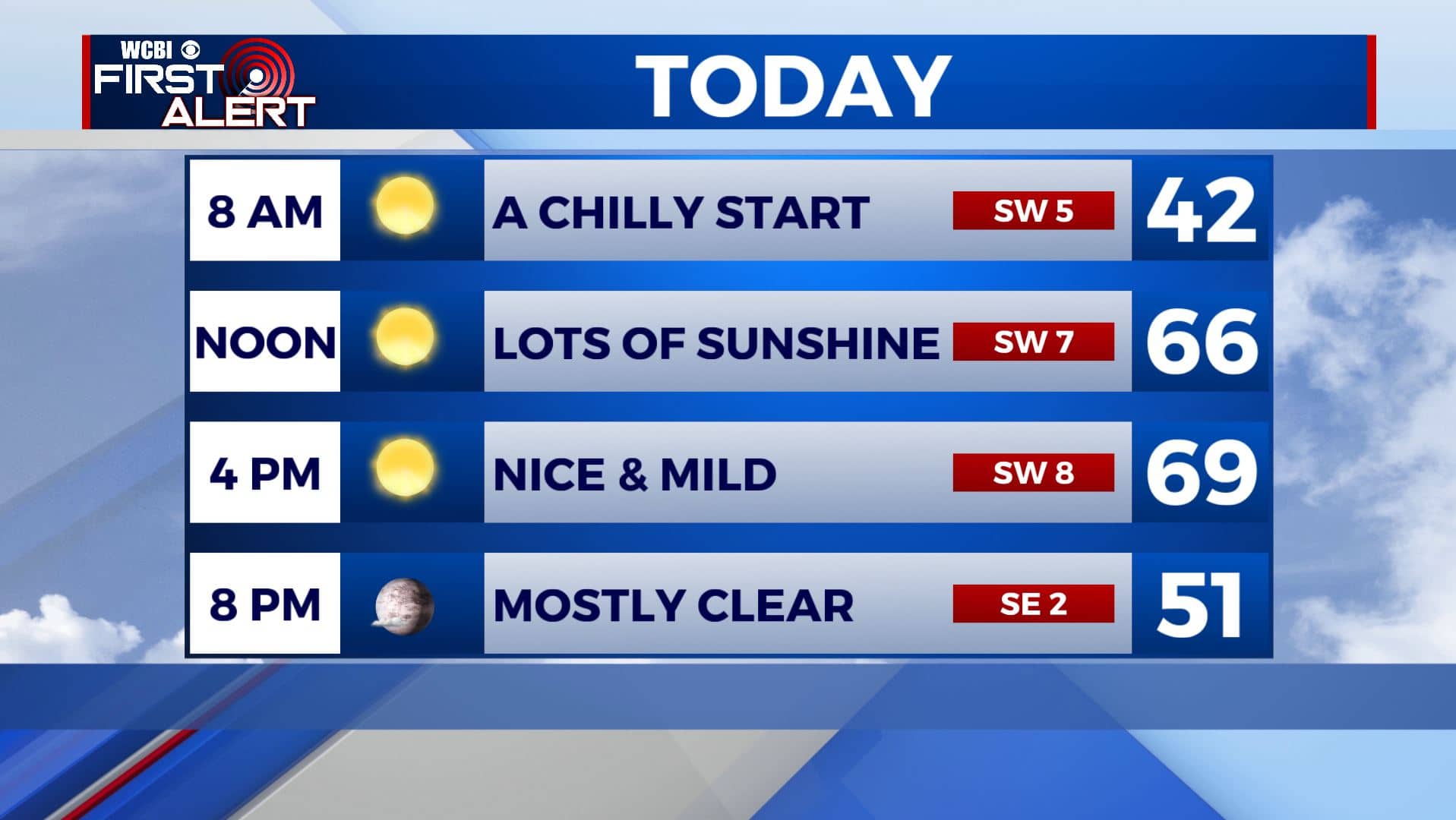

MONDAY NIGHT: Mostly clear skies. Overnight lows in the upper 30s.
TUESDAY: Mostly sunny skies as clouds begin to move back in. Highs in the lower 70s.
TUESDAY NIGHT: Partly cloudy skies. Overnight lows into the mid 40s.
WEDNESDAY: A mix of sun and clouds. Highs in the lower to mid 70s. Overnight lows into the 50s.
THURSDAY: Mostly cloudy skies. Highs in the mid 70s.
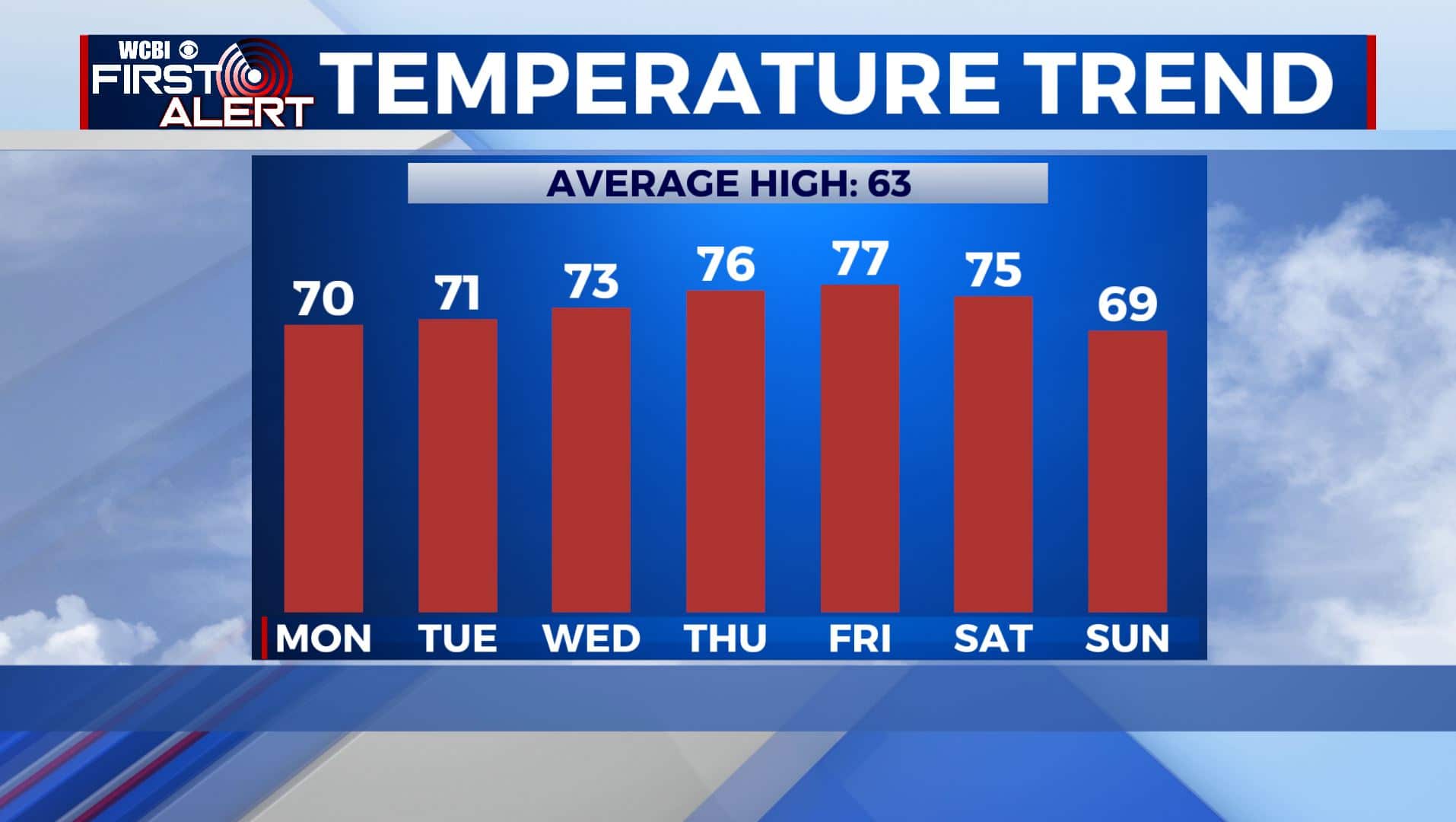
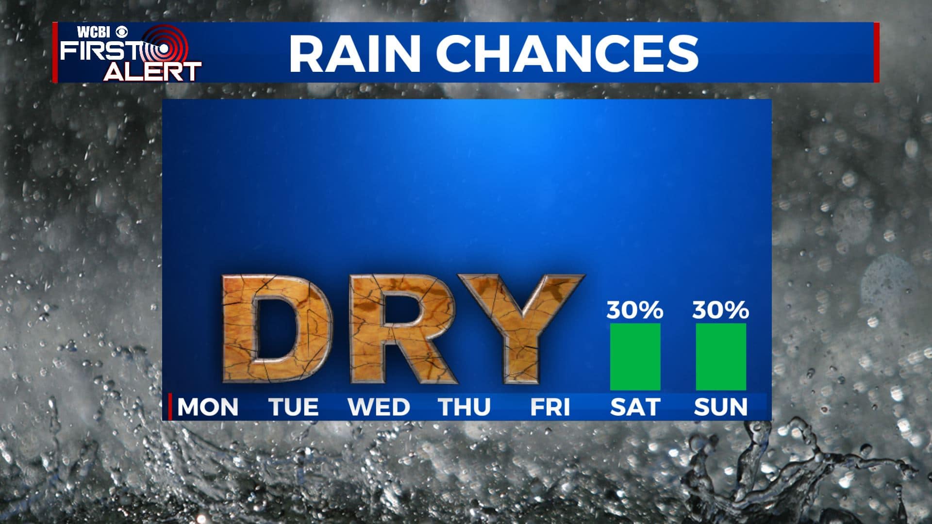
FRIDAY-SATURDAY: Cloudy skies for the end of the week with a few peeks of sunshine. It appears we’ll be dry for the most part but some showers are possible on Saturday. Highs will be in the mid 70s with overnight lows in the 50s.
SUNDAY-MONDAY: Our next best chances of rain will be Sunday into early Monday as our next storm system moves in. We could also be dealing with some storm chances with this system so stay tuned throughout the week for the latest. Highs will be in the upper 60s.
Stay connected with @WCBIWEATHER on Facebook, Twitter, Instagram, and the WCBI News App


Leave a Reply