The colder temperatures have arrived
COLUMBUS, Mississippi (WCBI)- After the showers and storms that passed earlier this week, cold air began sinking into the Deep South. Temperatures are going to be staying below average for several more days.
FRIDAY NIGHT: Partly cloudy coverage will continue through the overnight hours tonight, with some possible sprinkles. Low temperatures will drop into the low to middle 30s.
SATURDAY: Heavier cloud coverage will begin the weekend and will clear off to the South and East throughout the day, eventually providing sunshine for the afternoon and early evening hours. High temperatures will be cool and mild in the lower 50s. The overnight low temperatures will fall into the middle 20s.
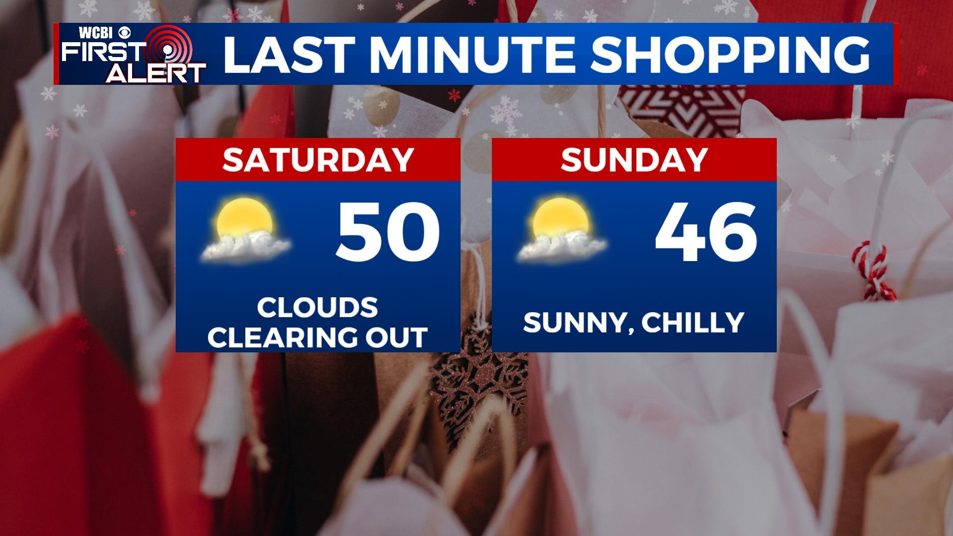
SUNDAY: Light clouds will be moving back in on Sunday, though plenty of sun will continue to be seen. High temperatures will be a hair cooler, reaching only the middle 40s. There is a 0% chance for any rain showers for the end of the weekend. Temperatures overnight will again be in the middle 20s.
MONDAY/TUESDAY: High temperatures will continue the trend of being in the middle to upper 40s. Mostly cloudy to overcast cloud coverage will be present. Rain chance also makes a return with Monday at a 40% chance and Tuesday at a 30%. Overnight low temperatures will be in the middle to upper 30s.


