Thursday cold front keeps winter in full force
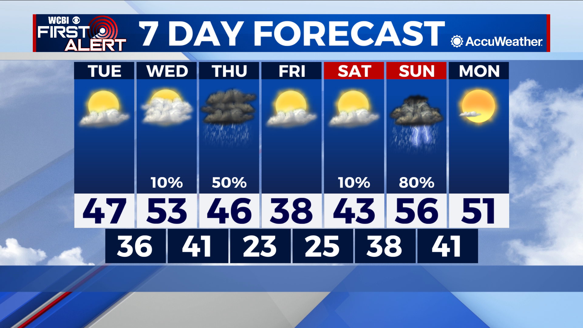
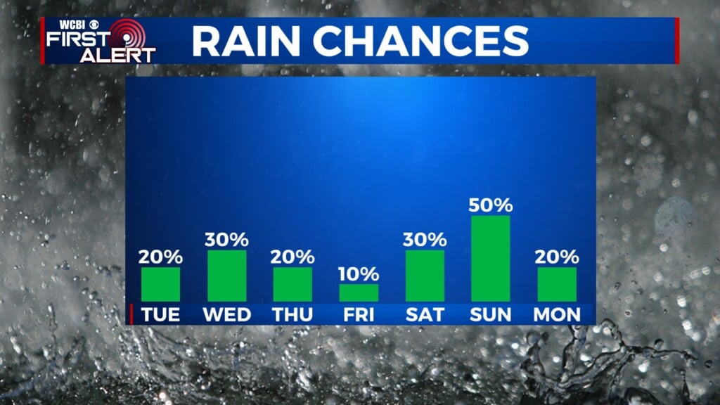
COLUMBUS – SUMMARY: Cold temperatures in the 40s and 50s dominate a much more seasonable week compared to what we experienced in December. Two distinct rain chances make an appearance on Thursday with a cold front and Sunday, although no winter precipitation is expected this time around. Lows will drop as low as the low 20s and as high as the low 40s.
TUESDAY: Conditions Tuesday improve quite a bit over the 32 degree highs experienced, topping out in the high 40s in the afternoon. Skies remain relatively clear and no rain chance is expected. Overnight lows will reach back into the 30s.
WEDNESDAY: An increase in cloud cover Wednesday will do little to stop temperatures from further improving into the low 50s Wednesday. The possibility for a stray sprinkle exists but otherwise the day will be dry. Lows also continue to improve, this time reaching the low 40s overnight.
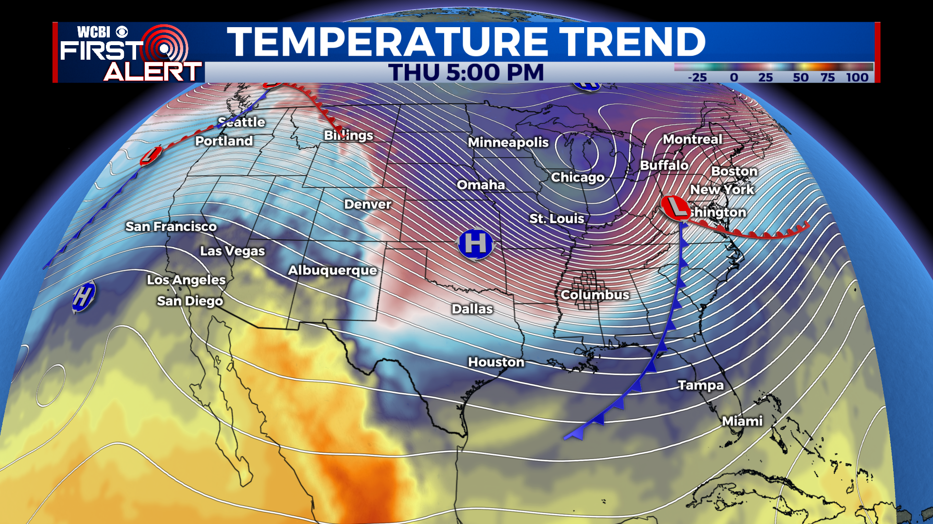
REST OF THE WEEK: The next big rain chance comes on Thursday, with the passing of a strong cold front through the region. The odd rumble of thunder cannot be ruled out but the storms on Thursday should be relatively mundane. The greatest impact will be the cold temperatures injected into the area, which will once again bring lows back into the low 20s. Temperatures will rebound back into the 50s by next Monday but warming will be slow. Yet another chance for thunderstorms crops up on Sunday, bring more rain to the area.