Trending warmer, 80s return Thursday
COLUMBUS, Mississippi (WCBI) – A pronounced warming trend is in store for the rest of the week. It will culminate in a severe weather risk Friday afternoon and evening.
TUESDAY: After another morning freeze wears off, sun & clouds will be the rule the rest of the day. Afternoon highs should reach the 60s with a southeast breeze developing.
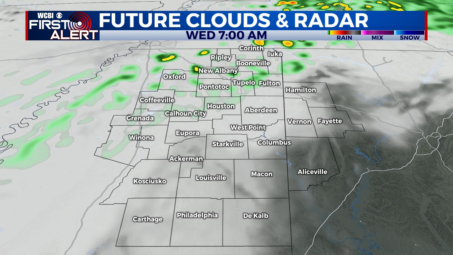
TUESDAY NIGHT: Mostly cloudy and above freezing! Lows will only drop into the upper 40s with spotty showers moving in after midnight, mainly north of US-82.
WEDNESDAY: Any spotty showers in our northern counties should fizzle before lunch, leaving the afternoon dry and warm. Highs will be in the 70s!
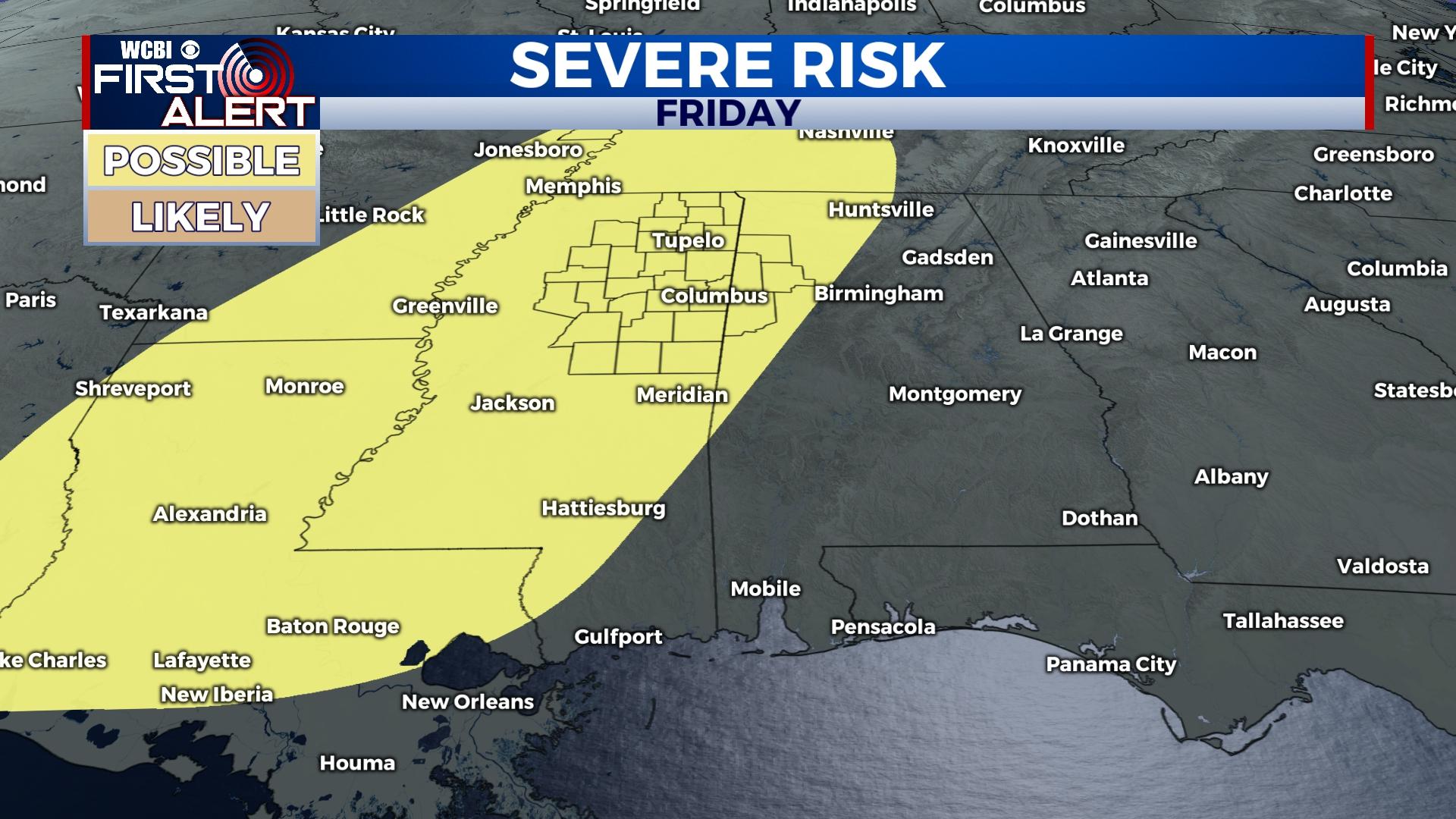
END OF WEEK: The sky becomes mostly sunny Thursday as a ridge becomes established over the Gulf. This will help boost high temperatures into the 80s Thursday afternoon. Moisture continues returning into the region as well, and this could manifest into low clouds or areas of fog by Friday morning. Variable clouds will continue through Friday, again yielding highs into the 80s. A strong Pacific front moves in Friday afternoon, bringing showers and potentially severe storms along with it. Sufficient wind shear, instability, and moisture point to an all-hazard severe weather event, including the chance of tornadoes. 3 PM to midnight is the time frame with which we’re most concerned, but stay tuned for further updates!
WEEKEND: Behind Friday’s front, temperatures won’t fall much Saturday. Expect plenty of sun with highs staying in the 70s. Showers and storms appear possible again by Sunday evening as yet another system rolls through the region. While not likely, a few of these storms could also become severe if parameters line up any better than currently forecast.


